A Look at the Alabama Weather Situation at 10 pm
Severe thunderstorm warning for Jackson and DeKalb Counties.
Severe storm near Ider and Flat Rock. Will cross I-59 between MM 231 and 245.
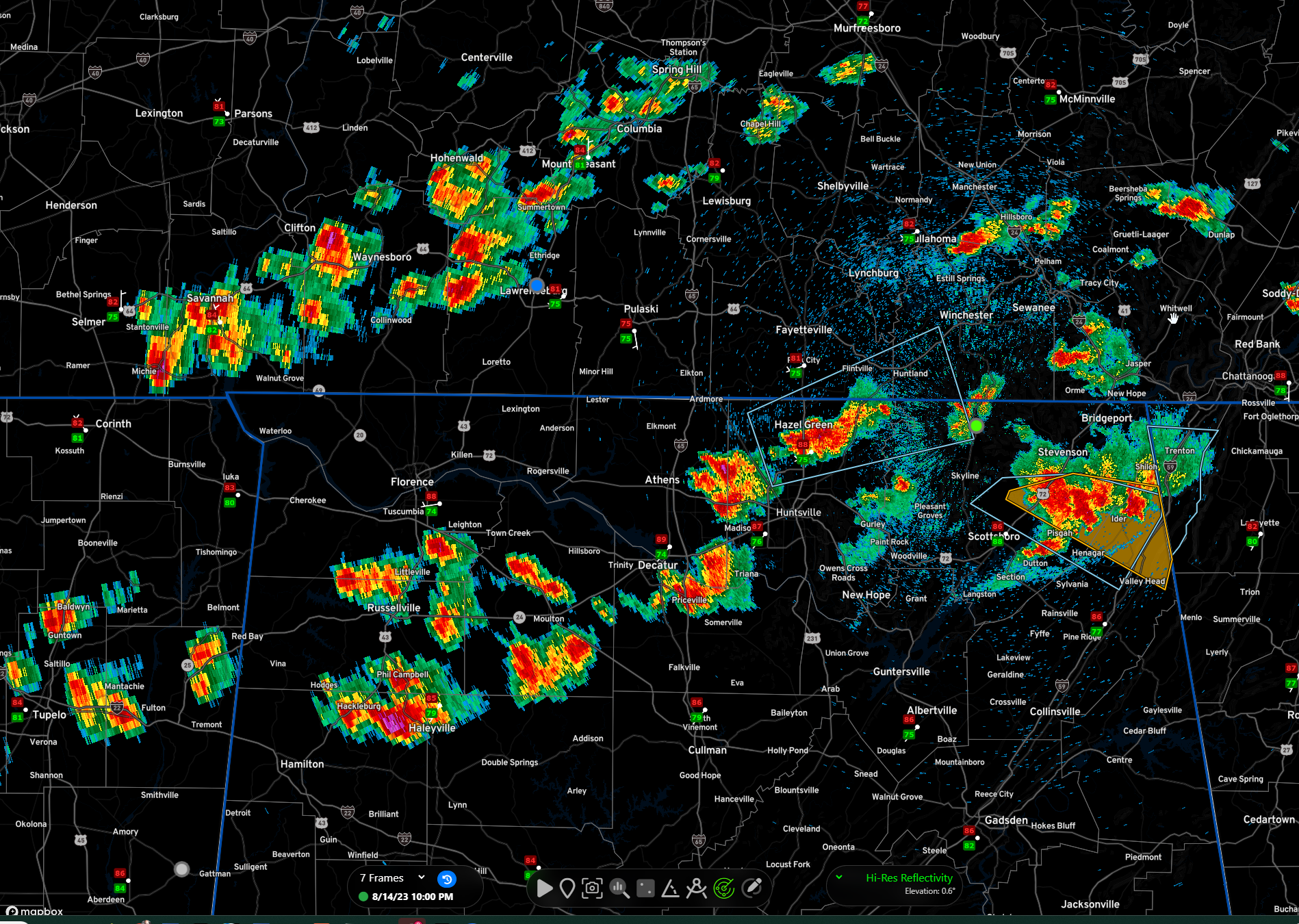
The National Weather Service in Huntsville Alabama has issued a
* Severe Thunderstorm Warning for…
East central Jackson County in northeastern Alabama…
Northeastern DeKalb County in northeastern Alabama…
* Until 1030 PM CDT.
* At 955 PM CDT, a severe thunderstorm was located near Pisgah, or 14
miles south of Bridgeport, moving east at 25 mph.
HAZARD…60 mph wind gusts and penny size hail.
SOURCE…Radar indicated.
IMPACT…Expect damage to roofs, siding, and trees.
* Locations impacted include…
Henagar, Hollywood, Ider, Pisgah, Valley Head, Hammondville,
Mentone, Martintown, Rosalie and Fabius.
Elsewhere, scattered storms across North Alabama are moving east north. The line is sinking ever so slowly, but it may not get much further south than Cullman.
Category: Alabama's Weather, ALL POSTS, Severe Weather
About the Author (Author Profile)
Bill Murray is the President of The Weather Factory. He is the site's official weather historian and a weekend forecaster. He also anchors the site's severe weather coverage. Bill Murray is the proud holder of National Weather Association Digital Seal #0001 @wxhistorianSubscribe
If you enjoyed this article, subscribe to receive more just like it.


