Flash Flood Warning for Madison and Jackson Counties
Rainfall is approaching 2.5 inches in the warning area, which has received a lot of rain in the past few days.
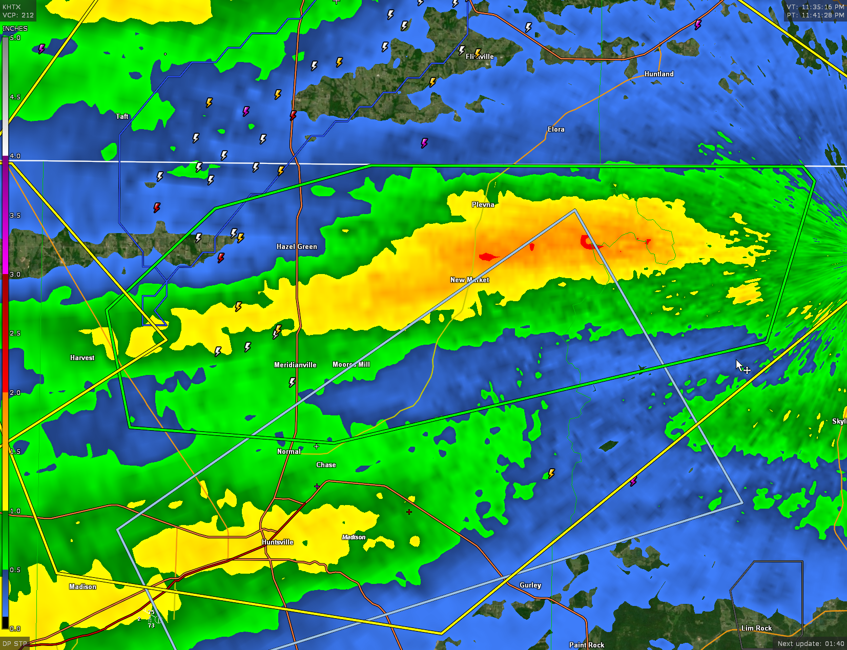
BULLETIN – EAS ACTIVATION REQUESTED
Flash Flood Warning
National Weather Service Huntsville AL
1143 PM CDT Mon Aug 14 2023
The National Weather Service in Huntsville has issued a
* Flash Flood Warning for…
Northern Madison County in north central Alabama…
Northwestern Jackson County in northeastern Alabama…
* Until 245 AM CDT.
* At 1143 PM CDT, Doppler radar and automated rain gauges indicated
thunderstorms producing heavy rain across the warned area. Between
1 and 2 inches of rain have fallen. Additional rainfall amounts of
1 to 2 inches are possible in the warned area. Flash flooding is
ongoing or expected to begin shortly.
HAZARD…Flash flooding caused by thunderstorms.
SOURCE…Radar and automated gauges.
IMPACT…Flash flooding of small creeks and streams, urban
areas, highways, streets and underpasses as well as
other poor drainage and low-lying areas.
* Some locations that will experience flash flooding include…
Northern Huntsville, Moores Mill, Meridianville, Hazel Green, New
Market, Harvest, Plevna, Fisk, Francisco, Larkin and Estillfork.
Category: Alabama's Weather, ALL POSTS, Severe Weather
About the Author (Author Profile)
Bill Murray is the President of The Weather Factory. He is the site's official weather historian and a weekend forecaster. He also anchors the site's severe weather coverage. Bill Murray is the proud holder of National Weather Association Digital Seal #0001 @wxhistorianSubscribe
If you enjoyed this article, subscribe to receive more just like it.


