Late Morning Update
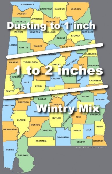
After a peek at the 12Z models, looks like our snow forecast for Thursday is pretty much on track. Not much change since this morning…
We note the morning runs were a little more aggressive with the moisture, but we won’t change anything for now. The real fun begins when the system actually crosses down into Montana and the Dakotas and we will get a good look at it, and it also gets into the American upper air network tomorrow.
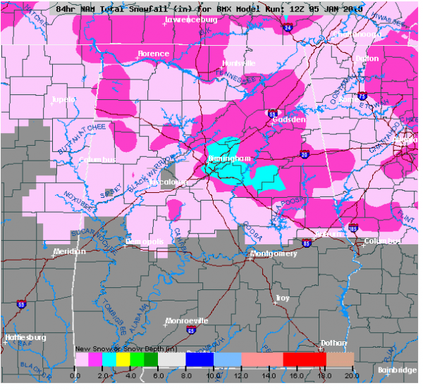
Just for the fun of it, here is the raw snow accumulation output from the 12Z NAM… shows a bullseye of two to three inches from Birmingham to Ashland. This all noise, of course. Again, we won’t change the forecast for now.
Just finished recording WeatherBrains for this week; the new discussion and afternoon Weather Xtreme video will be up by 3:30. Stay tuned…
Category: Uncategorized


