The stage is set!
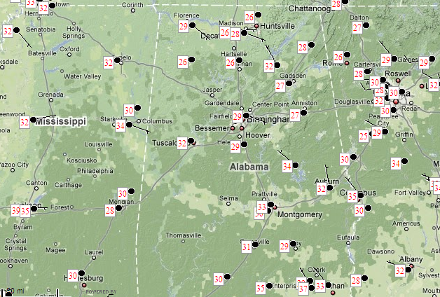
Temperatures are below freezing now across most of Mississippi, Alabama, and Georgia. Temperatures won’t fall too much overnight, as we get a little bit of southeast flow ahead of the next cold front. We should drop slowly through the upper 20s. But, that SE flow should also bring a little more moisture in here, probably helping us get a little more snow than we would have if there was no Atlantic nor Gulf of Mexico flow at all.
It’s about time to start looking out the window as James says, and it will be interesting to see the raw upper-air data from balloons that were released all over the country at 00 UTC. That data should come in very soon.
The snow will be supported by the strong cold front approaching…causing low-level convergence along its leading edge; by slight warm advection ahead of the front; and by upper-level divergence associated with a strong jet stream maximum (winds over 100 knots in the Plains).
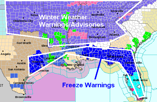
NWS has areas from Oklahoma to Virginia under Winter Weather Advisories and Winter Storm Warnings. Almost the entire Gulf coast and Florida is under a freeze warning. This winter event will continue to be historic, especially in the Southeast US where temperatures are so far below normal. I’m crunching some numbers to find out if this could wind up being the coldest 10-day or 2-week period ever in BHM history…maybe not, but it will be close. Parts of Bluff Creek (off Warrior River) were even frozen today…pictures later.
Category: Uncategorized


