A Few Pesky Showers Out There At Midday
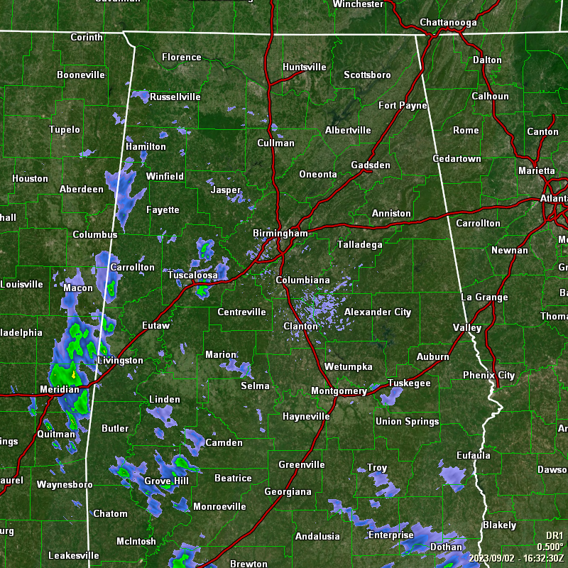
As we are approaching the midday hour on this first Saturday of September, and of Meteorological Fall, it is actually starting to feel like that outdoors, even though we still have a moist and humid airmass in place. We have scattered pockets of light showers out there mainly over the western half of the area and down into the extreme southeastern parts. The rest of the area have mostly cloudy skies. Temperatures were only in the lower 70s to the lower 80s at this point, and afternoon highs will reach the lower to mid 80s.
We can expect a few more scattered showers and maybe some thunder to develop during the afternoon and early evening, but most of the activity will be over the extreme southwestern parts of the area. While a passing shower may be possible over the rest of Central Alabama, most will stay dry. Drier air will be moving in by this evening, and showers will quickly diminish. Lows will get down into the mid 60s to the lower 70s.
If you are east of a line from Hamilton to Tuscaloosa to Selma, you will remain dry on Sunday, but along and west of that line, a few isolated to scattered showers and storms will be possible during the afternoon hours. It will be a warmer day with highs reaching the mid 80s to the lower 90s.
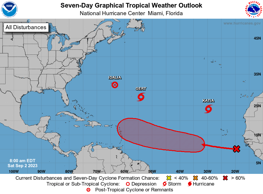
The tropics are still very active today. While we have two tropical storms out there, our main focus will have to be on the tropical wave located just off the African coast and will be moving toward the west-northwest. While it is still just a disturbance at this time, it has a high chance of becoming a depression soon. By the end of the work week, I wouldn’t be surprised if we have a strong tropical storm or a hurricane moving close to or over the Windward and Leeward islands. We’ll have to watch and see what direction it goes as there is a possibility of it affecting the southeastern parts of the US within about 10 days or so. We’re still very early in the game, and we’ll get better details once this becomes better organized and develops a stronger center of rotation. Gert will only be with us for about 36 more hours before she will dissipate, and Katia is only expected to last until Monday evening. Both are no threat to any land.
Category: Alabama's Weather, ALL POSTS, Tropical
About the Author (Author Profile)
Scott Martin is an operational meteorologist, professional graphic artist, musician, husband, and father. Not only is Scott a member of the National Weather Association, but he is also the Central Alabama Chapter of the NWA president. Scott is also the co-founder of Racecast Weather, which provides forecasts for many racing series across the USA. He also supplies forecasts for the BassMaster Elite Series events including the BassMaster Classic.Subscribe
If you enjoyed this article, subscribe to receive more just like it.


