

It’s a Mighty Nice Midday, But Some Showers Are Forming
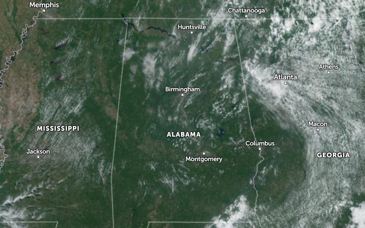
As we hit the midday hour, skies are mostly clear across Central Alabama, but we are starting to see some shower activity forming in the northeast corner of the state and over into Georgia. Everyone is dry across Central Alabama at the moment. Temperatures at midday were in the 80s across the area. Troy was the hot spot at 89 degrees, while Haleyville was the cool spot at 81 degrees. Birmingham was at 85 degrees. Afternoon highs will reach the mid 80s to the lower 90s, with a few isolated to scattered showers and storms possible, mainly north of US-280 on the eastern half of the area. Rain will end this evening and skies will eventually become mostly clear with lows in the 60s.
It will almost be the same exact story for your Sunday, as a few isolated to scattered showers and storms will be possible, mainly east of a line from Oneonta to Rockford to Troy. The rest of the area will remain dry with mostly sunny skies. Highs in the mid 80s to the lower 90s.
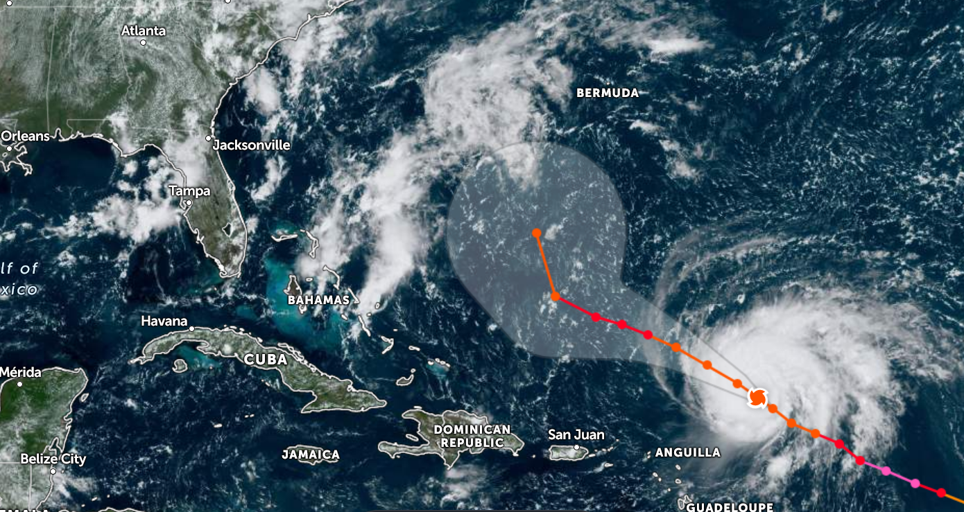
At 1100 AM AST (1500 UTC), the center of Hurricane Lee was located near latitude 20.3 North, longitude 58.2 West, or around 350 miles east-northeast of the northern Leeward Islands. Lee is moving toward the west-northwest near 12 mph (19 km/h), and this motion is expected to continue through early next week, with a significant decrease in forward speed beginning later today and Sunday. On the forecast track, Lee is expected to pass well to the north of the northern Leeward Islands, the Virgin Islands, and Puerto Rico into early next week. Data from NOAA and Air Force Hurricane Hunter aircraft indicate that the maximum sustained winds are near 115 mph (185 km/h) with higher gusts. Lee is a category 3 hurricane on the Saffir-Simpson Hurricane Wind Scale. Little change in strength is expected today, but gradual restrengthening is forecast to occur on Sunday and Monday. Hurricane-force winds extend outward up to 30 miles (45 km) from the center, and tropical-storm-force winds extend outward up to 175 miles (280 km). The latest minimum central pressure estimated from Air Force Reserve Hurricane Hunter aircraft data is 957 mb (28.26 inches).
It is way too soon to know what level of impacts, if any, Lee might have along the U.S. East Coast, Atlantic Canada, or Bermuda late next week, particularly since the hurricane is expected to slow down considerably over the southwestern Atlantic. Regardless, dangerous surf and rip currents are expected along most of the U.S. East Coast beginning Sunday and Monday. Continue to monitor updates to Lee’s forecast during the next several days.
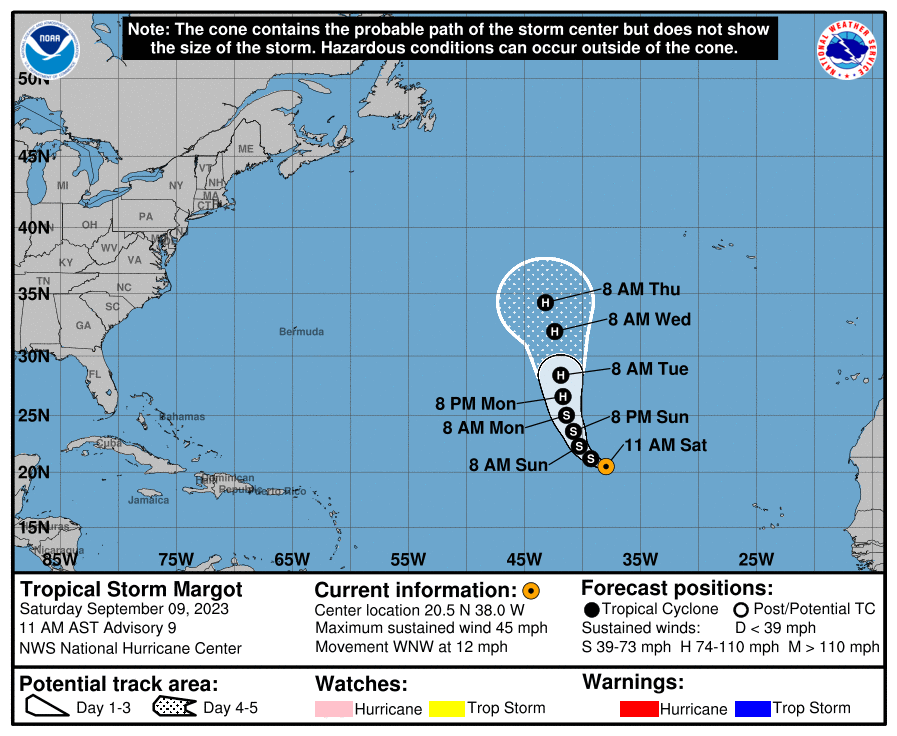
At 1100 AM AST (1500 UTC), the center of Tropical Storm Margot was located near latitude 20.5 North, longitude 38.0 West. Margot is moving toward the west-northwest near 12 mph (19 km/h). A west-northwestward to northwestward motion is expected during the next day or so. A north-northwestward to northward motion is forecast to begin by late Sunday. Maximum sustained winds are near 45 mph (75 km/h) with higher gusts. Gradual strengthening is forecast over the next several days, and Margot is forecast to become a hurricane early next week. Tropical-storm-force winds extend outward up to 45 miles (75 km) from the center. The estimated minimum central pressure is 1004 mb (29.65 inches).
Category: Alabama's Weather, ALL POSTS, Tropical
About the Author (Author Profile)
Scott Martin is an operational meteorologist, professional graphic artist, musician, husband, and father. Not only is Scott a member of the National Weather Association, but he is also the Central Alabama Chapter of the NWA president. Scott is also the co-founder of Racecast Weather, which provides forecasts for many racing series across the USA. He also supplies forecasts for the BassMaster Elite Series events including the BassMaster Classic.Subscribe
If you enjoyed this article, subscribe to receive more just like it.


