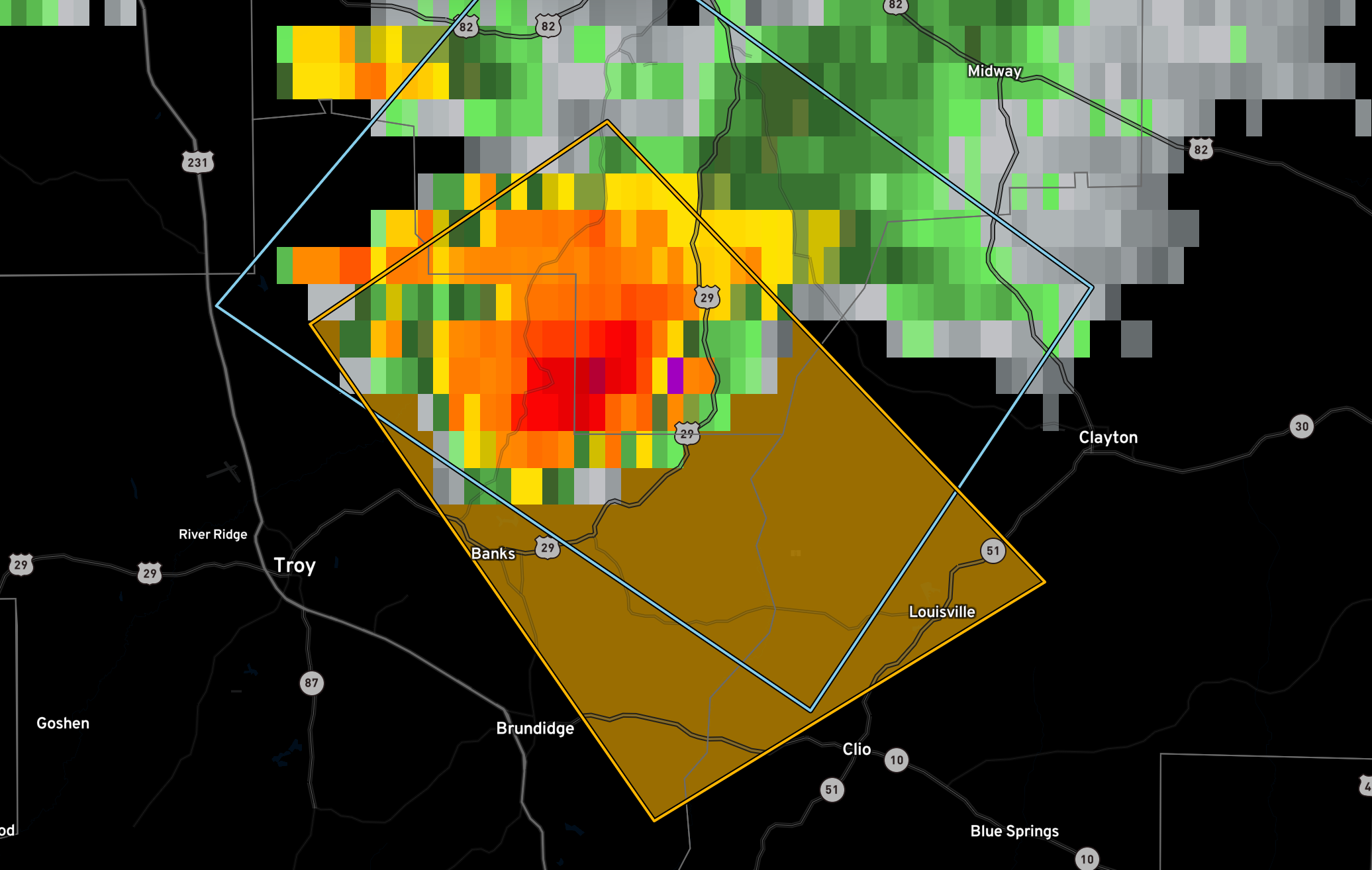
Severe Thunderstorm Warning for Parts of Pike, Barbour, Bullock
The National Weather Service in Birmingham has issued a
* Severe Thunderstorm Warning for…
Eastern Pike County in southeastern Alabama…
Southwestern Bullock County in southeastern Alabama…
West central Barbour County in southeastern Alabama…
* Until 830 PM CDT.
* At 744 PM CDT, a severe thunderstorm was located near Linwood, or
13 miles northeast of Troy, moving southeast at 25 mph.
HAZARD…60 mph wind gusts and quarter size hail.
SOURCE…Radar indicated.
IMPACT…Hail damage to vehicles is expected. Expect wind damage
to roofs, siding, and trees.
* Locations impacted include…
Brundidge, Clio, Louisville, Banks, Linwood, Boot Hill, Tanyard,
Sandfield, Monticello, Perote, and Josie.
Category: Alabama's Weather, ALL POSTS, Severe Weather
About the Author (Author Profile)
Bill Murray is the President of The Weather Factory. He is the site's official weather historian and a weekend forecaster. He also anchors the site's severe weather coverage. Bill Murray is the proud holder of National Weather Association Digital Seal #0001 @wxhistorianSubscribe
If you enjoyed this article, subscribe to receive more just like it.


