Mid-Afternoon Update — Nice but Very Warm
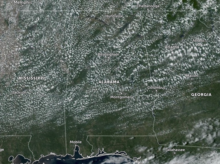
Skies across Central Alabama as we approach 3 pm on this last day of September have some fair-weather cumulus clouds, but nothing in the way of blocking out the sun for more than a few seconds at a time. Temperatures were in the mid 80s to the lower 90s as of the 2pm round up, and the forecast highs are up in the upper 80s to the lower 90s. Skies will stay mostly clear to clear tonight with lows dipping down into the lower to mid 60s… so much better than those muggy night with lows in the 70s. If you liked today’s weather, then you will get an almost-exact copy of it on Sunday. Skies will be partly to mostly sunny and highs in the mid 60s to the lower 90s.
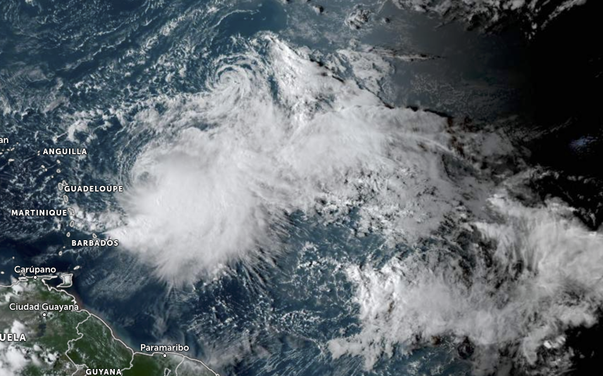
The mass of clouds you see in the above satellite image are actually two tropical storms that are very close together. Here is the latest on Philippe and Rina…
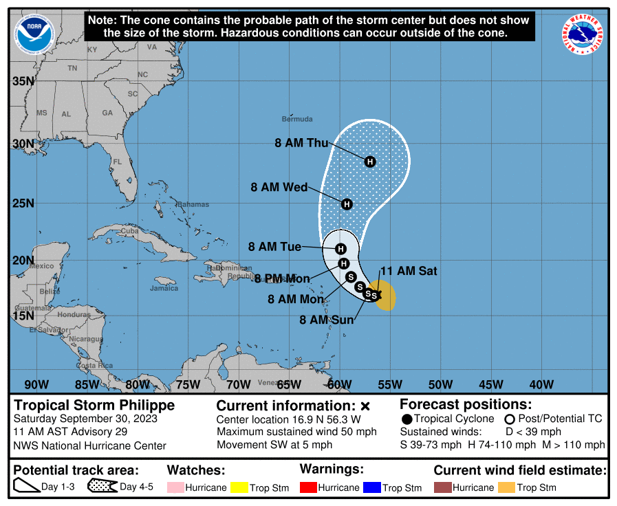
As of 10 am CDT, the center of Tropical Storm Philippe was located near latitude 16.9 North, longitude 56.3 West, or around 455 miles east of the northern Leeward Islands. Philippe is moving toward the southwest near 5 mph (7 km/h). A slow turn toward the west-southwest and west is expected through early Sunday, followed by a turn toward the northwest and north-northwest Sunday night through Tuesday. Maximum sustained winds are near 50 mph (85 km/h) with higher gusts. Some strengthening is forecast during the next few days, and Philippe could become a hurricane early next week. Tropical-storm-force winds extend outward up to 140 miles (220 km) from the center. The estimated minimum central pressure is 999 mb (29.50 inches).
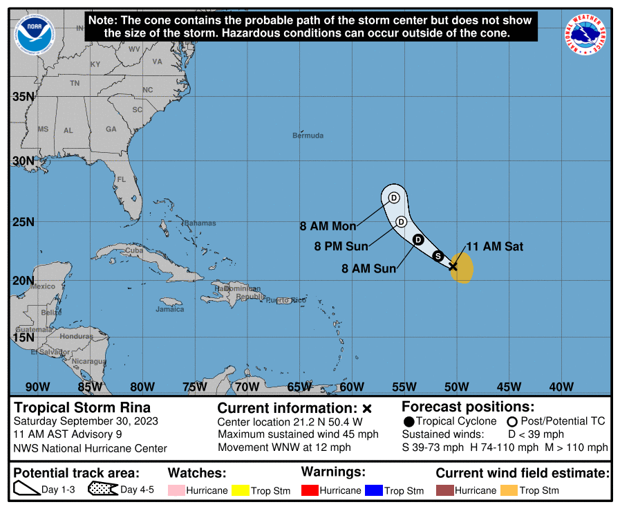
As of 10 am CDT, the center of Tropical Storm Rina was located near latitude 21.2 North, longitude 50.4 West, 850 miles east-northeast of the northern Leeward Islands. Rina is moving toward the west-northwest near 12 mph (19 km/h). The storm should move generally northwestward through Sunday and turn northward on Monday. Maximum sustained winds have decreased to near 45 mph (75 km/h) with higher gusts. Some slow weakening is forecast during the next 48 hours, and Rina could dissipate early next week. Tropical-storm-force winds extend outward up to 140 miles (220 km) from the center. The estimated minimum central pressure is 1002 mb (29.59 inches).
Category: Alabama's Weather, ALL POSTS, Tropical
About the Author (Author Profile)
Scott Martin is an operational meteorologist, professional graphic artist, musician, husband, and father. Not only is Scott a member of the National Weather Association, but he is also the Central Alabama Chapter of the NWA president. Scott is also the co-founder of Racecast Weather, which provides forecasts for many racing series across the USA. He also supplies forecasts for the BassMaster Elite Series events including the BassMaster Classic.Subscribe
If you enjoyed this article, subscribe to receive more just like it.


