Friday Noon Update: Some Welcome Rainfall, Need More
After the warm, sunny weather of the past few days, the clouds and rain this morning are a welcome relief, especially given our recent dryness and drought conditions.
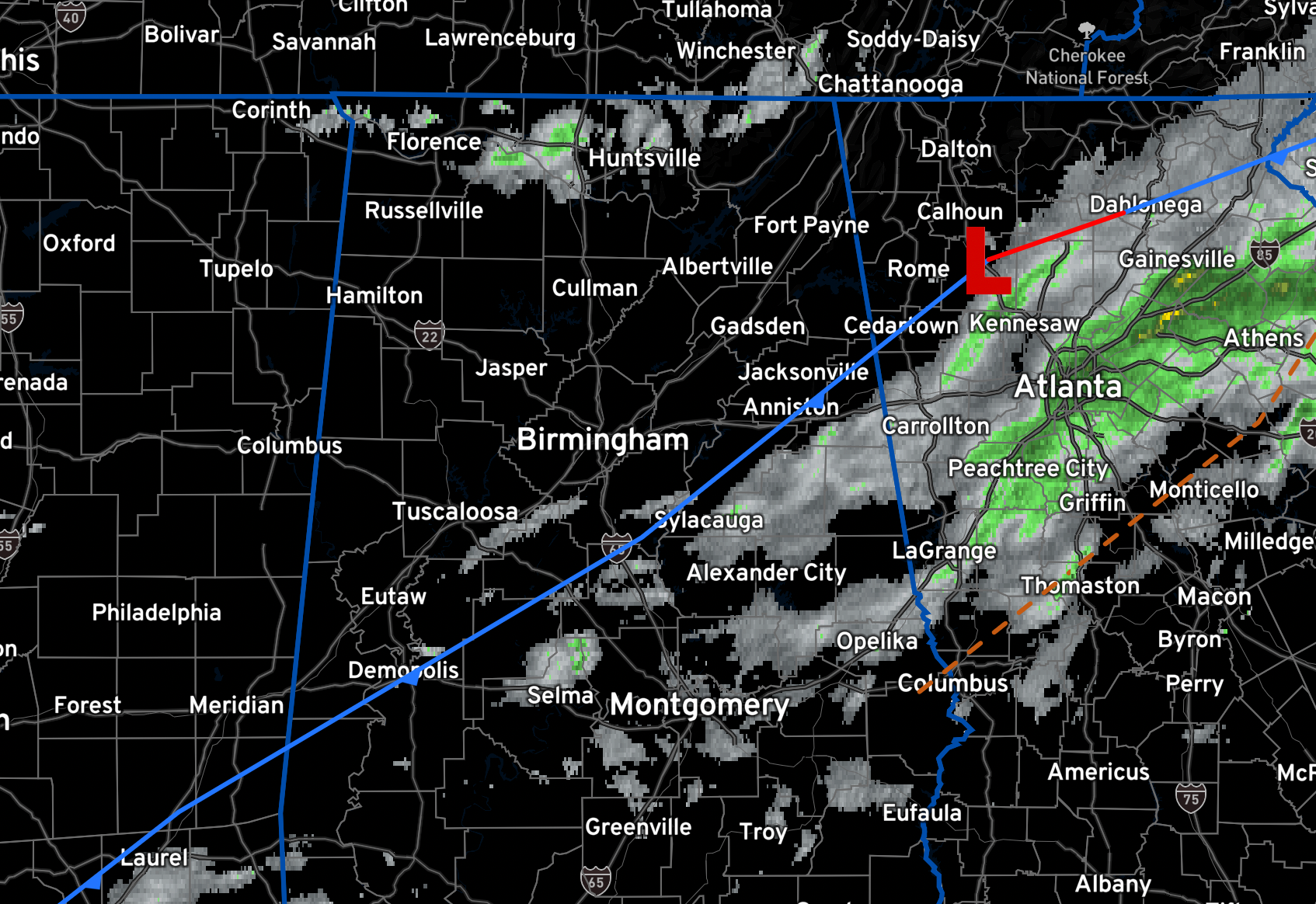
RADAR CHECK AT NOON: Most of the rain has moved into Georgia as we go through the lunchtime period.
ON THE WEATHER MAPS: A cold front is just south of I-20 early this afternoon. That front will slowly sink southward through the afternoon and overnight hours. Rain will increase across our area overnight as some upper level energy slides across the area, perturbing the atmosphere. Skies will remain mostly cloudy across the area. Highs this afternoon will be in the lower and middle 60s ahead of the front, and in the 50s behind it. Rain chances will remain high into tonight, especially over South Central Alabama, where rainfall amounts could one quarter to one half inch. Everyone else will get less unfortunately. Expect winds from the north shifting to the northeast, with speeds of 4 to 11 mph and gusts up to 19 mph. Overnight lows will be mostly in the 50s, with a couple of upper 40s over the Tennessee Valley.
FOR YOUR SATURDAY: A cooler day with temperatures starting out in the 50s mostly. Light rain is likely, especially along and south of Interstate 20, with the front meandering around the southern counties. Overcast conditions continue with northeast winds at 5 to 11 mph. The rain and cloud cover will keep temperatures moderated, with the warmest areas in the southeast reaching the upper 70s by early afternoon before the rain sets in.
SUNDAY: Periods of light rain will remain in the forecast. High temperatures will rise in to the 50s North and lower 60s South. Rainfall amounts will be in the by the end of the weekend will be in the one quarter of an inch to 1.5 inches over South Central Alabama. that’s great! Overcast skies will persist, and easterly winds will be gentle, around 5 to 9 mph.
NEXT WEEK: Monday will be dry, but more rain will move into the southern half of the state Tuesday, and we will mention some risk of rain statewide Wednesday through Friday. Seven day rain totals will range from around one inch for the Tennessee Valley, to 3-4 inches over South Alabama. Highs will be mostly in the 60s through the week.
FOOTBALL WEATHER: Periods of light rain are possible for the high school playoff games across the state tonight with temperatures hovering in the upper 50s and low 60s.
Tomorrow, Alabama travels to Lexington to take on Kentucky (11a CT kickoff). The sky will be mostly sunny with temperatures rising from near 52 at kickoff, to around 56 degrees by the final whistle.
UAB is also on the road; they will be in Annapolis MD play Navy (2:30p CT kickoff). It will be a great day for football; the sky will be sunny with temperatures falling from the mid 50s at kickoff, into the upper 40s by the fourth quarter.
Auburn will be in Fayetteville as they take on Arkansas (3:00p CT kickoff). The sky will be partly too mostly sunny with temperatures falling from the low 60s at kickoff, into the 50s by the fourth quarter.
BEACHCAST: Into a few beach weeks, a little rain must fall, and this will be one of those weeks. Rain chances will be in the forecast for much of the week ahead. Highs will range between the upper 60s to middle 70s. Lows will be falling back into the upper 50s to lower 60s. Water temperatures are still in the upper 60s. The rip current risk will be low for the next few days.
Click here to see the Beach Forecast Center page.
IN THE TROPICS: Nothing threatening to become a tropical cyclone through the weekend, but we could see something develop over the western Caribbean toward the middle of the week.
ADVERTISE WITH US: Deliver your message to a highly engaged audience by advertising on the AlabamaWX.com website. The site enjoyed over 29 MILLION page views in the past 12 months. Don’t miss out! We can customize a creative, flexible, and affordable package that will suit your organization’s needs. Contact me, Bill Murray, at (205) 687-0782 and let’s talk.
WEATHERBRAINS: This week, the panel will entertain local meteorologist and all around nice lady, Ashley Gann! She has recently made some bold move in her career. Check out the show at www.WeatherBrains.com. You can also subscribe on iTunes. You can watch the show live at live.bigbrainsmedia.com or on James’ YouTube Channel You will be able to see the show on the James Spann 24×7 weather channel on cable or directly over the air on the dot 2 feed.
ON THIS DATE IN 2002: East Tennessee’s Mossy Grove once trusted in the protective magic of their towering mountains. But on this day in 2002, an F3 tornado shattered that myth along with their homes as it tore through their valley, killing 7. Follow my weather history tweets on Twitter. I am @wxhistorian at Twitter.com.
Category: Alabama's Weather, ALL POSTS
About the Author (Author Profile)
Bill Murray is the President of The Weather Factory. He is the site's official weather historian and a weekend forecaster. He also anchors the site's severe weather coverage. Bill Murray is the proud holder of National Weather Association Digital Seal #0001 @wxhistorianSubscribe
If you enjoyed this article, subscribe to receive more just like it.


