All’s Quiet as We Approach 2 O’clock: New Day One Outlook for Today
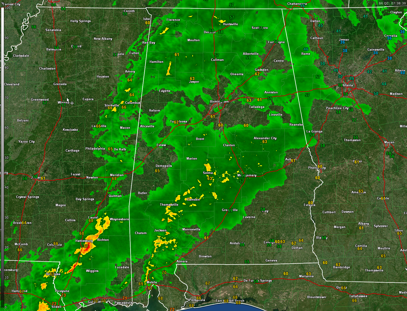
Rain is widespread over the northern third of Alabama tonight, and there is no severe weather threat there.
A 75 mile wide band of rain extends across Central and Southwest Alabama from near Roanoke and Alex City to Montgomery and Selma, to Atmore and Chatom.
Lightning is now limited to parts of Clarke and Mobile counties over Southwest Alabama. That is where the only instability is left.
Back over Mississippi. a line of strong storms extends from west of Waynesboro to east of Hattiesburg to along I-59 near Picayune.
There are no severe weather watches or warnings anywhere in the U.S.
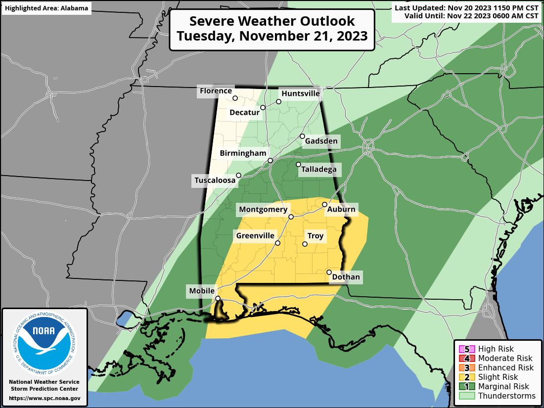
We will be watching for redevelopment along the back edge of the precipitation which now extends from Amory to Meridian to the stronger storms over Southeast Mississippi. That will probably not happen until noon or so and mainly south of a line from Millbrook to Auburn. Above is new Day One Severe Weather Outlook from the SPC.
We will close it down for tonight. James will have the video early and I will be covering potential severe weather during the day.
Category: Alabama's Weather, ALL POSTS
About the Author (Author Profile)
Bill Murray is the President of The Weather Factory. He is the site's official weather historian and a weekend forecaster. He also anchors the site's severe weather coverage. Bill Murray is the proud holder of National Weather Association Digital Seal #0001 @wxhistorianSubscribe
If you enjoyed this article, subscribe to receive more just like it.


