Afternoon Forecast Update: Freezes in our Future
Skies are cloudy across Alabama at this hour. Some peeks of sunshine are trying to force their way through the clouds over West Central Alabama across sparts of Pickens, Sumter, Greene, Tuscaloosa and Hale Counties.
Temperatures are in the 50s across all of North, Central, and Southeast Alabama, with only southwestern portions of the state in the 60s.
Most of the showers in the state are nearing the Georgia border at this hour. There are a few light showers across parts of Bibb, Perry, Chilton, Shelby into St. Clair Counties. I lowered our high today to around 55F.
The rain will continue moving east, and a few folks will get lucky and see some sunshine before sunset, but most of the clearing will come tonight. And we are expecting a little more clearing than we thought, which will allow temperatures to drop 2-3 degrees lower than earlier forecast. I think the departing clouds and gusty winds will keep up the mixing and prevent much in the way of frost overnight, but it will be
cold. Lows by morning will be in the upper 20s over northwestern sections with lower to middle 30s elsewhere. Winds could gust to 20 mph at times.
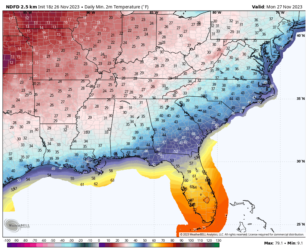
Highs on Monday will struggle to reach 50F across the northern third of the state, officially calling for a high of 49F at Birmingham. A brisk northwest wind will make it feel even colder. Skies should be mostly sunny though. Expect a widespread freeze Monday night with lows between 24-27F over North Alabama, with 28F-30F in the O-20 Corridor and lower 30s over South Central Alabama.
Tuesday will still be cool, with highs in the upper 40s North and lower to middle 50s Central. Wednesday morning lows will be below freezing over nearly the entire state. Only parts of Mobile and Baldwin County may escape freezing readings and even there most inland sections will be below freezing. A warming trend will commence during the day Wednesday with widespread 50s and a few 60s thrown in for good measure.
We stay dry through most of Thursday before showers come knocking on our western border toward sunup Friday. The GFS is a little faster with the bulk of the rain and storms arriving during the morning and moving out during the afternoon, perhaps stunting any severe weather potential that might have developed. I think the lift will have outrun the instability and the event will be mostly rain. The Euro is less bullish on precipitation, but hopefully we can still get an inch out of the system. Even the GFS is predicting less now.
But the models are more bullish on a return to rain for Saturday night and Sunday. Hopefully between all these systems we will pick up a couple of inches.
Category: Alabama's Weather, ALL POSTS
About the Author (Author Profile)
Bill Murray is the President of The Weather Factory. He is the site's official weather historian and a weekend forecaster. He also anchors the site's severe weather coverage. Bill Murray is the proud holder of National Weather Association Digital Seal #0001 @wxhistorianSubscribe
If you enjoyed this article, subscribe to receive more just like it.


