Severe Thunderstorm Warning For Parts of Tuscaloosa, Walker, and Southwest Jefferson Counties: Strong Winds Will be Moving into Birmingham Metro Within the Hour
Winds gusted to 48 mph at the Tuscaloosa Airport.
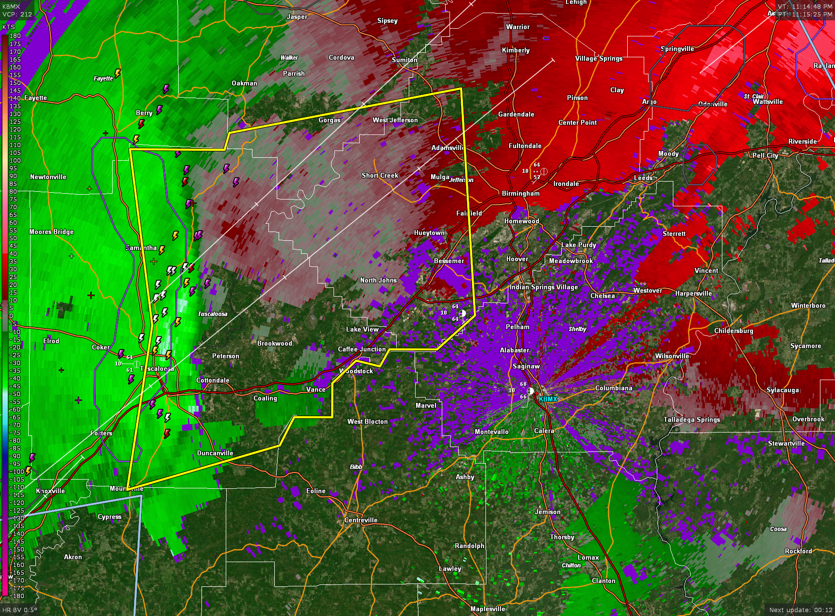
The storm is getting impacted by a rear inflow jet which is causing it to produce very strong winds. Winds may be over 60 mph along the leading edge of the storms.
Quarter sized hail has been reported on the Strip in Tuscaloosa.
The National Weather Service in Birmingham has issued a
* Severe Thunderstorm Warning for…
Southeastern Walker County in central Alabama…
Tuscaloosa County in west central Alabama…
Southwestern Jefferson County in central Alabama…
* Until midnight CST.
* At 1111 PM CST, severe thunderstorms were located along a line
extending from near Boley Springs to 6 miles northwest of Deerlick
Creek Campgrounds to near Shelton State Community College, moving
northeast at 50 mph.
HAZARD…60 mph wind gusts and quarter size hail.
SOURCE…Radar indicated.
IMPACT…Hail damage to vehicles is expected. Expect wind damage
to roofs, siding, and trees.
* Locations impacted include…
Southwestern Birmingham, Tuscaloosa, Bessemer, Northport, Hueytown,
Fairfield, Holt, Pleasant Grove, Midfield, Adamsville, Brighton,
Moundville, Lipscomb, Graysville, Lake View, Brookwood, Coaling,
Sylvan Springs, Vance, and Brookside.
Category: Alabama's Weather, ALL POSTS, Severe Weather
About the Author (Author Profile)
Bill Murray is the President of The Weather Factory. He is the site's official weather historian and a weekend forecaster. He also anchors the site's severe weather coverage. Bill Murray is the proud holder of National Weather Association Digital Seal #0001 @wxhistorianSubscribe
If you enjoyed this article, subscribe to receive more just like it.


