An Uptick in the Storms
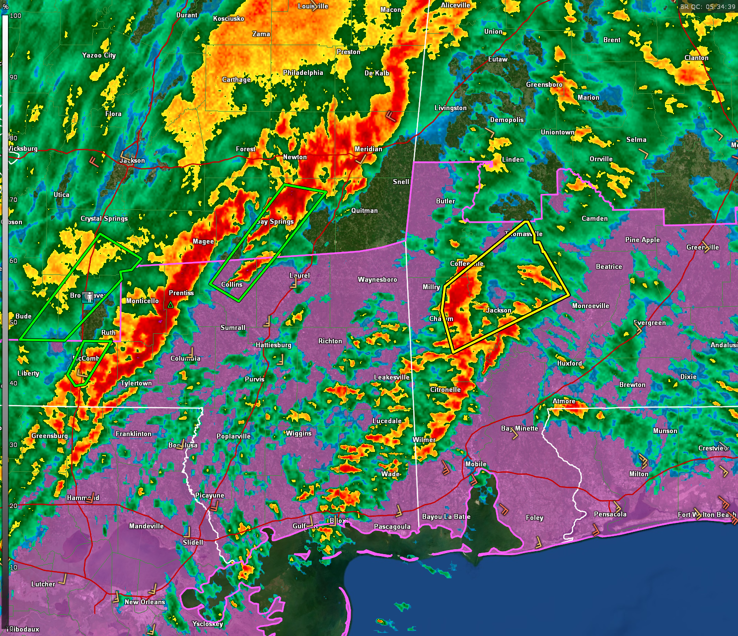
A couple of the storms over southern Mississippi and southern Alabama are exhibiting intensification. One is over Washington County, Alabama southwest of Chatom. A severe thunderstorm was was just issued for parts of Washington, Choctaw, Clarke, and Monroe Counties. That storm is producing 18 flashes of lightning per minute. There is broad rotation ENE of Chatom. This dangerous part of the storm will pass near St. Stephens and cross Alabama 69 northwest of Jackson, then US-84 east of Coffeeville.
In Mississippi, the line segment from southeastern Simpson through western Jefferson Davis County into Lawrence County have picked up intensity as well.
The warm front now is further inland over southern Mississippi and southern Alabama. It extends from Columbia MS to Hattiesburg to Bay Minette to Pensacola. It will continue to lift slowly northward. There is the possibility for severe storms and a tornado along this front and in any storms that form ahead of the cold front. That front now extends along I-55 in Mississippi.
The NWS in Birmingham just issued a special weather statement for parts of Greene and Sumter counties. The segment from Scooba down to Panola MS and down over the Meridian area is intensifying and how a bowing look to it. It could be capable of 50 mph wind gusts. We will monitor it to make sure it doesn’t become severe.
A tornado watch continues until 7 a.m. for South Alabama.
Category: Alabama's Weather, ALL POSTS, Severe Weather
About the Author (Author Profile)
Bill Murray is the President of The Weather Factory. He is the site's official weather historian and a weekend forecaster. He also anchors the site's severe weather coverage. Bill Murray is the proud holder of National Weather Association Digital Seal #0001 @wxhistorianSubscribe
If you enjoyed this article, subscribe to receive more just like it.


