Alabama Update at 7:25 pm
All is quiet at this hour across Alabama.
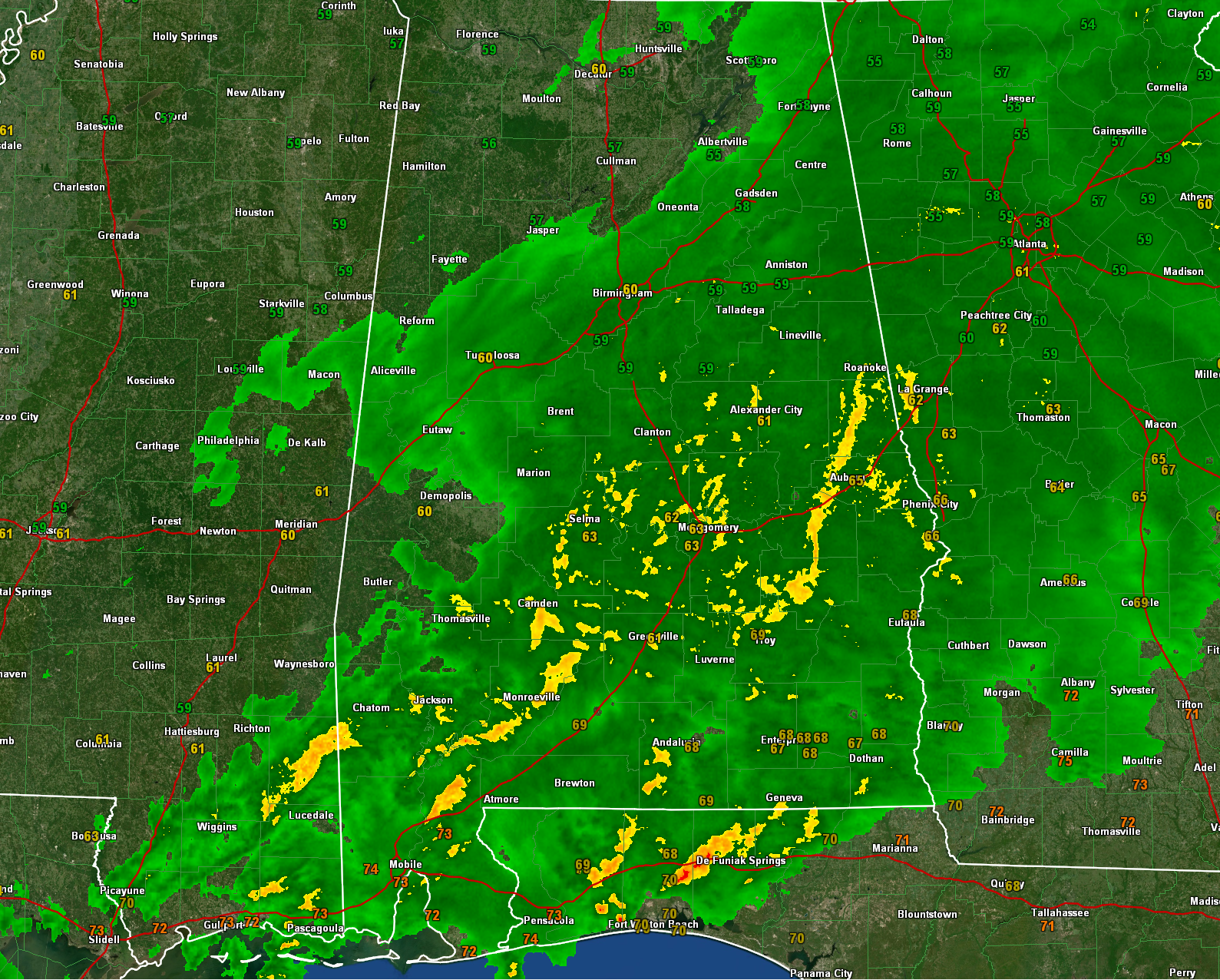
Moderate to heavy rain covers much of Central Alabama south of a line from Marion to Centreville to Birmingham to Centre.
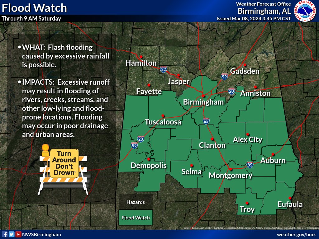
Rainfall amounts across North Central Alabama have been fairly moderate. Several counties were cleared from the flash flood watch earlier this afternoon, mainly across North Central Alabama. Flash flooding is a concern, particularly for areas that have already experienced rainfall through the late morning and early afternoon. Near all time maximum precipitable water values for this time of year are contributing to the heavy showers and thunderstorms.
Overnight, the axis of widespread rain transitions more centrally over Alabama, potentially leading to flash flooding and severe weather threats, particularly along the I-85 corridor. Flash flooding may occur during the overnight hours, necessitating awareness and precautionary measures.
The SPC has pushed the severe threat further south and east. Here is their 7 p.m. update:
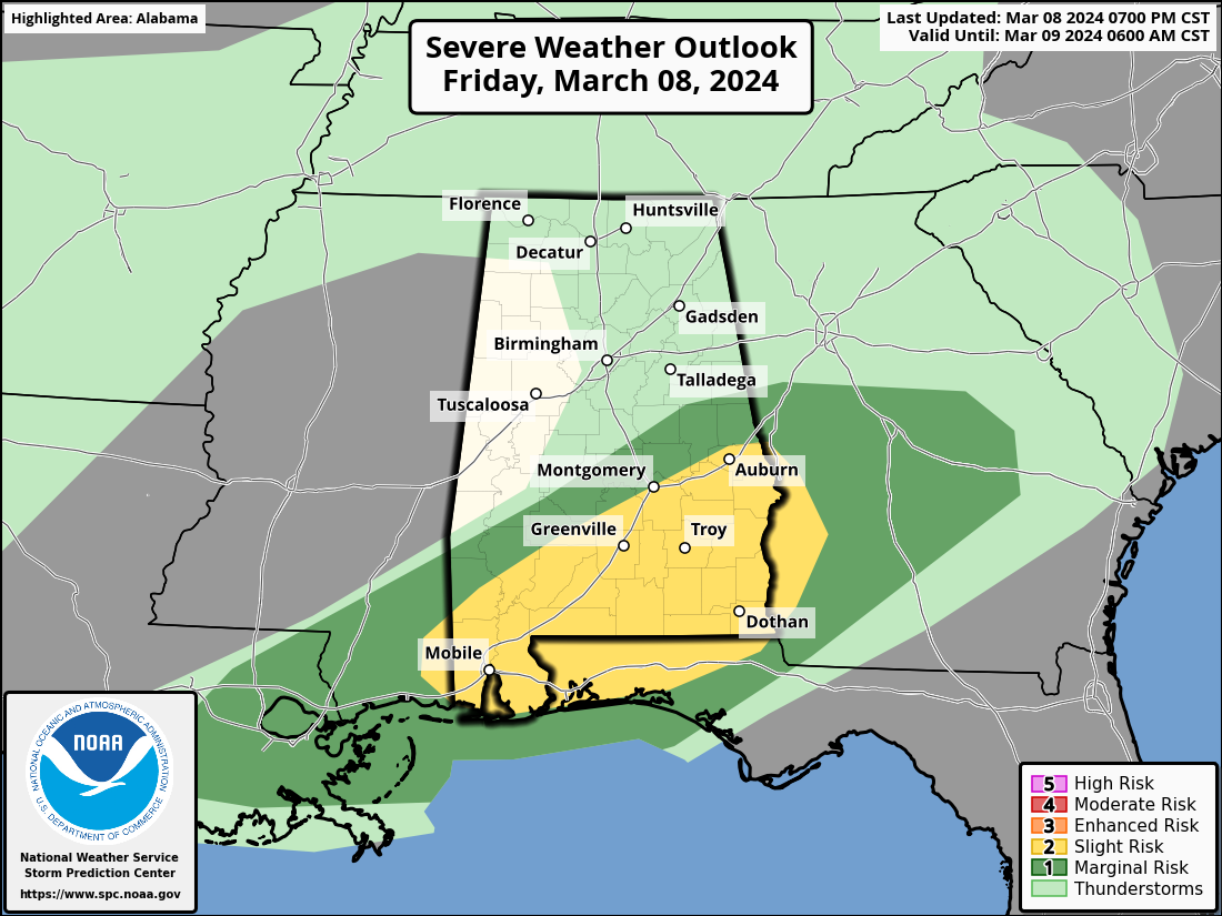
Instabilities increase into the 1000 J/kg range in the far southern counties during the evening, with upper-level divergence and stronger mid-level winds enhancing severe weather potential.
Areas north of a line from Butler to Selma to Rockford to Roanoke have no threat of severe weather overnight. The best chance for any severe weather including damaging winds and a couple of tornadoes will be south of a line from Chatom to Vredenburgh to Montgomery to Valley.
A tornado watch is in effect for Southwest Alabama, southern Mississippi, and parts of Southeast Louisiana until 9 p.m.
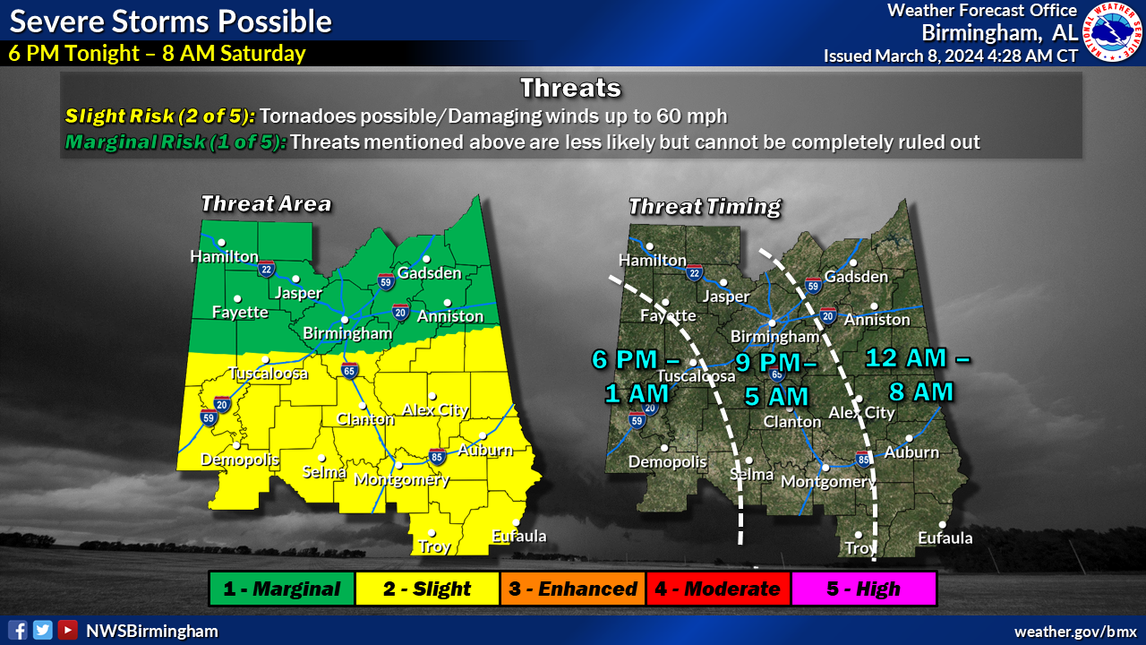
Time frames for severe weather look like this:
But so far all is good across Central Alabama. There was an interesting circulation in a little mesoscale convective vortex that has spun through Washington, Clarke, and Wilcox Counties, but it has weakened as it has run into more stable air.
Overnight temperatures will remain in the mid-50s to low 60s, with a saturated low-level profile leading to broken to overcast skies on Saturday.
Dry and cool weather expected Saturday night through Wednesday, with potential frost development Sunday and Monday nights, especially across cooler locales in the far north of Central Alabama.
A system may approach towards the end of the extended period next Thursday into Friday, increasing rain chances.
Stay informed with the latest forecasts and updates throughout the night here on AlabamaWX.
Category: Alabama's Weather, ALL POSTS, Severe Weather
About the Author (Author Profile)
Bill Murray is the President of The Weather Factory. He is the site's official weather historian and a weekend forecaster. He also anchors the site's severe weather coverage. Bill Murray is the proud holder of National Weather Association Digital Seal #0001 @wxhistorianSubscribe
If you enjoyed this article, subscribe to receive more just like it.


