Sunday Morning Weather Briefing: Frost Possible Tonight
As we wake up to a new day, it’s worth noting that last night marked the transition to Daylight Saving Time, bringing with it the familiar shift forward in our clocks. As we adjust to this annual change, our focus remains on the weather conditions shaping our day and the week ahead across North and Central Alabama. From the aftermath of yesterday’s cold front passage to the gradual transition towards warmer temperatures and potential rainfall by week’s end, let’s delve into the forecast to ensure you’re well-prepared for the days ahead.
SATURDAY REWIND: Yesterday, a cold front swept through the state, ushering in cooler and drier air from the north. Clouds hung tough through the day, although a few peeks of sunshine did manage to sneak through at times. The mercury struggled to get out of the 50s across the Tennessee Valley with 60s generally elsewhere across Central Alabama. A few South Central Alabama locations managed to reach 70F. Skies cleared overnight from the northwest, and temperatures dropped quickly despite northwesterly winds that remained a little brisk. Readings this morning are in the 30s over the northern half of the state, with lower and middle 40s south. Fortunately, the winds helped prevent a lot of frost from forming.
FOR YOUR SUNDAY: Today’s Readings will be a little cooler than yesterday despite abundant sunshine. Afternoon readings will be in the upper 50s to middle 60s.
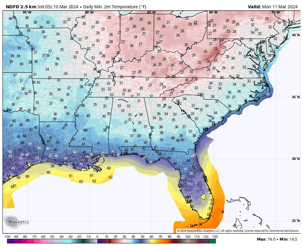
FROST CONCERNS TONIGHT: With temperatures running a few degrees colder tonight, Tennessee Valley locations might register a light freeze. Frost is possible across parts of Central Alabama, where readings in the middle 30s will combine with light winds to make conditions right for it. Readings will range from 31-33F across the Valley, and 33-38F across Central Alabama.
EARLY PART OF THE WEEK: As we move into the early part of the week, stable weather conditions are expected to prevail across Alabama. High pressure will dominate, bringing dry and pleasant conditions to start the week. Monday will see plenty of sunshine, allowing temperatures to gradually warm up into the upper 50s to mid-60s range despite a persistent northwesterly flow. By Tuesday, the influence of the high-pressure system will continue, leading to further warming as southerly to southwesterly flow develops. This will result in temperatures rebounding into the 60s and potentially even approaching the 70-degree mark. Cloud cover may increase slightly as a couple of passing shortwaves move through the region, but any impacts on local weather are expected to be minimal. Heading into Wednesday, the trend of warmer temperatures persists as the airmass continues to moderate. While there may be some increase in cloud cover, particularly in the afternoon hours, conditions overall remain dry with no significant precipitation expected. It’s shaping up to be a pleasant start to the week, providing an opportunity to enjoy the outdoors and take advantage of the mild temperatures before potential changes later in the week.
LATE WEEK STORM SYSTEM: Transitioning towards the latter part of the week, we anticipate a shift in our weather pattern as a significant system approaches the region. By Thursday, the influence of a shortwave and associated surface low will become more pronounced, increasing cloud cover and bringing a heightened chance of precipitation to North and Central Alabama. Rain showers are likely, accompanied by the possibility of thunderstorms as the system moves through. Severe weather looks likely to the west of Alabama, but conditions do not look supportive by the time the storm system moves into Bama.
WEEKEND OUTLOOK: As we progress into Friday and the weekend, this weather system is expected to linger over the area, potentially leading to continued wet conditions. Model guidance suggests discrepancies regarding the timing and extent of the rainfall, so we will wait for more clarity before making a call for weekend weather.
VOODOO TERRITORY: Another wet weather system will loom on the horizon for the start of the week two forecast period. Rain and storms look likely for Monday night the 18th into Tuesday the 19th, but the precipitation should be gone by Wednesday the 20th. We will enjoy a short period of fine weather as high pressure takes over until another storm brings some unsettled weather for the weekend.
BEACHCAST: Cooler weather is the weather story for the beautiful beaches of Alabama and Northwest Florida. Things should be dry through Wednesday, when a few showers may return to the scene. Unfortunately, rain will be in the picture each day right on through the weekend. Temperatures will be in the 60s for highs through Tuesday, but 70s will return for the remainder of the week. Lows will be in the 40s through Tuesday morning, with warming overnight lows through the end of the week and in to the weekend. Rip current risk should be low to moderate all week. Water temperatures have warmed into the lower 70s.
Click here to see the Beach Forecast Center page.
NATIONALLY: As the calendar turns to Sunday, the nation braces for a diverse array of weather phenomena. In the northern Mid-Atlantic and southern New England, a potent mix of consolidating low-pressure systems and advancing cold fronts is poised to unleash heavy rainfall and vigorous winds through tonight. This turbulent weather extends into the northern Appalachians, where the cold air descending southward will transform rain into heavy, wet snow, accumulating 6 to 12 inches, accompanied by strong gusts. This snowy onslaught is anticipated to persist into Sunday, heralding lake-effect snowstorms across the lower Great Lakes into Monday morning, affecting areas with over 6 inches of snowfall. Meanwhile, the Pacific Northwest and northern Rockies are gearing up for a spell of unsettled weather as they face rounds of lower-elevation rain and substantial snowfall across higher terrains, highlighted by 1 to 2 feet of snow in the Washington Cascades. This climatic tableau is framed by cooler-than-usual temperatures across the Mid-Atlantic and Northeast, contrasting with warmer spells dominating the central and northern US, as the West maintains near-normal temperature levels. The country is thus enveloped in a mélange of weather patterns, marking a dynamic and diverse start to the week.
DANCING WITH THE STATS: 90F in the Land of Mickey Mouse yesterday at Orlando International. This broke the previous record for the date of 89F. 87F at Daytona Beach also broke their record for the date, which was 85F. Downtown Charleston SC broke their daily rainfall record as 3.63” of rain fell, smashing the old record for the date of 1.49”
ADVERTISE WITH US: Deliver your message to a highly engaged audience by advertising on the AlabamaWX.com website. We have a lot of big plans for this year. Don’t miss out! We can customize a creative, flexible, and affordable package that will suit your organization’s needs. Contact me, Bill Murray, at (205) 687-0782 and let’s talk.
WEATHERBRAINS: This week, the panel will entertain Dr. Harold Brooks, of severe weather research fame. We will be talking about Hans Ertel, a famous German meteorologist, as well as other German meteorologists who made contributions to the field. Check out the show at www.WeatherBrains.com. You can also subscribe on iTunes. You can watch the show live on our new YouTube channel for the show.You will be able to see the show on the James Spann 24×7 weather channel on cable or directly over the air on the dot 2 feed.
ON THIS DATE IN 1899: An early morning F2 tornado skipped along a four-mile path on the eastern side of Birmingham from Avondale to Woodlawn. Twenty-five homes and two churches were damaged or destroyed. Only three people were injured. There was one other significant tornado that early morning, one estimated to have been an F2, that touched down east of Jasper. No one was injured although many animals were killed. Follow my weather history tweets on Twitter. I am @wxhistorian at Twitter.com.
Category: Alabama's Weather, ALL POSTS
About the Author (Author Profile)
Bill Murray is the President of The Weather Factory. He is the site's official weather historian and a weekend forecaster. He also anchors the site's severe weather coverage. Bill Murray is the proud holder of National Weather Association Digital Seal #0001 @wxhistorianSubscribe
If you enjoyed this article, subscribe to receive more just like it.


