Clouds Are Hangin’ On Across Portions of Central Alabama This Afternoon
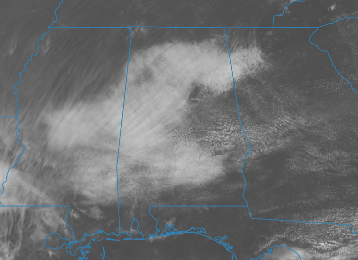
As of 1:45 PM on the day preceding St. Patrick’s Day, Central Alabama is experiencing a mix of cloud cover, with some areas seeing partial clearing and others under a blanket of clouds. This variation is reflected in the current temperatures, ranging from the upper 50s where clouds persist to the lower 70s where sunshine dominates. Specific temperature readings include Eufaula at 72º, Jasper at 57º, and Birmingham at 61º.
Over the course of the day, we anticipate these clouds to gradually dissipate, allowing for increased sunshine across much of the region. This trend will keep conditions dry, with temperatures potentially climbing into the 70s for many areas. However, locations where cloud cover lingers may see highs remaining in the 60s. The overall outlook remains favorable, although there is a looming possibility of rain as we head into tonight.
Clouds will make a comeback tonight as a system approaches from the west, leading to the development of showers after midnight moving from southwest to northeast. Overnight temperatures are expected to drop into the 50s.
Looking ahead to Sunday, the advancing system will bring a trough axis northward, resulting in a frontal passage across Central Alabama. This setup will introduce a chance of showers throughout the day, particularly north of I-20, while areas south of this line may experience rain accompanied by a few storms. Although no severe weather is currently forecasted for Central Alabama, a Marginal Risk is in effect for Mobile and Baldwin Counties, and along with the Florida Panhandle. High temperatures are anticipated to range from the lower 60s to the lower 70s.
Category: Alabama's Weather, ALL POSTS
About the Author (Author Profile)
Scott Martin is an operational meteorologist, professional graphic artist, musician, husband, and father. Not only is Scott a member of the National Weather Association, but he is also the Central Alabama Chapter of the NWA president. Scott is also the co-founder of Racecast Weather, which provides forecasts for many racing series across the USA. He also supplies forecasts for the BassMaster Elite Series events including the BassMaster Classic.Subscribe
If you enjoyed this article, subscribe to receive more just like it.


