

Sunday Brunch Update: Freeze Watches for Monday Night into Tuesday Morning
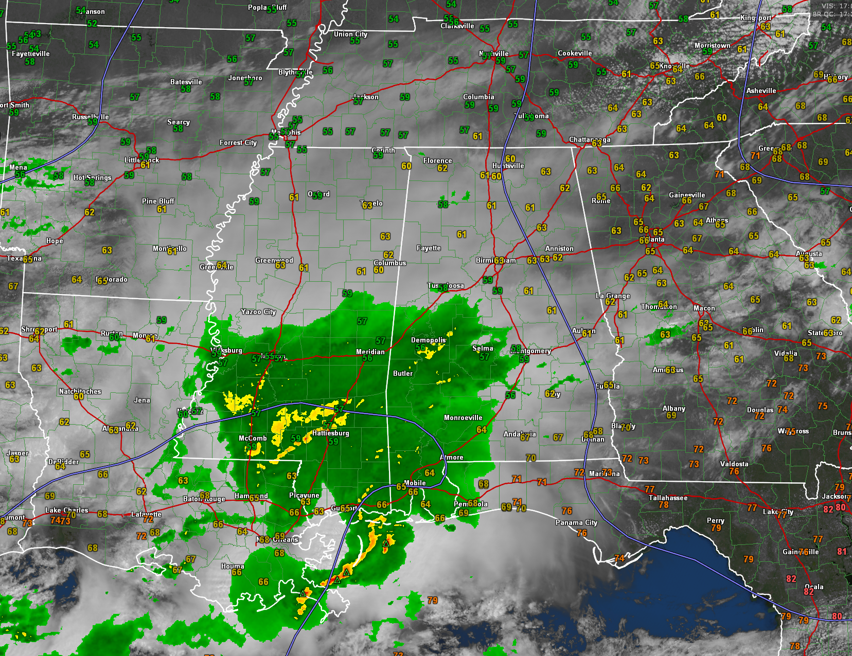
It’s been a tale of two wet weather systems this morning across Alabama. The first, triggered by a weakening disturbance, pushed into West Alabama, mainly along and north of US-80 around 1:15 a.m. It progressed eastward during the night and exited eastern sections of the state around 9 a.m. Most folks picked up less that a tenth of an inch of rain (I got 0.09″ near Acton Road, and BHM picked up 0.03″), but the US-80 Corridor was a little luckier with a little rumbling thunder and heavier rain. Montgomery’s Dannelly Field picked up .19 inches and Grouby Field in Selma picked up .36 inches.
Morning lows ranged from 48F at Anniston to 51F at Tuscaloosa, to 52F at Birmingham, to 53F at Bessemer, to 54F at Calera.
Outside of the precipitation areas, skies have been partly sunny, and this has allowed temperatures to warm into the lower 60s North, with upper 50s prevalent in the rainier areas.
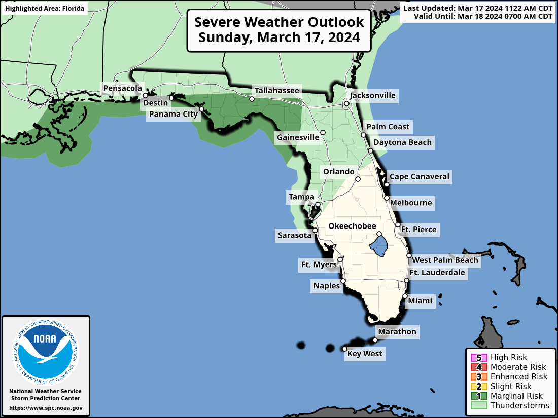
A second batch of rain with storms near the Gulf Coast is moving through South Alabama. It is associated with a mesoscale convective complex (an organized disturbance) that moved out of Southeast Texas overnight. The SPC does have extreme coastal sections under a marginal risk for severe weather today and tonight (level 1/5).
Here is current radar and satellite along with temperatures:
Skies will clear tonight and it will turn colder as northwesterly flow brings us lots of colder air. Readings by morning shoudl look like this:
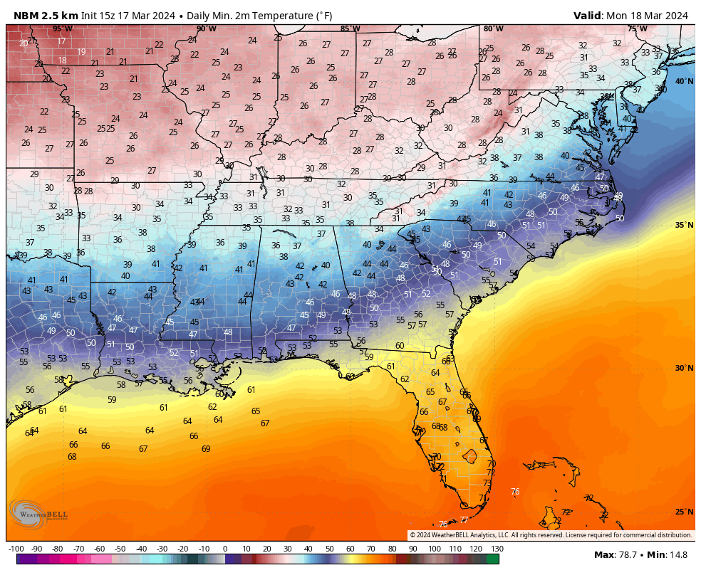
Some frost is possible overnight, but a persistent wind through the night should limit those chances to protected areas.
Monday will feature sunshine but below average temperatures. Highs will be in the upper 40s to low 50s North, with 54-60F across Central Alabama.
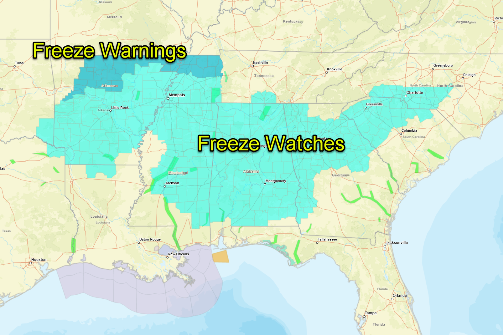
Monday night will be the problem, with freezing conditions likely. NWS offices in Birmingham, Huntsville, Mobile, and Tallahassee (all the ones that serve our state) have issued freeze watches for tomorrow night into Tuesday morning.
Make sure to protect tender vegetation, pets, and people tomorrow night with the cold late season readings.
Temperatures will moderate a little Tuesday and be quite nice by Wednesday and Thursday. Rain returns late Thursday night.
Category: Alabama's Weather, ALL POSTS
About the Author (Author Profile)
Bill Murray is the President of The Weather Factory. He is the site's official weather historian and a weekend forecaster. He also anchors the site's severe weather coverage. Bill Murray is the proud holder of National Weather Association Digital Seal #0001 @wxhistorianSubscribe
If you enjoyed this article, subscribe to receive more just like it.


