

Severe Thunderstorm Warning for Macon and Montgomery Counties
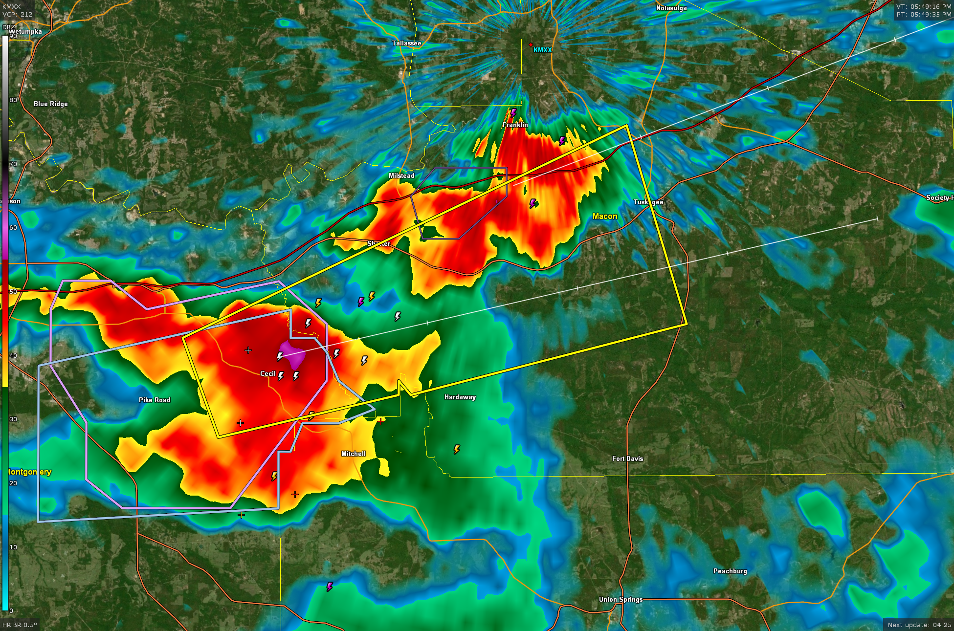
Severe thunderstorm over northeastern Montgomery County near Cecil. It is moving into Macon County as it moves east northeast into Macon County at 30 mph. It will be near Tuskegee before 630 p.m.
BULLETIN – IMMEDIATE BROADCAST REQUESTED
Severe Thunderstorm Warning
National Weather Service Birmingham AL
546 PM CDT Sat Apr 20 2024
The National Weather Service in Birmingham has issued a
* Severe Thunderstorm Warning for…
Southwestern Macon County in southeastern Alabama…
East central Montgomery County in south central Alabama…
* Until 630 PM CDT.
* At 546 PM CDT, a severe thunderstorm was located near Waugh, or 11
miles southwest of Milstead, moving east at 30 mph.
HAZARD…60 mph wind gusts and quarter size hail.
SOURCE…Radar indicated.
IMPACT…Hail damage to vehicles is expected. Expect wind damage
to roofs, siding, and trees.
* Locations impacted include…
Tuskegee, Shorter, Franklin, Liverpool, Cross Keys, and Cecil.
PRECAUTIONARY/PREPAREDNESS ACTIONS…
For your protection move to an interior room on the lowest floor of a
building
Category: Alabama's Weather, ALL POSTS, Severe Weather
About the Author (Author Profile)
Bill Murray is the President of The Weather Factory. He is the site's official weather historian and a weekend forecaster. He also anchors the site's severe weather coverage. Bill Murray is the proud holder of National Weather Association Digital Seal #0001 @wxhistorianSubscribe
If you enjoyed this article, subscribe to receive more just like it.


