

Alabama Update at 6:30 p.m.
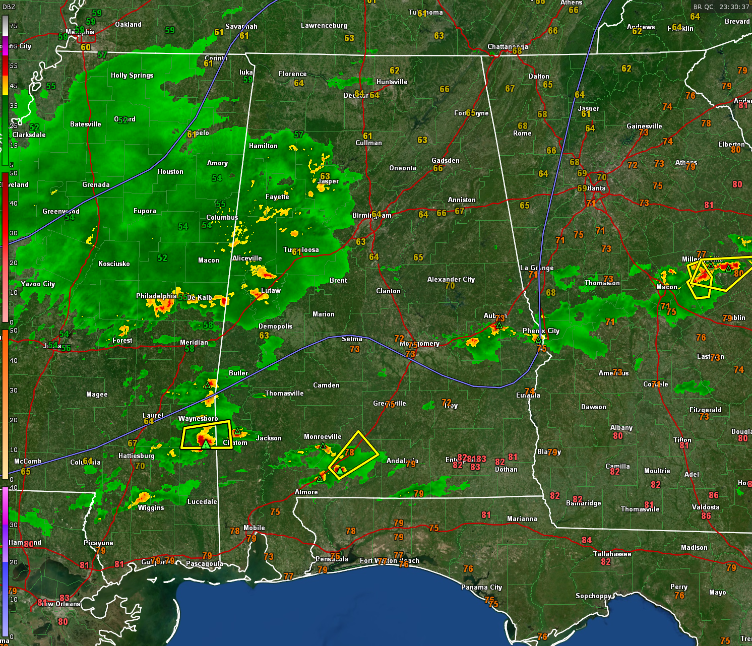
A large area of rain is moving across the northern half of Mississippi at this hour and is well into western Alabama.
Thunderstorm now are over Walker, Tuscaloosa, and Pickens counties extending back into eastern Mississippi north of I-20.
This area of rain and storms will rumble across much of North Central Alabama over the next few hours. Heavy rain, gusty winds, and some small hail may accompany the stronger storms. CAPE values are very low and shear is marginal, so the severe weather threat is nearly non-existent.
A broken line of strong storms extends southward over southeastern Mississippi, entering western Alabama. A severe thunderstorm warning is in effect for northwestern Washington County, Alabama, including areas west of Millry and Chatom.
In the I-85 Corridor, strong storms extend from southwest of Auburn to between Shorter and Tuskegee. They are not severe.
In the I-65 Corridor, a severe storm is along the Escambia/Conecuh County line southwest of Castleberry. It will be approaching Evergreen, which is in the polygon.
Category: Alabama's Weather, ALL POSTS, Severe Weather
About the Author (Author Profile)
Bill Murray is the President of The Weather Factory. He is the site's official weather historian and a weekend forecaster. He also anchors the site's severe weather coverage. Bill Murray is the proud holder of National Weather Association Digital Seal #0001 @wxhistorianSubscribe
If you enjoyed this article, subscribe to receive more just like it.


