The Sunday Briefing — A Few More Scattered Showers & Storms Today
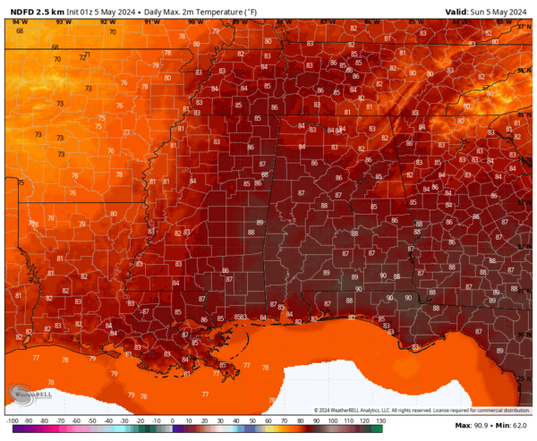
Sunday will be warmer and a little more humid than what we saw on Saturday, as we are still seeing the potential of a shortwave moving into the area by the evening which will bring an increase to our rain and storm chances, eventually becoming likely across Central Alabama by the start of the late night hours. However, scattered showers and storms will be possible during the afternoon as well, with the daytime heating. For now, severe weather does not look likely, but we could see a strong storm or two as some gusty winds may occur. Afternoon highs will reach the mid 80s to the lower 90s. Rain and storms will be likely into the late night and overnight hours, with lows in the lower to mid 60s.
On Monday morning, the shortwave system will move northeast, leading to less morning rain and clouds. In the afternoon, expect isolated to scattered showers, especially in the northeast. Later in the day, another shortwave may bring a few showers and storms, but ridging over the southeast could reduce these chances. Highs will be in the 80s.
Ridging over the southeast will really limit the moisture levels on Tuesday, but there will be enough available that a small chance of isolated to scattered showers and storms are possible. However, most of Central Alabama will remain dry, with highs in the mid to upper 80s.
Same story on Wednesday for the area, but it will be hotter. We’ll have a small chance of a few isolated showers or storms for now. We’ll be watching to see if another MCS forms to our west and moves into Central Alabama, but for now, much of the activity looks to stay north of the state. Highs in the mid 80s to the lower 90s.
A strong cold front is expected to move into the area late on Thursday that looks to create a highly unstable airmass ahead of it. This setup shows the potential of large hail and damaging winds with any storms that form at that time, or with an MCS that may form and move through. Better forcing will be just north of Central Alabama, but we still have to watch for the potential for severe storms, as that is uncertain for now. Highs in the mid 80s to the lower 90s.
Most locations on Friday will see cooler temperatures after the front passes through, but rain and storms will continue to be possible along and ahead of the front. The good news is that pleasant spring weather is expected for the weekend ahead. Highs ranging from the upper 70s to the upper 80s.
As stated, more seasonable weather is expected for the weekend. We can expect dry weather with mostly sunny skies on both days, with highs in the 70s.
Category: Alabama's Weather, ALL POSTS, Severe Weather, Weather Xtreme Videos


