Checking Out the SPC Day One Outlook
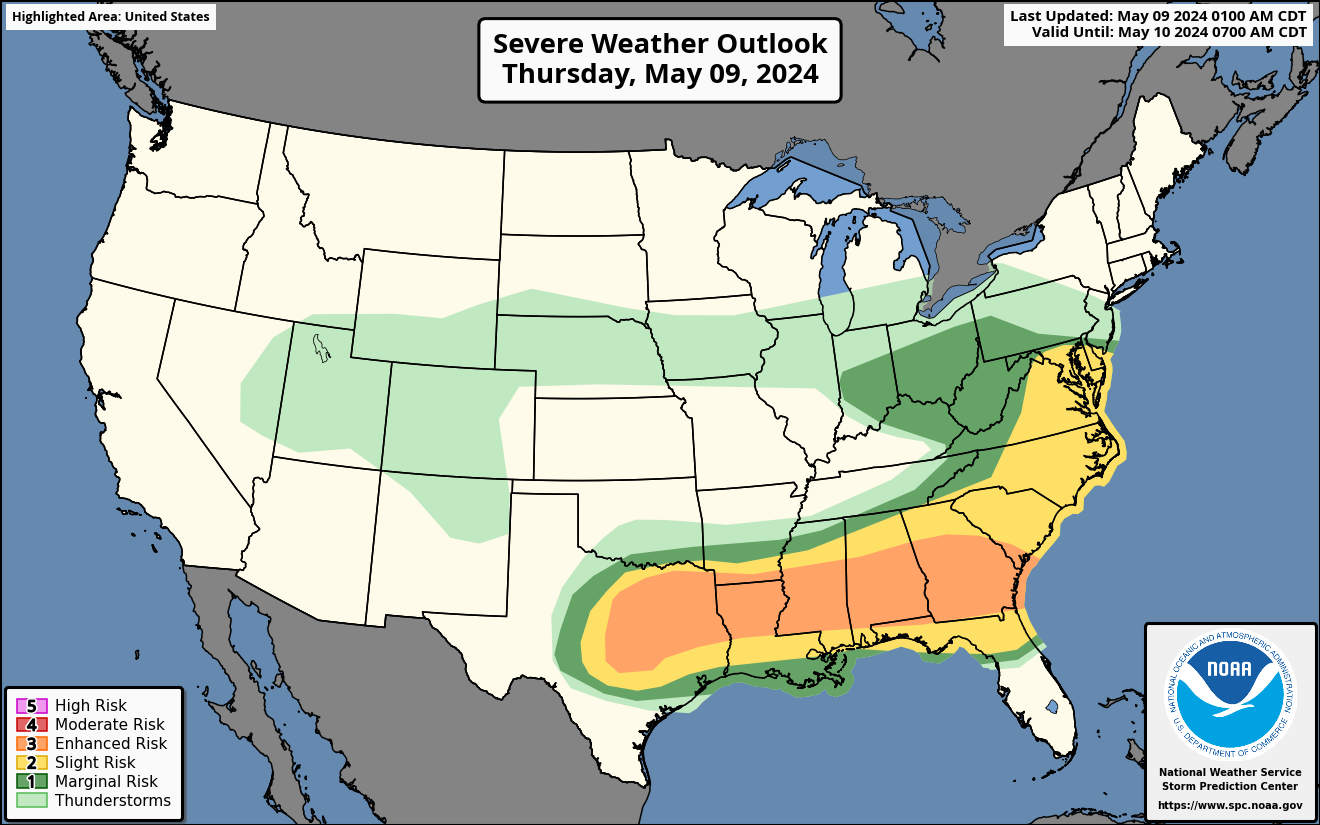
The SPC Day One Outlook for Thursday came out a couple of hours ago and it in interesting. Here is a closer look at Alabama’s portion of it…
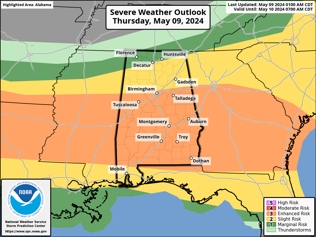
The outlook contemplates two rounds of severe weather today and tonight. The first is evolving now and will incorporate the threats from the batch of storms that will be moving southward into Central Alabama during the morning and its further intensification as it drops southward during the day.
Then, a large mesoscale convective system is depicted by the convection allowing models like the HRRR to move from Texas across the southern states during the evening into into Alabama during the pre-dawn hours again. It appears this thunderstorm complex will remain south of I-20, with the strongest storms south og US-80 from DEmopolis to Selma to Montgomery to Auburn.
Damaging winds and large hail will be the main threats with the second system, but a tornado or two can’t be ruled out.
Category: Alabama's Weather, ALL POSTS, Severe Weather
About the Author (Author Profile)
Bill Murray is the President of The Weather Factory. He is the site's official weather historian and a weekend forecaster. He also anchors the site's severe weather coverage. Bill Murray is the proud holder of National Weather Association Digital Seal #0001 @wxhistorianSubscribe
If you enjoyed this article, subscribe to receive more just like it.


