Flash Flood Warning for Huntsville & Vicinity
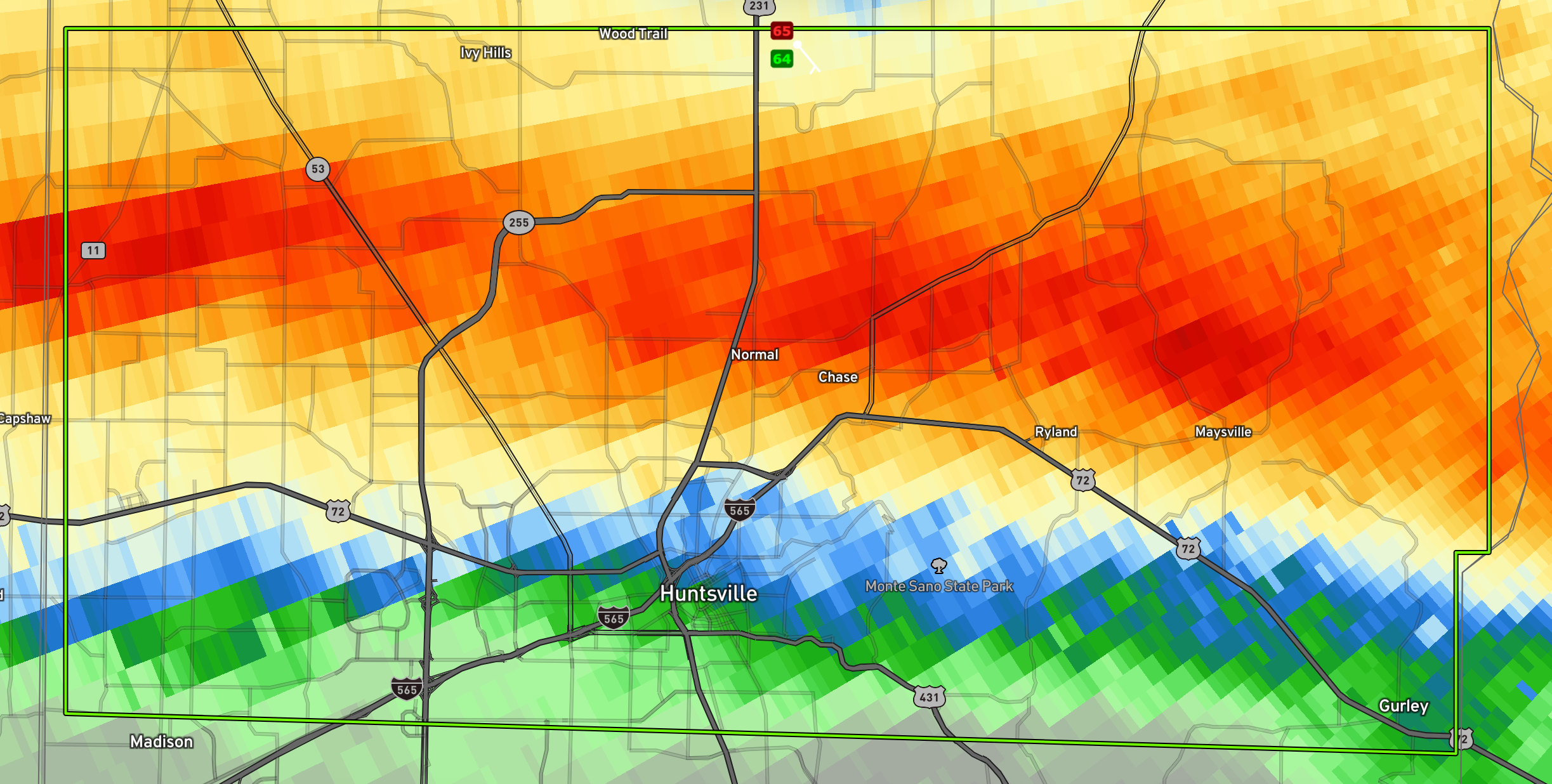
3.5-4 inches of rain has fallen in the red areas on this graphic of the warning…
BULLETIN – EAS ACTIVATION REQUESTED
Flash Flood Warning
National Weather Service Huntsville AL
606 AM CDT Thu May 9 2024
The National Weather Service in Huntsville has issued a
* Flash Flood Warning for…
Central Madison County in north central Alabama…
* Until 915 AM CDT.
* At 606 AM CDT, An off duty NWS employee reported thunderstorms
producing heavy rain across the warned area. Between 2 and 4
inches of rain have fallen. The expected rainfall rate is 0.25 to
0.5 inches in 1 hour. Additional rainfall amounts up to 1 inch are
possible in the warned area. Flash flooding is ongoing or expected
to begin shortly.
HAZARD…Flash flooding caused by thunderstorms.
SOURCE…Off duty NWS employee reported.
IMPACT…Flash flooding of small creeks and streams, urban
areas, highways, streets and underpasses as well as
other poor drainage and low-lying areas.
* Some locations that will experience flash flooding include…
Huntsville, Madison, Moores Mill, Meridianville, Redstone Arsenal,
Gurley, Alabama A And M University, University Of Alabama In
Huntsville, Harvest, Ryland, Brownsboro and Maysville.
PRECAUTIONARY/PREPAREDNESS ACTIONS…
Turn around, don’t drown when encountering flooded roads. Most flood
deaths occur in vehicles.
Category: Alabama's Weather, ALL POSTS, Severe Weather
About the Author (Author Profile)
Bill Murray is the President of The Weather Factory. He is the site's official weather historian and a weekend forecaster. He also anchors the site's severe weather coverage. Bill Murray is the proud holder of National Weather Association Digital Seal #0001 @wxhistorianSubscribe
If you enjoyed this article, subscribe to receive more just like it.


