Alabama Update at 6:35 p.m.
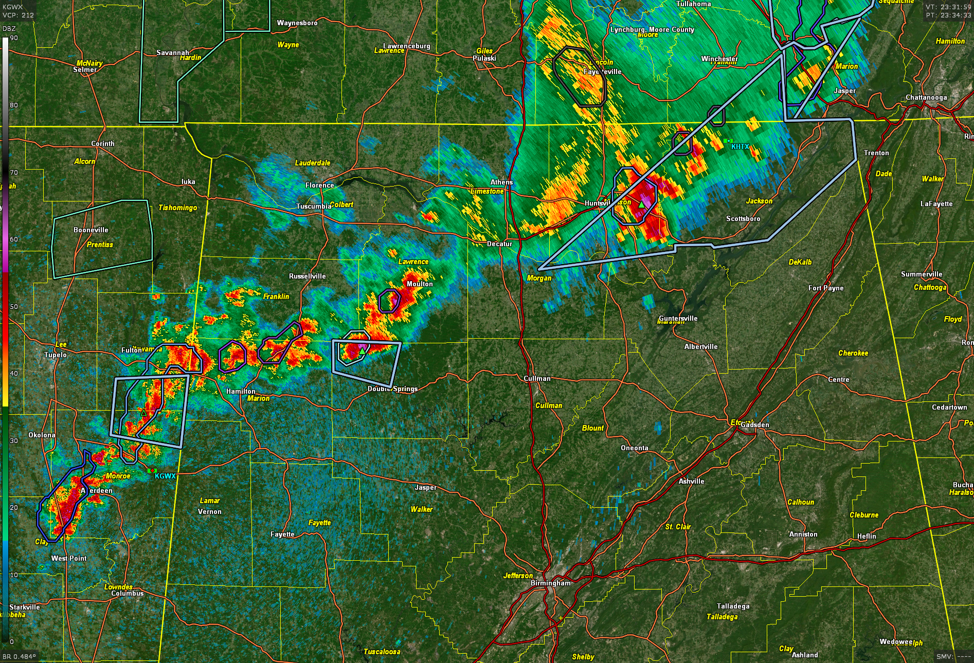
A line of thunderstorms continues to push east across northern Alabama tonight.
A severe thunderstorm watch remains in effect until 8 p.m. CDT for 7 counties in the Tennessee Valley.
At 6:35 p.m., the line extends from Jackson and Madison Counties, just east of Huntsville, across Morgan and Lawrence Counties, where there is a strong storm southwest of Moulton, into northwestern Winston County north of Haleyville to near Hackleburg and Bexar in Winston Counties. The line then extends into Itawamba, Monroe, and Clay Counties in northeastern Mississippi.
The strongest storm is the one near Haleyville in Winston County and the one in Madison County between Huntsville and Gurley. Neither are quite severe, but they both have hail to the size of mothballs and winds that could gust to 40 mph. We are most closely watching the Winston County storm right now, as it looks to have a chance to become severe.
The mesoscale environment looks like this:
…CAPE in the 1,000 – 2,000 joules of CAPE (moderate)
…Effective shear is about 35 knots (low)
…0-1km helicity…very low…so no tornadoes
The line should be near Jasper and Cullman by 830 pm, and in the Birmingham area and I-59 Corridor around 10:30 pm. They will weaken substantially by the time they reach Birmingham.
Category: Alabama's Weather, ALL POSTS, Severe Weather
About the Author (Author Profile)
Bill Murray is the President of The Weather Factory. He is the site's official weather historian and a weekend forecaster. He also anchors the site's severe weather coverage. Bill Murray is the proud holder of National Weather Association Digital Seal #0001 @wxhistorianSubscribe
If you enjoyed this article, subscribe to receive more just like it.


