Storms over Southeastern Alabama
Here’s an update on the Alabama weather situation at 1:35 PM
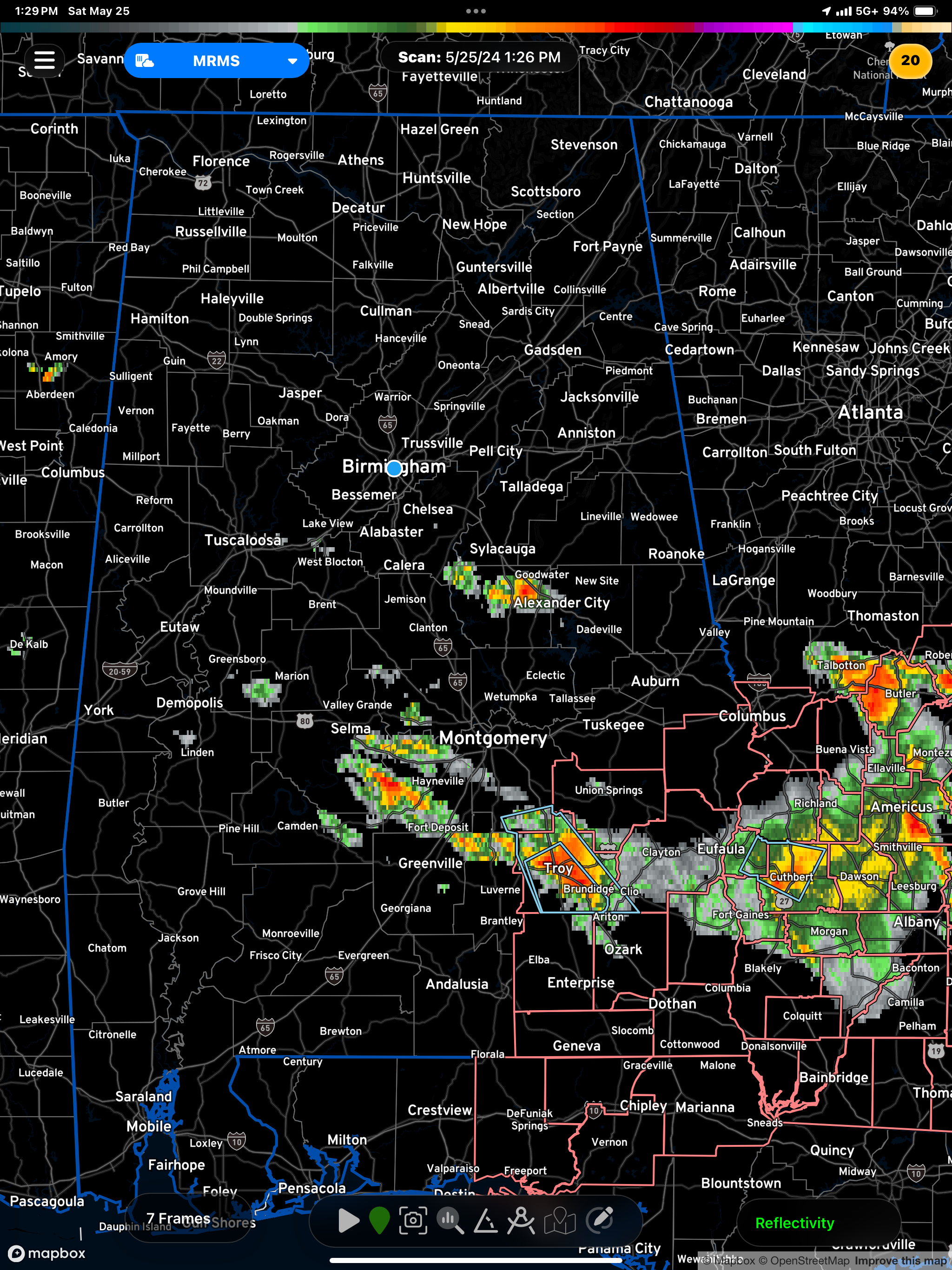
The northern half of Alabama is mostly free of showers and thunderstorms this hour, but there is a developing thunderstorm between Amory and Aberdeen in Eastern Mississippi.
There is an isolated shower south of Chelsea in Shelby County
Other showers extend from Southeastern Shelby County across Coosa and Tallapoosa counties with a heavier shower with some thunder near Alexander city in Tallapoosa county.
Scatter showers extend from Marengo county into Southwestern Perry county then over to Dallas county near Selma. The strongest thunderstorms in Alabama are from Southwest of Montgomery Southwest of Hainesville to deposit to Troy and Brundidge. A significant weather advisory is an effect for Troy and Brundage, where some gusty winds could reach 40 miles an hour with some small hail very heavy rain and lightning.
A severe thunderstorm watch is an effect for eight counties in the southeastern corner of the state. It goes until 7 PM.
Category: Alabama's Weather, ALL POSTS, Severe Weather
About the Author (Author Profile)
Bill Murray is the President of The Weather Factory. He is the site's official weather historian and a weekend forecaster. He also anchors the site's severe weather coverage. Bill Murray is the proud holder of National Weather Association Digital Seal #0001 @wxhistorianSubscribe
If you enjoyed this article, subscribe to receive more just like it.


