The Sunday Briefing — Strong/Severe Storms Possible Tonight Through Memorial Day
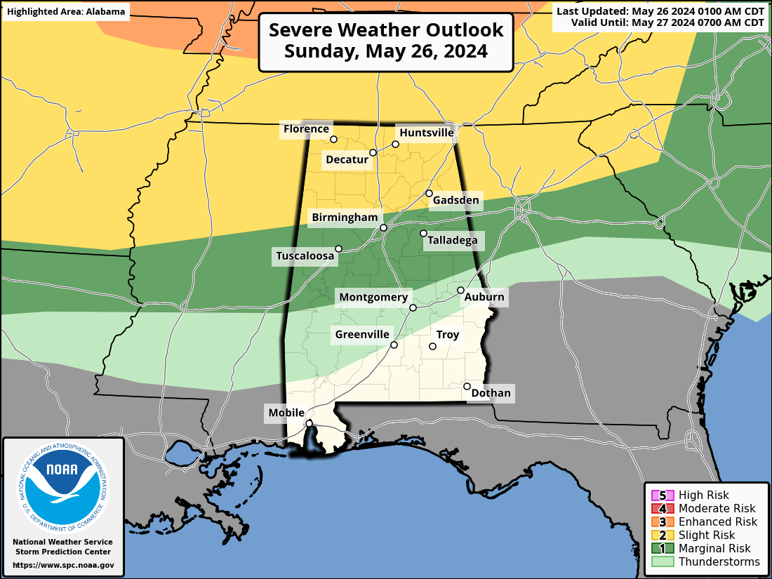
Ridging across Central Alabama today will keep any thunderstorms from forming during the daylight hours, but that same ridge will allow our highs to reach the upper 80s to the lower 90s. However, as we approach the midnight hour tonight, storms look to enter from the northwest and move southeast across the northern half of the area overnight. We’ll have plenty of instability in place. A slight risk for severe storms is up along and north of a line from Millport to Gardendale to Jacksonville, while a marginal risk extends southward to Uniontown to Deatsville to LaFayette. All modes of severe weather will be possible, including a low-end threat of tornadoes, mainly from 2am to 8am Monday morning.
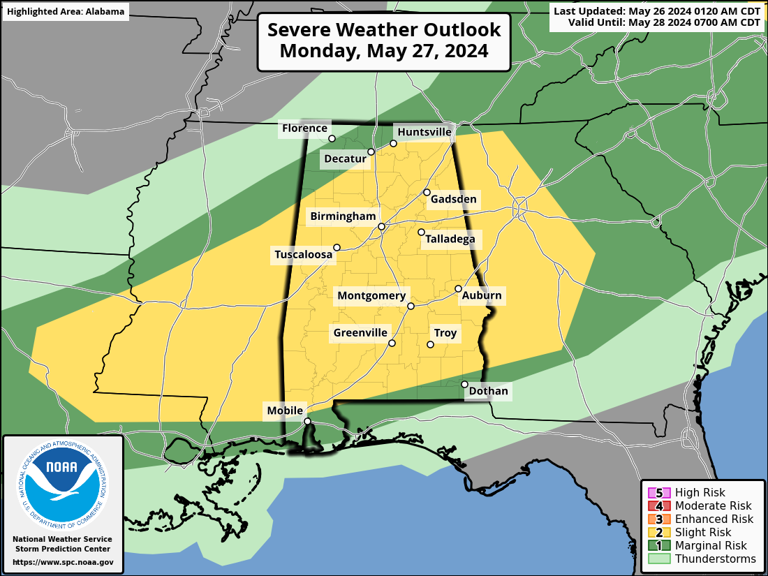
Once those storms come to an end on Monday, a surface front will begin to push across Central Alabama, and more strong to severe storms will accompany that front during the afternoon and evening hours. A slight risk is up for nearly all of Central Alabama, with a marginal risk up extending northward of that. Once again, all modes of severe weather will be possible, but the tornado threat will be on the lower end. The threat should come to an end just before midnight. Highs in the mid 80s to the lower 90s.
Calm, but very warm weather will greet us on Tuesday as a ridge builds across the southeast. Skies will be sunny with highs in the mid 80s to the lower 90s.
Much of the same story on Wednesday, even though some guidance is suggesting that a couple of shortwaves may move through the area during the afternoon through Thursday. However, I’m going with a mostly sunny with slightly cooler highs in the lower 80s to right around 90 degrees.
Once again on Thursday, skies will be mostly sunny as we will remain dry. We’ll be slightly cooler, with highs throughout the 80s.
As we start to lose the protective bubble of the ridge on Friday, we’ll have the potential for a few isolated to scattered showers and storms, mainly after sunset and through the overnight hours. Skies will be mostly sunny during the day, with highs in the mid 80s to the lower 90s.
And at the end of the forecast period on Saturday, We’ll keep the small chance of isolated to scattered showers and storms in the forecast, but most of you will stay dry. Skies will be mostly sunny otherwise, with highs in the mid 80s to the lower 90s.
Saturday is also the 1st day of June, which is the start of the Atlantic Hurricane Season, and the start of Meteorological Summer.
Category: Alabama's Weather, ALL POSTS, Severe Weather
About the Author (Author Profile)
Scott Martin is an operational meteorologist, professional graphic artist, musician, husband, and father. Not only is Scott a member of the National Weather Association, but he is also the Central Alabama Chapter of the NWA president. Scott is also the co-founder of Racecast Weather, which provides forecasts for many racing series across the USA. He also supplies forecasts for the BassMaster Elite Series events including the BassMaster Classic.Subscribe
If you enjoyed this article, subscribe to receive more just like it.


