The Saturday Briefing: Strong Storms Possible on This First Day of Meteorological Summer
Good morning, Central Alabama! Welcome to today’s weather briefing! The forecast for the next seven days will be the typical one that you would here for summer in Alabama. Now we have transitioned out of our tornado season, we are now entering into Meteorological Summer and the start of the Atlantic Hurricane Season.
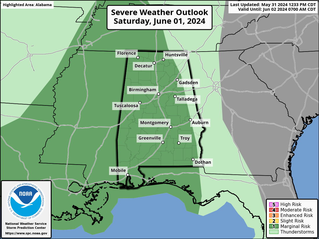
On this first day of June, showers and storms will be likely at anytime throughout the day, but mainly during the afternoon to evening hours. Some of these afternoon and evening storms could be strong to severe, with gusty to damaging winds. The SPC has a Marginal Risk up for locations west of a line from just east of Gadsden to Auburn to just west of Eufaula. The threat window will be approximately from 12pm to 9pm. Dewpoints will be slowly rising through the day, so highs in the upper 70 to the mid 80s will feel slightly muggy.
For now, there is no severe weather threat on Sunday, but we’ll keep scattered to numerous showers and storms at times throughout the day in the forecast. Dewpoints will approach the 70s tomorrow, so that officially reaches the “muggy” category (in my book). While it won’t be an all-day rain out, showers and storms can be expected at any time. Highs in the lower to mid 80s.
And here is where we start that repetitive, summer forecast that we are so used to seeing and hearing about once we hit June. Monday will be a partly to mostly sunny day with the small chance of a few isolated to scattered afternoon showers and storms. Highs in the 80s. Tuesday will be much of the same, with isolated to scattered afternoon showers and storms possible. Highs in the mid 80s to the lower 90s.
Wednesday will continue the “rinse and repeat” forecast, as scattered showers and storms will be possible, mainly during the afternoon and early evening. Highs in the mid 80s to the lower 90s. Thursday will be a near repeat, as scattered afternoon and early evening showers and storms are possible. Some locations will be just a touch cooler, as highs range from the lower 80s to the lower 90s.
And at the end of the forecast period on Friday, we see a reduction in those overall rain chances, but we’ll keep a small chance of an isolated shower or two in the forecast. Highs in the lower 80s to the lower 90s.
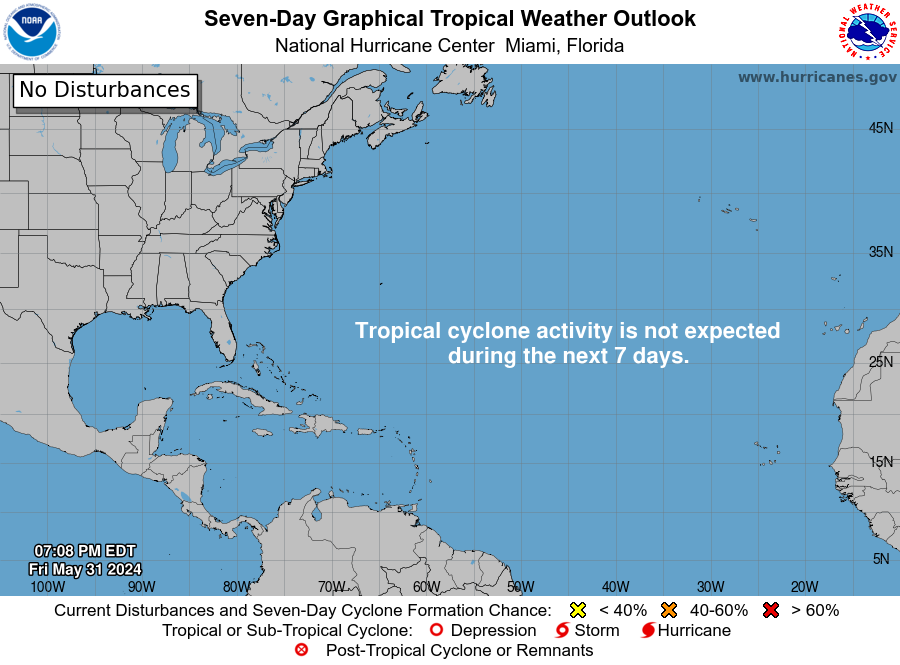
As mentioned earlier, today is the start to the 2024 Atlantic Hurricane Season. NOAA has projected a grand total of 17-25 named storms, with 8-13 of those becoming hurricanes, and 4-7 of those reaching category 3 strength or greater. For now, the tropics are quiet, and no tropical activity is expected through the next seven days. The name of the first storm of the season will be Alberto.
Category: Alabama's Weather, ALL POSTS, Severe Weather, Tropical
About the Author (Author Profile)
Scott Martin is an operational meteorologist, professional graphic artist, musician, husband, and father. Not only is Scott a member of the National Weather Association, but he is also the Central Alabama Chapter of the NWA president. Scott is also the co-founder of Racecast Weather, which provides forecasts for many racing series across the USA. He also supplies forecasts for the BassMaster Elite Series events including the BassMaster Classic.Subscribe
If you enjoyed this article, subscribe to receive more just like it.


