Evening Update
A quick note from the forecast office this evening… the last three sets of the RPM, and the available 00Z global data suggest the ongoing forecast is in pretty good shape. Highlights….
*Very little snow north of I-20…
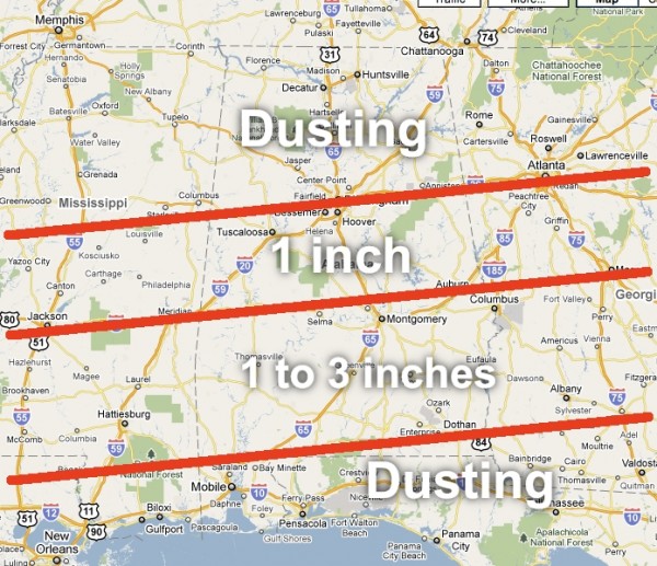
*The I-20 corridor should see just a dusting, to around one inch in spots. Including Tuscaloosa, Birmingham, and Anniston. I don’t think we have too many issues here from the snow on Friday.
*The best snow accumulation should set up between U.S. 80 and U.S. 84… this includes places like Camden, Greenville, Troy, Montgomery, Eufaula, Ozark, Evergreen, and Monroeville. Average amounts 1 to 3 inches, with isolated amounts to 5 to 6 inches. We won’t be able to identify those spots until the snow bands set up Friday morning.
*Some snow accumulation is possible as far south as I-10 (Mobile to Pensacola to Crestview). Our friends on the immediate coast might even see some snow flakes mixed in with the rain down there.
The graphic below is still valid and looks good. I will have the next full Weather Xtreme video and discussion here by 6:30 a.m.
Category: Uncategorized


