Storms Over Tuscaloosa County, Western Jefferson County
Storms over Tuscaloosa County really exploded over the past hour, but are now starting to rain themselves out.
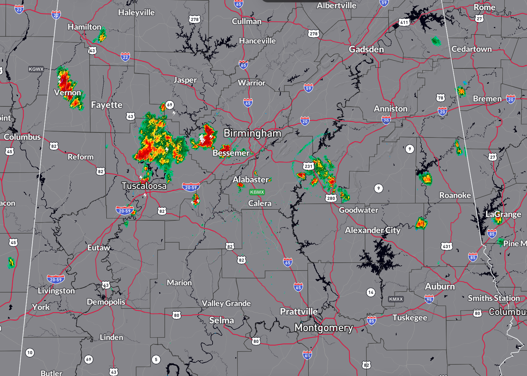
The storms extend from near Northport and west of Brookwood up AL-69 to Windham Springs, and up to Kellerman, Bull City, and Providence in Tuscaloosa County. The strongest core right now is east of Skelton Bend Estates and over Lake Tuscaloosa. Be alert for cloud to ground lightning strike s, especially if you are at the lake.
In Jefferson County, storms extend from Rock Creek down Lock 17 Road to Oak Grove. Very little movement, like the Tuscaloosa County storms, but these are strengthening. Some small hail could be falling west of Rock Creek.
A new storms is forming rapidly in the Bessemer area.
Elsewhere, a strong storm is near Vernon in Lamar County. A developing storm is in Marion County near Pea Ridge, north of I-22.
Isolated storms are over East Alabama. One is west of Fort Payne and DeKalb County, another in Randolph County southwest of Wedowee, south of the Harris reservoir.
Storms are on the Talladega/St. Clair County line are weakening put are propelling an outflow boundary west along US-280. This could fire up storms in northern Shelby and southern Jefferson County.
The storms are single cell and multicellular with no bulk shear to speak of to keep them organized.
One good thing is that the storms have cooled the heat a bit. The mercury has dropped to 79F. It is still 97 at Tuscaloosa, and as hot as 97F at Birmingham. At Birmingham, the temp has dropped to 93F with some cloud cover.
Category: Alabama's Weather, ALL POSTS, Severe Weather
About the Author (Author Profile)
Bill Murray is the President of The Weather Factory. He is the site's official weather historian and a weekend forecaster. He also anchors the site's severe weather coverage. Bill Murray is the proud holder of National Weather Association Digital Seal #0001 @wxhistorianSubscribe
If you enjoyed this article, subscribe to receive more just like it.


