Alabama Afternoon Radar Update
No video today since we are on Spann vacation schedule.
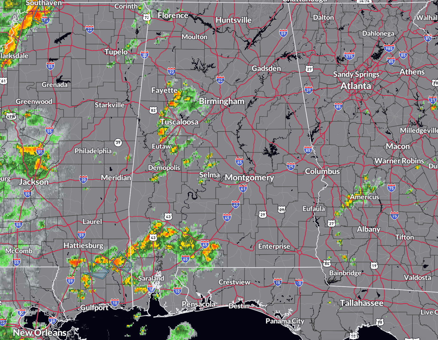
Showers are plentiful over West Central Alabama, as we expected. Little bit of lighting in Tuscaloosa County.
They extend from Fayette and southern Walker Counties, across Tuscaloosa, eastern Pickens, northern Greene, Hale, Perry, Dallas, and Marengo Counties. An even bigger batch is across South west Alabama.
Some storms are near Americus, Georgia, and will be approaching Columbus GA and Eufaula in Barbour County.
There are a few showers in Colbert, Lauderdale, and Franklin Counties in Northwest Alabama.
Everything is pushing northwest.
The activity in southwestern sections of Alabama will works its way up into West Central Alabama including Demopolis, Eutaw, and Tuscaloosa late this afternoon, moving out of the area or dissipating by 7=8 pm.
The Hurricane Hunters are enroute to the low pressure system in the southwestern Gulf of Mexico to see if a tropical depression has formed. It will move west northwestward toward the Mexican coast if it is able to organize and become a depression or tropical storm.
Category: Alabama's Weather, ALL POSTS
About the Author (Author Profile)
Bill Murray is the President of The Weather Factory. He is the site's official weather historian and a weekend forecaster. He also anchors the site's severe weather coverage. Bill Murray is the proud holder of National Weather Association Digital Seal #0001 @wxhistorianSubscribe
If you enjoyed this article, subscribe to receive more just like it.


