Snow update 230 pm and atmospheric dynamics
**NATIONAL WEATHER SERVICE ISSUES WINTER STORM WARNING**
**SEE JAMES’ POSTS BELOW FOR DETAILS**
In blog posts below from James, JB, and me, you’ll see that we have raised the snow totals in central Alabama somewhat, and it looks like it may start as early as 7 am in BHM. 12 UTC model runs are fairly consistent with snow amounts in BHM:
NAM: 2.5″
GFS: 3.5″
Canadian: 1.5″
European: 2″
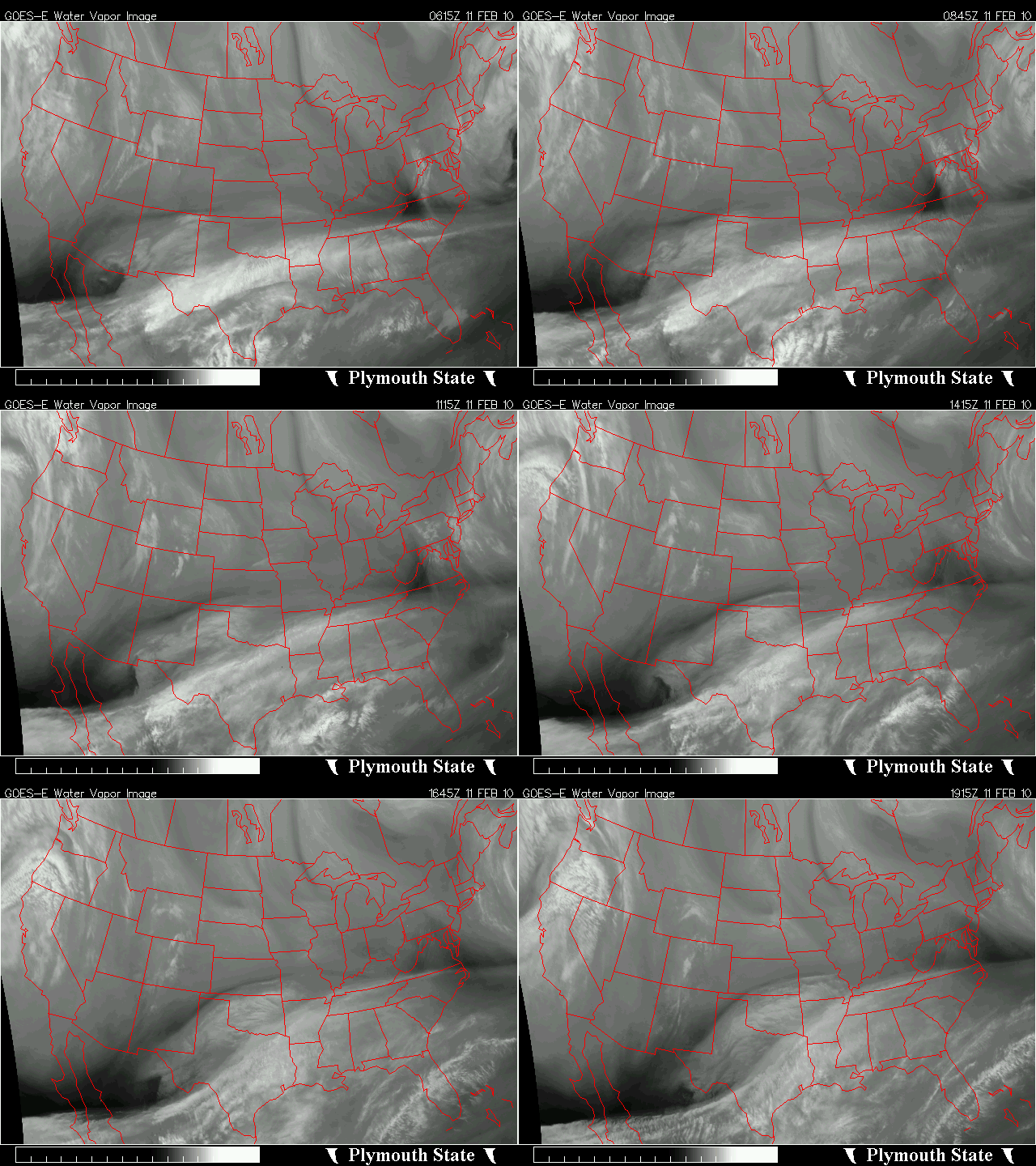
As I mentioned earlier, one reason for this is a secondary upper-level disturbance (trough of low pressure), now over north Texas, that will move into central Alabama tonight. You can see spin in the upper atmosphere in the above loop of water vapor imagery (a satellite picture that sees moisture above 15,000 feet).
You hear meteorologists talk about “upper level disturbances” a lot. But what is one, and how does it cause precipitation and clouds? Here is a semi-technical explanation of what will be going on over Alabama early tomorrow morning. See below the graph for more explanation.
A) shows an isobar in the atmosphere, with a trough of low pressure to the west and a ridge of high pressure to the east. Normal atmospheric flow is geostrophic, meaning that it flows parallel to the isobars, with low pressure on the left (clockwise around high pressure, counterclockwise around low pressure). This is due to the force balance on each air parcel shown in B). In geostrophic balance, the pressure gradient is pushing the air toward low pressure (to the left), equal to the Coriolis force pushing it to the right (The Coriolis force, due to the rotation of the earth, always is to the right of the wind in the Northern Hemisphere).
When air moves into and around a trough of low pressure, centrifugal force moves the air out of the curve some, and the combination of forces slows the air parcel down in the trough. In the ridge, centrifugal force also moves the air out of the curve, but this time the combo of forces speeds it back up. So, all things being equal, air moves slower in a trough than a ridge. This is shown in C).
When air moves from a trough toward a ridge (ahead of the trough), it is speeding up from slow to normal to fast, causing divergence. When air diverges aloft, air must move upward to replace it from below, causing clouds and precipitation. So, east of an upper trough, the weather is usually rainy. East of a ridge, where the air is slowing down aloft, convergence occurs, and air moves downward, suppressing rain.
This storm is still developing, and with the low being farther out in the Gulf than normal due to the cold winter we’ve had, it still looks like the largest snow amounts will be over south Alabama. However, with this system being strong, and plenty of cold air in place, things would have to change a lot for us to get < 1″ of snow in BHM.
Category: Met 101/Weather History


Comments (5)
Trackback URL | Comments RSS Feed
Sites That Link to this Post