9:00 News
Some notes from the weather office…
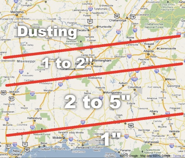
*The 00Z NAM prints 0.30″ liquid for Birmingham, or around 3 inches of snow. Makes the NWS idea of 2 to 4 inches here look pretty good. We will stick with 1-2 inches for the I-20 corridor.
*Timing still looks good; snow begins over West Alabama soon after midnight, with snow arriving in Birmingham before the sun comes up. Snow should reach Anniston in the 5:00 to 7:00 a.m. time frame.
*In Mississippi, Washington Co. SO reporting bridges in central Washington Co beginning to accumulate snow. 0.50 inches on grass and elevated surfaces in Greenville.
*The surface low in the Northwest Gulf of Mexico is about where it should be, and down to 1006 mb.
*The heaviest snow will be over the southern half of the state, where 2 to 5 inches is expected.
Category: Uncategorized


