4pm Info on Beryl
Still 65 mph. But will become a hurricane before landfall. The storm is getting slowly more organized.
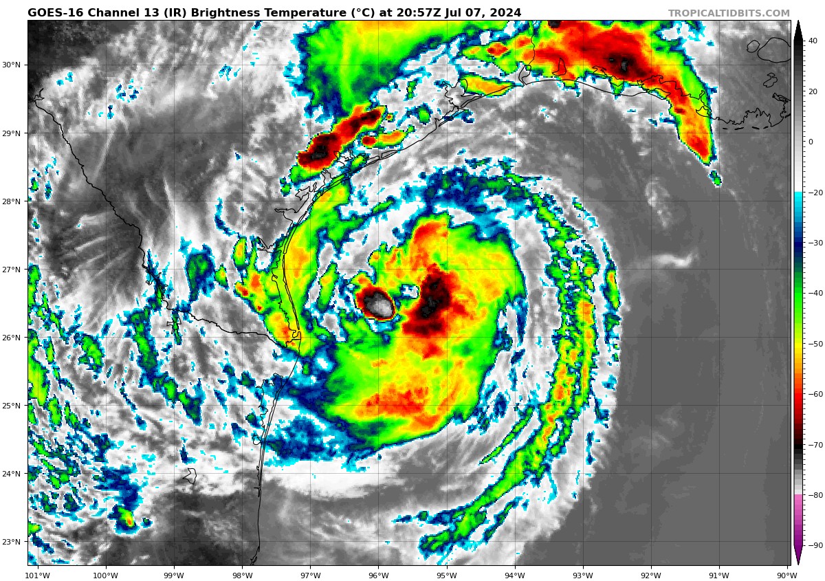
The hurricane models generally show a period of quick strengthening before landfall. The HWRF shows 960 mb and 110 mph at landfall.
The storm is now moving NNW at 12 mph.
It will reach land on Matagorda Island near the town of Matagorda around 3 a.m., passing over Bay City a few hours later.
Surge heights have been revised upwards a bit…
STORM SURGE: The combination of storm surge and tide will cause
normally dry areas near the coast to be flooded by rising waters
moving inland from the shoreline. The water could reach the
following heights above ground somewhere in the indicated areas if
the peak surge occurs at the time of high tide…
Port O’Connor, TX to San Luis Pass, TX…4-7 ft
Matagorda Bay…4-7 ft
San Luis Pass, TX to High Island, TX…4-6 ft
Galveston Bay…4-6 ft
Mesquite Bay, TX to Port O’Connor, TX…3-5 ft
High Island, TX to Sabine Pass, TX…3-5 ft
About the Author (Author Profile)
Bill Murray is the President of The Weather Factory. He is the site's official weather historian and a weekend forecaster. He also anchors the site's severe weather coverage. Bill Murray is the proud holder of National Weather Association Digital Seal #0001 @wxhistorianSubscribe
If you enjoyed this article, subscribe to receive more just like it.


