Updating the Alabama Weather Situation at 11:30 am: Heat Advisories and a Severe Weather Threat
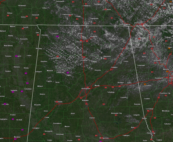
CURRENT CONDITIONS: As we approach the noon hour, temperatures across Central Alabama are heating up. It’s currently 81°F in Anniston with some clouds, 88°F in Tuscaloosa, and 90°F in Birmingham. Calera is at 85°F, while Montgomery’s Dannelly Field is at 91°F. The state’s hotspot is Florence, coming in at 92°F. Dewpoints remain high in the mid to upper 70s, leading to heat index values in the mid to upper 90s across much of the region, including 97°F in Tuscaloosa, Birmingham, Gadsden, and Pell City, and 100°F in Selma.
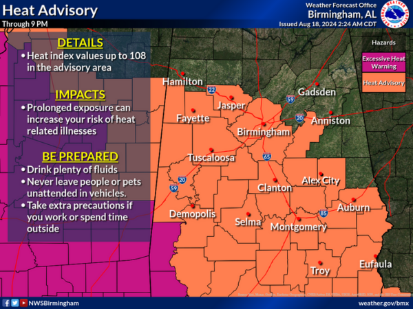
HEAT ADVISORY: A Heat Advisory remains in effect until 9 PM CDT this evening for much of Central and Southern Alabama, including Birmingham, Tuscaloosa, Montgomery, and surrounding areas. Heat index values are expected to reach up to 108°F this afternoon, which can lead to heat-related illnesses if precautions aren’t taken. Residents are advised to drink plenty of fluids, stay in air-conditioned environments, and avoid strenuous outdoor activities during peak heat hours. Check on the elderly, neighbors, and pets to ensure their safety. Communities affected include Birmingham, Montgomery, Tuscaloosa, Selma, and Gadsden, among others.
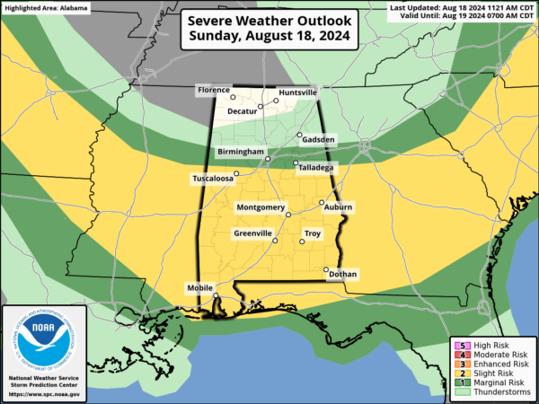
SEVERE WEATHER OUTLOOK: The Storm Prediction Center has placed much of Central Alabama under a slight risk for severe weather today, particularly areas south of a line from Fayette to Birmingham to Anniston, with the best chances for severe weather south of a line from Tuscaloosa to Clanton to Alex City. The key ingredients for severe weather include a seasonably moist airmass with 15-16 g/kg lowest 100-mb mean mixing ratios, and strong daytime heating leading to afternoon CAPE values exceeding 2500 J/kg. These conditions, combined with moderately strong mid-level winds and considerable dry air aloft, will promote the development of widely scattered thunderstorms by mid to late afternoon. The primary threat from these storms will be damaging downburst winds of up to 60 mph, particularly in the strongest storm cores as they push towards coastal areas by early evening.
LOOKING AHEAD: As we progress through the week, the oppressive heat will start to give way to slightly cooler and drier conditions, especially in the northern parts of Alabama. While temperatures will remain warm, the reduction in humidity will make it feel more comfortable, particularly by mid-week.
Category: Alabama's Weather, ALL POSTS, Severe Weather


