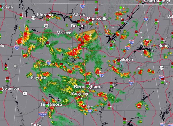
A Pox on My Radar
We knew today would be active with all the unstable air in place, and that has been the case.
The atmosphere has bubbled over with thunderstorms popping up all over. High CAPE values are powering the storms, but almost no shear is leading to pulse thunderstorms that go up quickly and come just nearly as fast. This, of course, produces outflow boundaries.
There have been several reports of trees down including in Chelsea, in Adger, and in Hoover.
At 2:30…the strongest storms are…
…southwest of Florette in Morgan County…a severe thunderstorm warning is in effect until 245 p.m. That storm will move in the general direction of Union Hill.
…across Winston and Cullman counties…from east of Double Springs to west of Cullman…strong winds possible in that area. Along with heavy rain. Strongest returns are south of Jones Chapel.
…a cell merger occurring just west of Springville in western St. Clair county
…a couple of strong cells in Cherokee county east of Centre and near Gaylesville. Very heavy rain and lightning. Could see a downburst with this storm as well.
Lots of outflow boundaries from the storms that are generally moving west and northwest. This lead lead to additional storm formation and collisions.
Category: Alabama's Weather, ALL POSTS, Severe Weather


