Tropical Storm Gordon Forms in the Atlantic
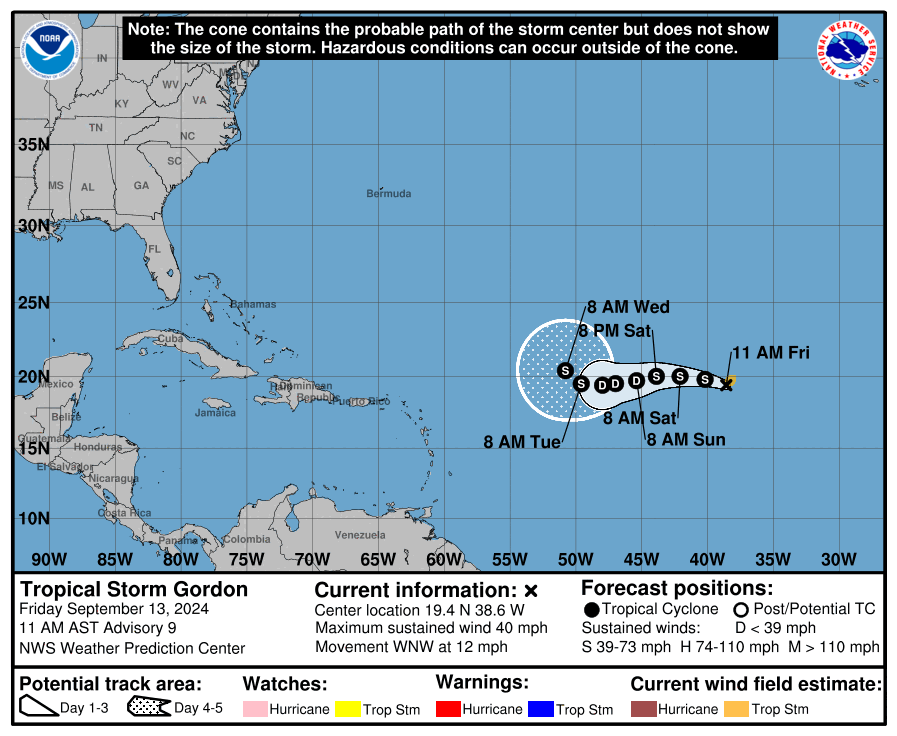
At 10:00 AM CDT, Tropical Depression Seven was upgraded to Tropical Storm Gordon as it moved west-northwest across the central Atlantic. The storm is currently located near 19.4°N, 38.6°W, about 990 miles west-northwest of the Cabo Verde Islands. Gordon is moving at a pace of 12 mph (19 km/h) in a west-northwest direction, with maximum sustained winds of 40 mph (65 km/h) and gusts higher than that. The storm’s minimum central pressure is 1006 mb, and tropical-storm-force winds extend outward up to 70 miles from the center. While no coastal watches or warnings are in effect, Gordon is expected to track westward over the next few days.
The storm has shown some signs of strengthening this morning, with improved structure noted on satellite imagery and Dvorak satellite estimates supporting the upgrade to a tropical storm. However, it’s not expected to be a long-lived system. While Gordon may strengthen slightly today, the environment it’s moving into is less favorable, with a moisture-starved atmosphere and moderate wind shear likely to inhibit further development. Both the GFS and Euro models suggest that Gordon will weaken over the weekend, possibly degenerating into a remnant low by early next week. However, there is a chance for some re-strengthening as it moves into a more conducive environment later next week.
The forecast track for Gordon shows it moving westward over the weekend before potentially curving northwestward by early next week, influenced by an amplifying shortwave trough to the north. While re-intensification is uncertain, the official forecast keeps Gordon as a tropical cyclone throughout the five-day period, with a slight possibility of recovery as it enters a more moist and unstable environment.
For now, Tropical Storm Gordon poses no immediate threat to land.
Stay tuned to AlabamaWX for further updates as we track Gordon’s progress across the Atlantic.
The next full advisory will be issued at 4:00 PM CDT.
Category: ALL POSTS, Social Media, Tropical
About the Author (Author Profile)
Bill Murray is the President of The Weather Factory. He is the site's official weather historian and a weekend forecaster. He also anchors the site's severe weather coverage. Bill Murray is the proud holder of National Weather Association Digital Seal #0001 @wxhistorianSubscribe
If you enjoyed this article, subscribe to receive more just like it.


