Rainfall Intensifying Again over Northwest and North Central Alabama
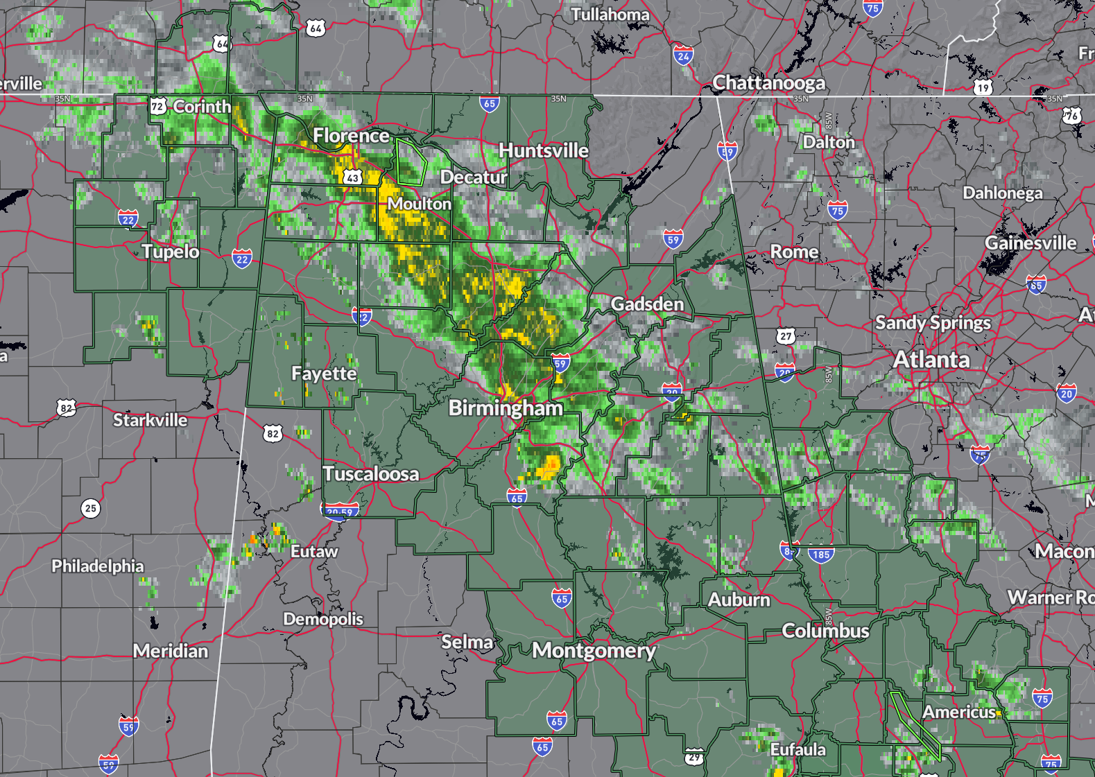
Just after 10 pm on this Saturday evening, the band of rainfall that lies from northwest to southeast to across North and Central Alabama is increasing in size and intensity.
Clouds tops are cooking and expanding indicating increasing convection.
So far, it is just light to moderate rain, but any rain over the already waterlogged areas of the state will likely cause flooding.
Right now, no flood advisories or warnings. But all of the green highlighted area is under a flash flood watch until at least tomorrow morning.
If you live in a flood prone area, make sure to have multiple ways to receive warnings during the night. And if your area is under an advisory or warning, be very careful if you have to drive. Remember, turn around, don’t drown.
Category: Alabama's Weather, ALL POSTS, Severe Weather, Social Media
About the Author (Author Profile)
Bill Murray is the President of The Weather Factory. He is the site's official weather historian and a weekend forecaster. He also anchors the site's severe weather coverage. Bill Murray is the proud holder of National Weather Association Digital Seal #0001 @wxhistorianSubscribe
If you enjoyed this article, subscribe to receive more just like it.


