PTC8 Likely to Become Tropical Storm Helene, Bringing Heavy Rain, Winds, and Coastal Flooding to the Carolinas
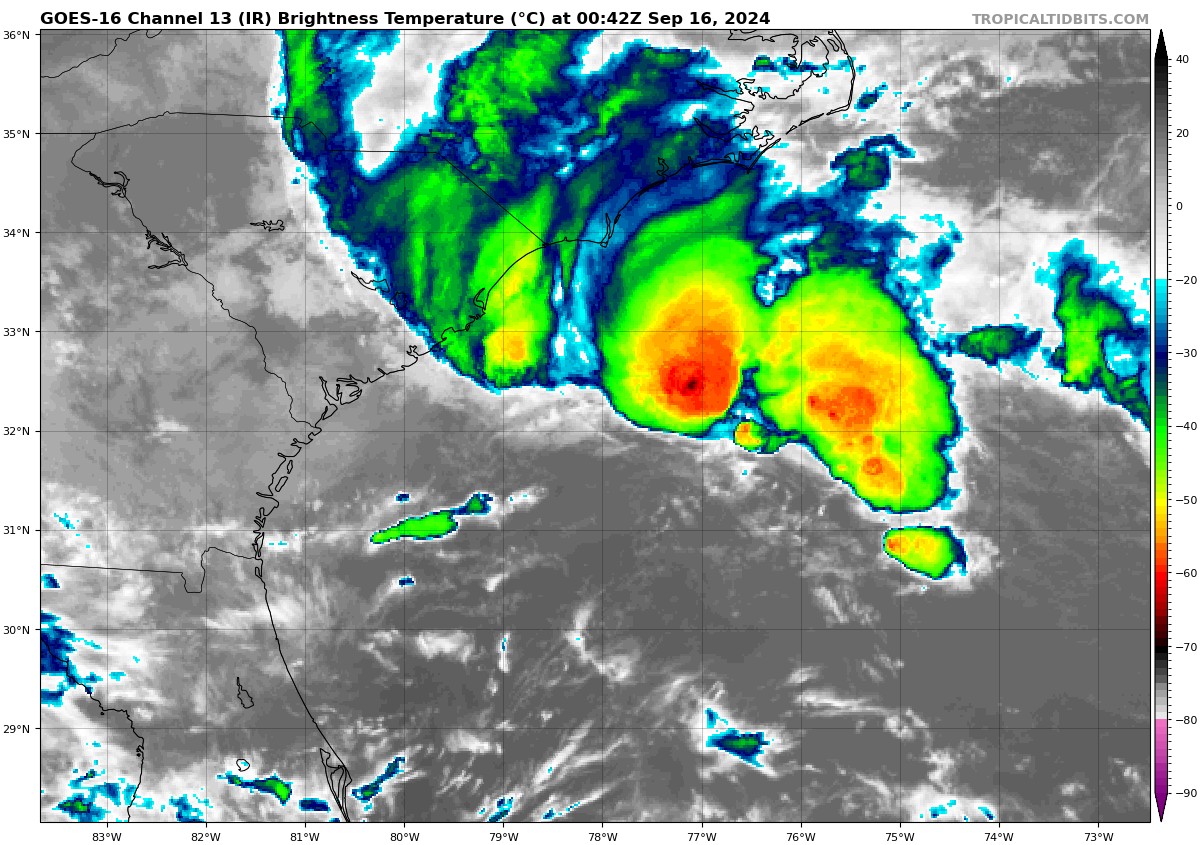
As of 8:00 PM CDT, Potential Tropical Cyclone Eight continues to move erratically off the coast of the Carolinas, located about 140 miles southeast of Charleston, South Carolina. The system is expected to intensify into a tropical storm overnight, bringing heavy rainfall, coastal flooding, and tropical storm-force winds as it makes landfall Monday. Maximum sustained winds are currently near 45 mph. Rainfall totals of 3 to 6 inches are forecast for northern South Carolina and coastal North Carolina, with isolated areas receiving up to 8 inches. A tropical storm warning is in effect from Edisto Beach, South Carolina, to Ocracoke Inlet, North Carolina.
A storm surge of 1 to 3 feet is expected along the coast, particularly from the South Santee River to Oregon Inlet, North Carolina, including the Neuse and Bay Rivers. Coastal areas will also experience dangerous surf and rip currents, with some risk of tornadoes in eastern North Carolina on Monday. Residents are urged to monitor local weather updates and take precautions against potential flooding and storm impacts.
The storm is certainly not any more organized on satellite tonight. Air Force recon did find slightly lower pressure though. Winds continue to be strong.
CAPE FEAR, NC:
Tropical storm conditions will bring overcast skies and heavy rainfall beginning Sunday night and continuing through Monday. Rainfall totals of up to 7 inches are expected, creating localized flooding. Winds will peak Monday morning, gusting up to 53 mph, before decreasing in the afternoon. Seas will remain rough, with waves between 9 and 12 feet, tapering off Monday night. Expect skies to remain cloudy throughout the storm’s passage.
CHARLESTON, SC:
Overcast skies and tropical storm conditions will develop overnight, with winds peaking between 2 AM and 4 AM CDT, gusting up to 47 mph. Rainfall will be lighter, around 1 inch, though minor coastal flooding is possible. Seas will be rough, with waves between 9 and 12 feet, decreasing through the day Monday.
MYRTLE BEACH, SC:
Expect overcast skies and tropical storm-force winds beginning late Sunday, with the heaviest rain and winds arriving midday Monday. Rainfall totals could reach 5 inches, causing localized flooding. Winds will peak around midday, gusting up to 58 mph, then diminish by Monday evening. Seas will range from 9 to 12 feet, gradually decreasing later in the day.
WILMINGTON, NC:
Tropical storm conditions will bring overcast skies and heavy rainfall through Monday. Winds will peak in the morning at 43 mph sustained, with gusts up to 52 mph, decreasing by the afternoon. Rainfall could total up to 7 inches, causing significant flooding. Seas will remain rough, with waves between 9 and 12 feet throughout the day, calming by Monday night.
Category: ALL POSTS, Social Media, Tropical
About the Author (Author Profile)
Bill Murray is the President of The Weather Factory. He is the site's official weather historian and a weekend forecaster. He also anchors the site's severe weather coverage. Bill Murray is the proud holder of National Weather Association Digital Seal #0001 @wxhistorianSubscribe
If you enjoyed this article, subscribe to receive more just like it.


