Tropics Update: Bye Bye to Gordon; Watching the CAG
Remnants of Gordon No Longer a Tropical Cyclone, But Monitoring for Possible Redevelopment
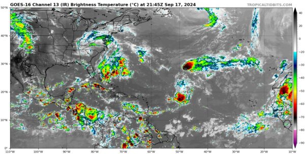
The National Hurricane Center has issued its final advisory on Gordon, as the storm has lost its tropical characteristics. The system has significantly weakened since the overnight hours, with only sporadic bursts of convection occurring south and east of the former center. Recent scatterometer data indicates that Gordon no longer possesses a well-defined, trackable center, marking its transition into a trough of low pressure. Maximum sustained winds are estimated at 25 knots (30 mph).
While the remnants of Gordon will continue drifting northward over open waters, short-term reorganization is unlikely. However, some models suggest the system may redevelop later this week as it moves into a more favorable environment, away from nearby frontal influences. The NHC will continue monitoring the system for signs of regeneration. If it does, it will still be named Gordon.
Tropical Mischief Brewing in the Western Caribbean
Attention is turning to the Western Caribbean, where a significant signal for potential tropical development is emerging. Models are increasingly picking up on what is known as the Central American Gyre (CAG)—a large, rotating area of low pressure that can spawn tropical cyclones. The setup appears ripe for development as we head into the next week, with favorable conditions aligning for something to potentially spin up and track into the Gulf of Mexico.
Sea surface temperatures in the region are well above average, providing plenty of energy to fuel potential storms. Early indications suggest that if development occurs, it could be slow-moving but significant. This area will be closely watched in the coming days, with updates likely in the tropical weather outlook as models continue to refine the potential threat.
Category: ALL POSTS, Social Media, Tropical


