Storm Surge and Tropical Storm Watches Issued for Parts of Southwest Florida
The National Hurricane Center has issued Storm Surge and Tropical Storm Watches for parts of southwest Florida as a potential tropical cyclone moves closer.
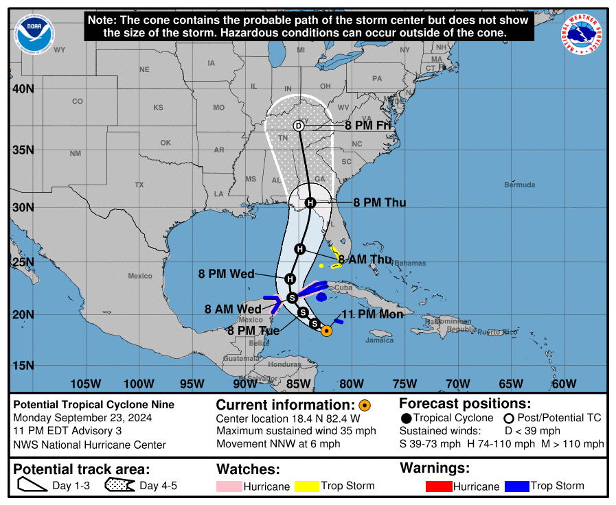
As of 11 PM EDT, the system is located about 100 miles southwest of Grand Cayman and is moving north-northwest at 6 mph with maximum winds of 35 mph and a central pressure of 1002 MB.
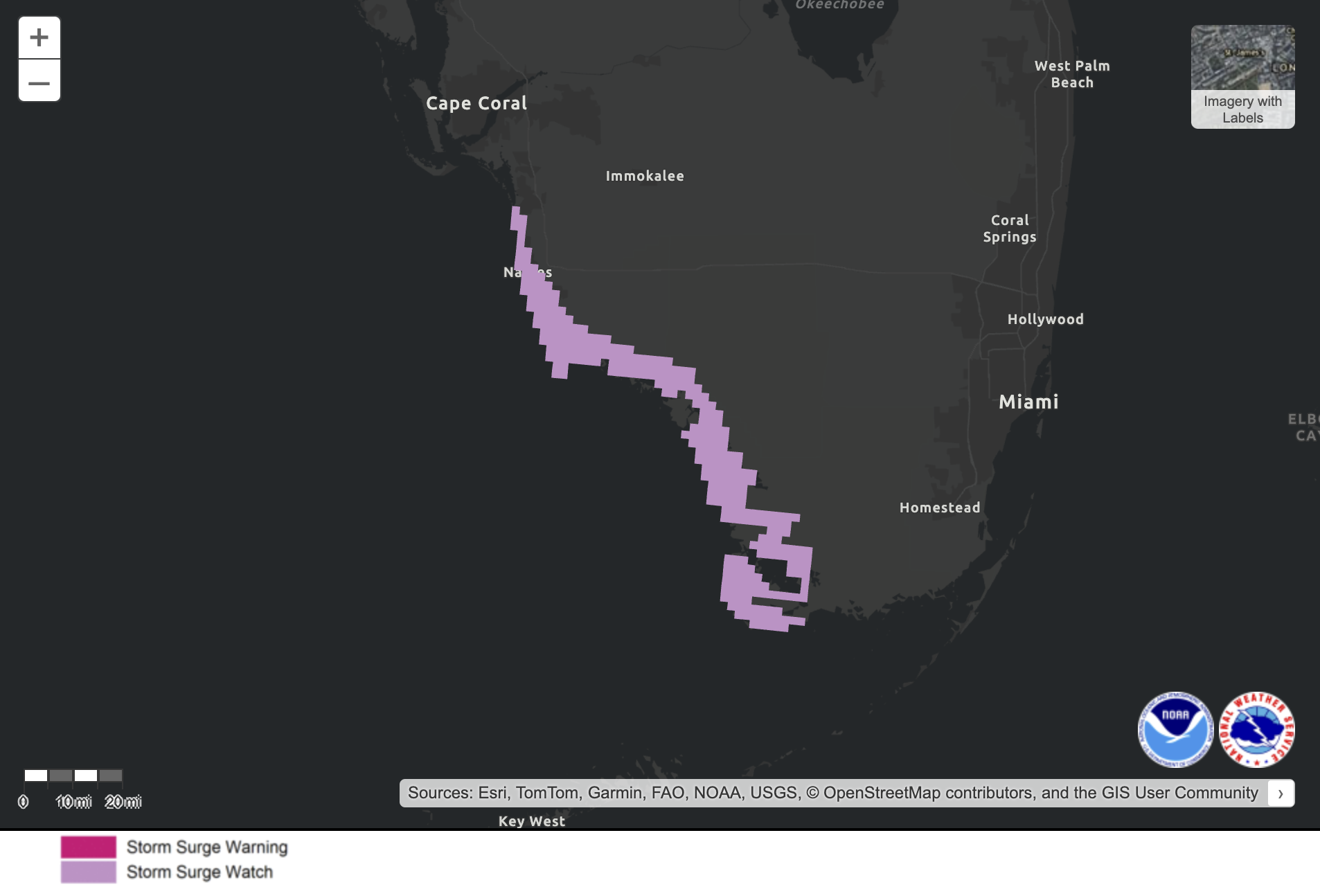
A Storm Surge Watch is now in effect from Bonita Beach to Flamingo, with water levels potentially rising 2 to 4 feet. A Tropical Storm Watch is in place for the same area and parts of the Lower Keys west of the Seven Mile Bridge. A Hurricane Watch has also been issued for areas in Mexico (Cabo Catoche to Tulum) and Cuba (Pinar del Rio province). Grand Cayman is under a Tropical Storm Warning.
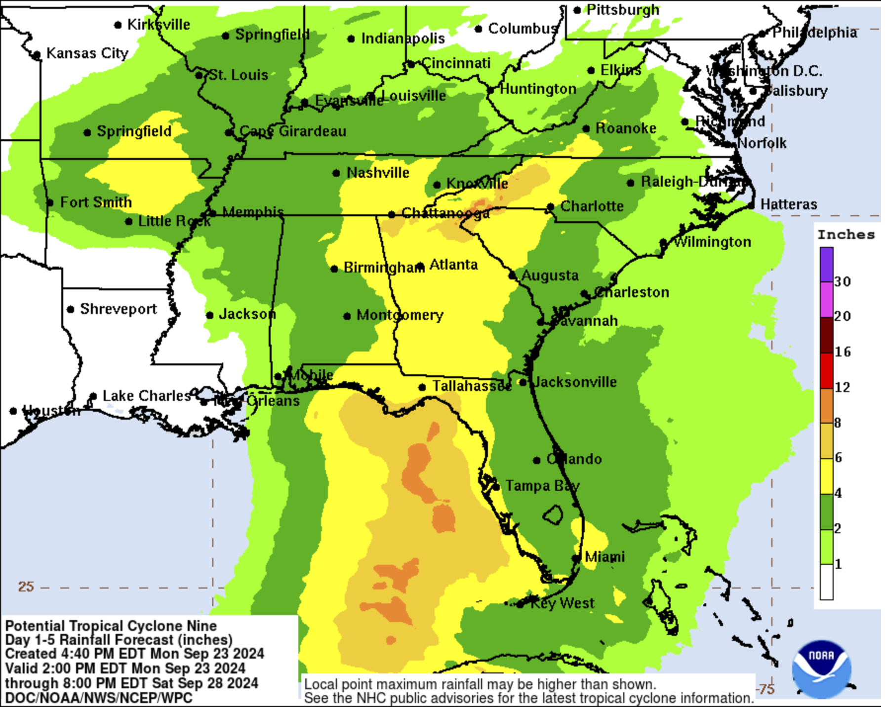
The system is expected to move across the northwestern Caribbean on Tuesday and into the eastern Gulf of Mexico by Wednesday and Thursday. It is forecast to strengthen into a hurricane by Wednesday. Rainfall in Western Cuba and the Cayman Islands could reach 4–8 inches, with some areas getting up to 12 inches, causing possible flooding. Parts of the southeastern U.S. could see 3–6 inches of rain, with isolated totals of 10 inches, leading to potential flash flooding.
Dangerous surf and rip currents are likely along the southern coast of Cuba, the Yucatán Peninsula, and the west coast of Florida.
If you’re in the Florida Panhandle, west coast of Florida, or the Keys, keep a close watch on updates, as more warnings may be issued tomorrow.
Category: ALL POSTS, Severe Weather, Social Media, Tropical
About the Author (Author Profile)
Scott Martin is an operational meteorologist, professional graphic artist, musician, husband, and father. Not only is Scott a member of the National Weather Association, but he is also the Central Alabama Chapter of the NWA president. Scott is also the co-founder of Racecast Weather, which provides forecasts for many racing series across the USA. He also supplies forecasts for the BassMaster Elite Series events including the BassMaster Classic.Subscribe
If you enjoyed this article, subscribe to receive more just like it.


