4PM CDT NHC Update: Helene Continues to Strengthen; Higher Storm Surge Now Expected
Well, the 4PM NHC update is here and it brings some concerning news. The most notable: storm surge levels in some areas in the Big Bend region are forecasted to be 15-20 ft.
Here are the updated stats from the 4PM CDT Advisory:
SUMMARY OF 400 PM CDT…2100 UTC…INFORMATION
———————————————-
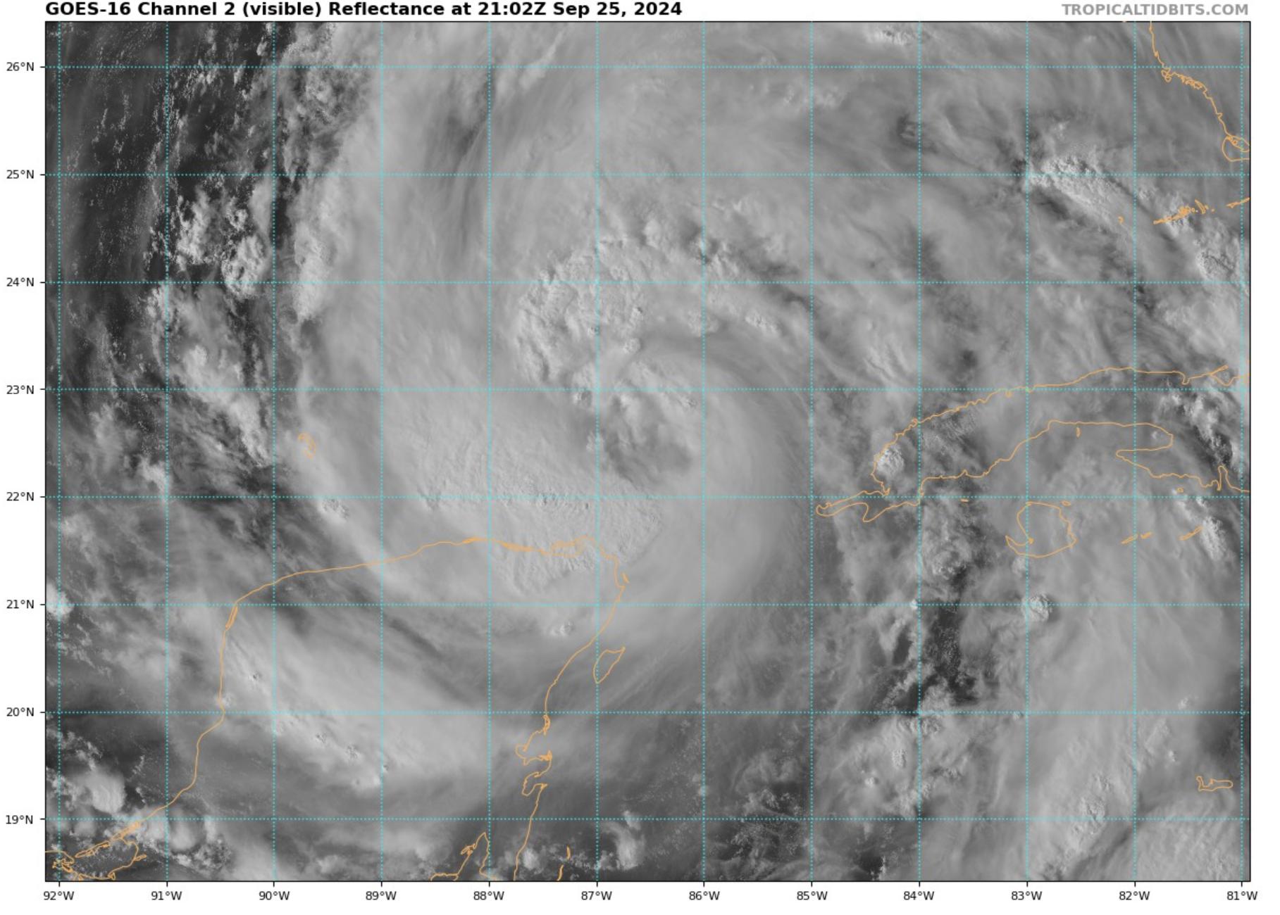
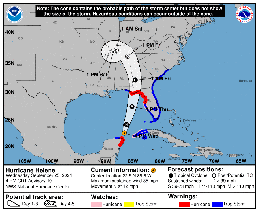
LOCATION…22.5N 86.6W
ABOUT 460 MI…735 KM SW OF TAMPA FLORIDA
ABOUT 505 MI…815 KM SSW OF APALACHICOLA FLORIDA
MAXIMUM SUSTAINED WINDS…85 MPH…140 KM/H
PRESENT MOVEMENT…N OR 355 DEGREES AT 12 MPH…19 KM/H
MINIMUM CENTRAL PRESSURE…978 MB…28.88 INCHES
WATCHES AND WARNINGS
——————–
CHANGES WITH THIS ADVISORY:
The Storm Surge Watch east of Mexico Beach to Indian Pass has been
upgraded to a Storm Surge Warning.
The Tropical Storm Watch north of South Santee River to Little
River Inlet has been upgraded to a Tropical Storm Warning.
SUMMARY OF WATCHES AND WARNINGS IN EFFECT:
A Storm Surge Warning is in effect for…
* Mexico Beach eastward and southward to Flamingo
* Tampa Bay
* Charlotte Harbor
A Hurricane Warning is in effect for…
* Anclote River to Mexico Beach
* Cabo Catoche to Tulum, Mexico including Cozumel
A Storm Surge Watch is in effect for…
* West of Indian Pass to Mexico Beach
A Hurricane Watch is in effect for…
* Cuban province of Pinar del Rio
* Englewood to Anclote River, including Tampa Bay
A Tropical Storm Warning is in effect for…
* Florida Keys, including the Dry Tortugas
* Flamingo to Anclote River, including Tampa Bay
* West of Mexico Beach to the Okaloosa/Walton County Line
* Flamingo northward to Little River Inlet
* Lake Okeechobee
* Rio Lagartos to Cabo Catoche, Mexico
* Cuban provinces of Artemisa, Pinar del Rio, and the Isle of Youth
Strength:
The NHC is now suggesting that Helene may intensify to a low-end category 4 hurricane (estimated 132 mph winds) by tomorrow afternoon. Model data also supports this claim. Regardless, the storm is set to make landfall as a major hurricane. Whether it is a category 3 or category 4 hurricane, this storm will cause damage to the Florida Coastline.
Track/Landfall:
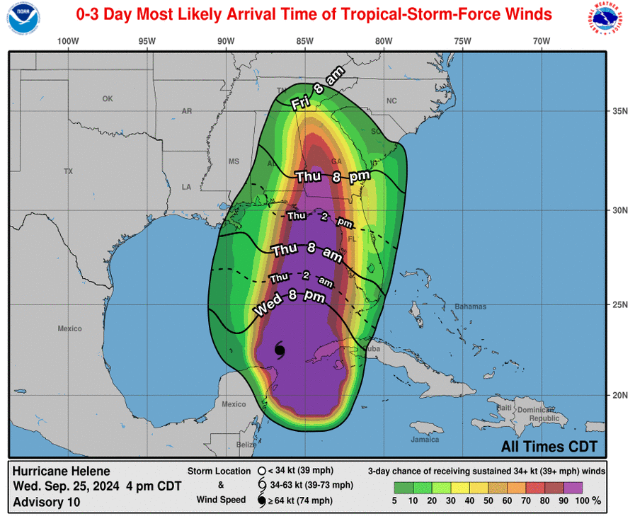
The track and the timing of the storm has not changed much. It is still expected to make landfall tomorrow evening (Thursday) in the Big Bend region of Florida. Tropical storm force winds will likely be felt starting tomorrow afternoon, a few hours before landfall occurs. The storm will impact regions far outside of the area of landfall. Much of Florida, Georgia, South Carolina, Tennessee, and Alabama will feel the effects of Helene. Wind and flooding are the main concerns, especially in the areas to the east of the low pressure center.
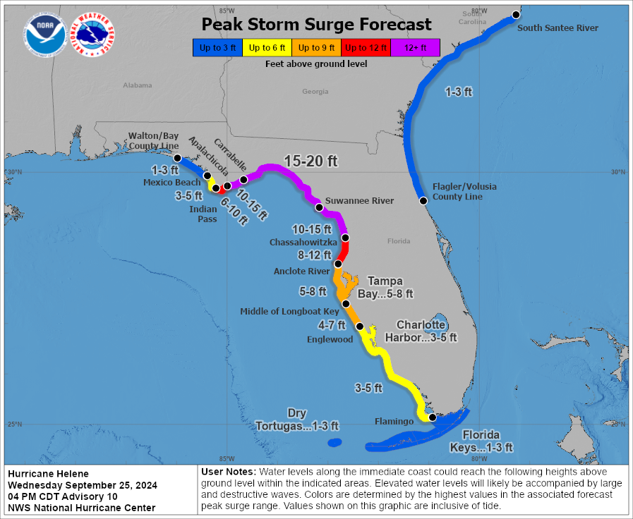
Storm Surge:
15-20 ft storm surge is now expected in the areas between (and including) Apalachicola, FL and Chassahowitzka, FL. This is an extremely high level of surge, and will have huge impacts on the Florida Coast if it occurs. The rest of the Florida Gulf Coast could see anywhere from 1-15 ft of surge, depending on proximity to the area of landfall.
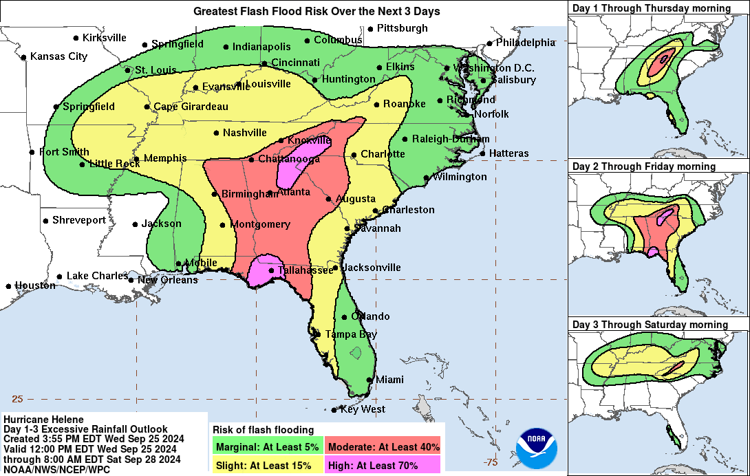
Flash Flooding:
There is a large risk of flash flooding all across the Southeastern United States over the next few days. Helene will bring lots of rainfall, especially to areas that have been especially dry. While rainfall can help alleviate dry conditions, too much at once can be dangerous. Keep an eye out for flash flood warnings as they pop up over the upcoming days.
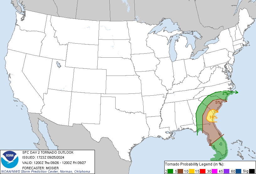
Tornado Threat:
There is a tornado threat, mostly inland, associated with this system. The SPC has highlighted an area of enhanced risk near the Georgia and South Carolina Coasts, but the lower risk areas extend into all of Southern Florida and much of Georgia/South Carolina. Most of the tornado threat will exist tomorrow night after Helene has made landfall.
We are continually monitoring this storm, and will continue to keep you updated.
Category: ALL POSTS, Social Media, Tropical
About the Author (Author Profile)
Scott is a senior at Mississippi State University studying professional and broadcast meteorology.Subscribe
If you enjoyed this article, subscribe to receive more just like it.


