Updated Model Projections for Alabama; Two More Disturbances to Watch in the Tropics
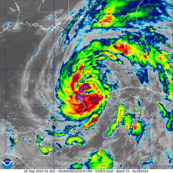
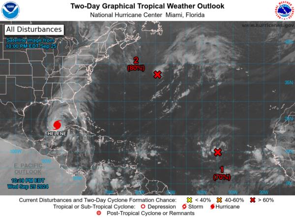
Hurricane Helene continues to churn her way over the Yucatán Channel and will soon be entering the southern Gulf of Mexico. For now, she is still a category 1 hurricane with 85 mph maximum sustained winds. Unfortunately, rapid intensification is highly likely, and we could see a category 4 hurricane at landfall. For now, projected landfall bullseye is set for Apalachicola, but it could hit anywhere from just west of Mexico Beach to several miles east of St. Marks, at some point on Thursday evening.
For now, the projected path has the eye pretty much riding up the Alabama/Georgia state line throughout the morning hours on Friday while weakening. With Helene now expected to reach category 4 strength, wind forecast will have to be raised area-wide along with rain and the potential of a few tropical-type tornadoes north and around to the east of the eye.
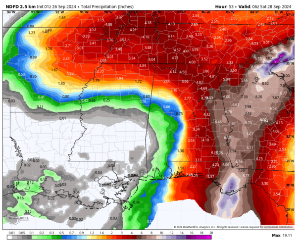
Rainfall forecast totals across the state up until 1am Saturday are currently ranging from none in the southwestern parts, to as high as nearly seven inches over the extreme eastern portions. For now, Birmingham could receive 2.00-3.00 inches, Montgomery around 3.00-4.00 inches, and around 4.00-5.00 inches in Huntsville. Surprisingly, for now, Mobile is only forecast to get less than one inch; but, that could change if the forecast track keeps nudging westward.
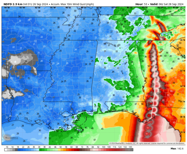
Forecasted wind gusts across the state are nearly uniform for the most part, as much of Alabama could see gusts in the 30-40 mph range, with gust reaching up to 40-50 mph close to the Alabama/Georgia state line, and potentially over 60 mph down in the extreme southeastern corner of the state. We also see that Atlanta is projected to get wind gusts as strong as a category 1 hurricane.
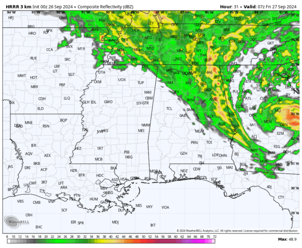
The latest run of the HRRR shows that the southwest and southeastern counties will have mostly dried out by 2-3am Friday morning, Central Alabama by 6-7am, and North Alabama just before noon. Now, with all the tropical moisture still in place, we can’t rule out a few scattered showers after those times, these will be lighter in nature and will not last as long.
While our main focus is on Helene at the moment, we can’t forget about the other two disturbances out there in the tropics. Here is the latest on each one.
Eastern and Central Tropical Atlantic (AL98):
Showers and thunderstorms have shown slight improvement in organization over the past 24 hours in connection with a broad low-pressure system along a tropical wave, located several hundred miles west of the Cabo Verde Islands. Environmental conditions favor gradual development, and a tropical depression is likely to form within the next couple of days as it moves westward to west-northwestward across the eastern and central tropical Atlantic.
– Formation chance through 48 hours: High (70%)
– Formation chance through 7 days: High (80%)
Central Subtropical Atlantic (AL99):
Showers and thunderstorms are becoming more organized around a gale-force low-pressure system located several hundred miles east-northeast of Bermuda. Recent satellite wind data indicate that the system has detached from its frontal boundary and is producing tropical-storm-force winds near the center. If this trend continues, it is likely to become a tropical storm soon. The system is expected to continue moving east-northeastward over the central and eastern subtropical Atlantic. For more details, including gale warnings, refer to High Seas Forecasts from the National Weather Service.
– Formation chance through 48 hours: High (80%)
– Formation chance through 7 days: High (80%)
Category: Alabama's Weather, ALL POSTS, Severe Weather, Social Media, Tropical

