Snow analysis – 930 am
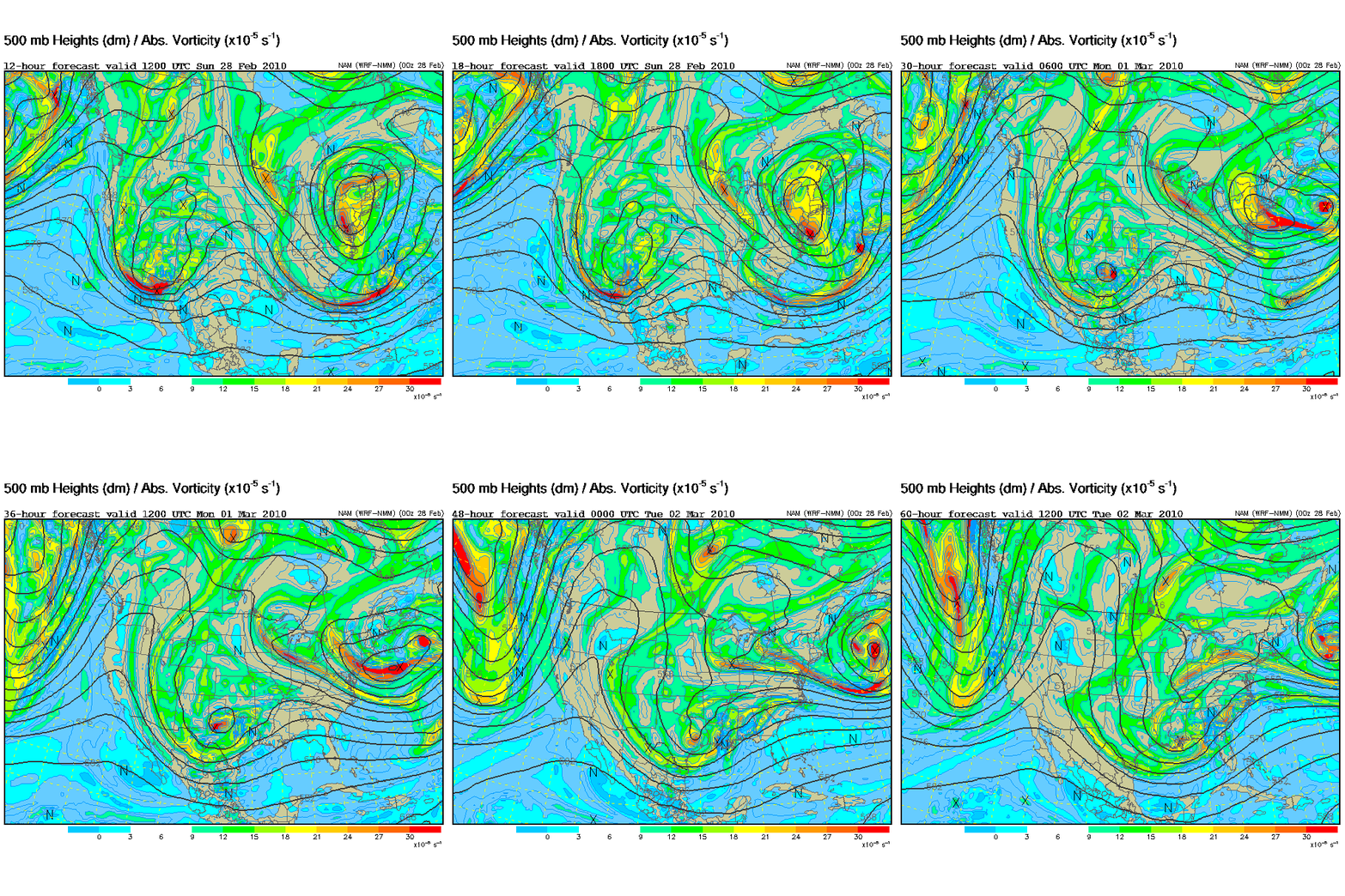
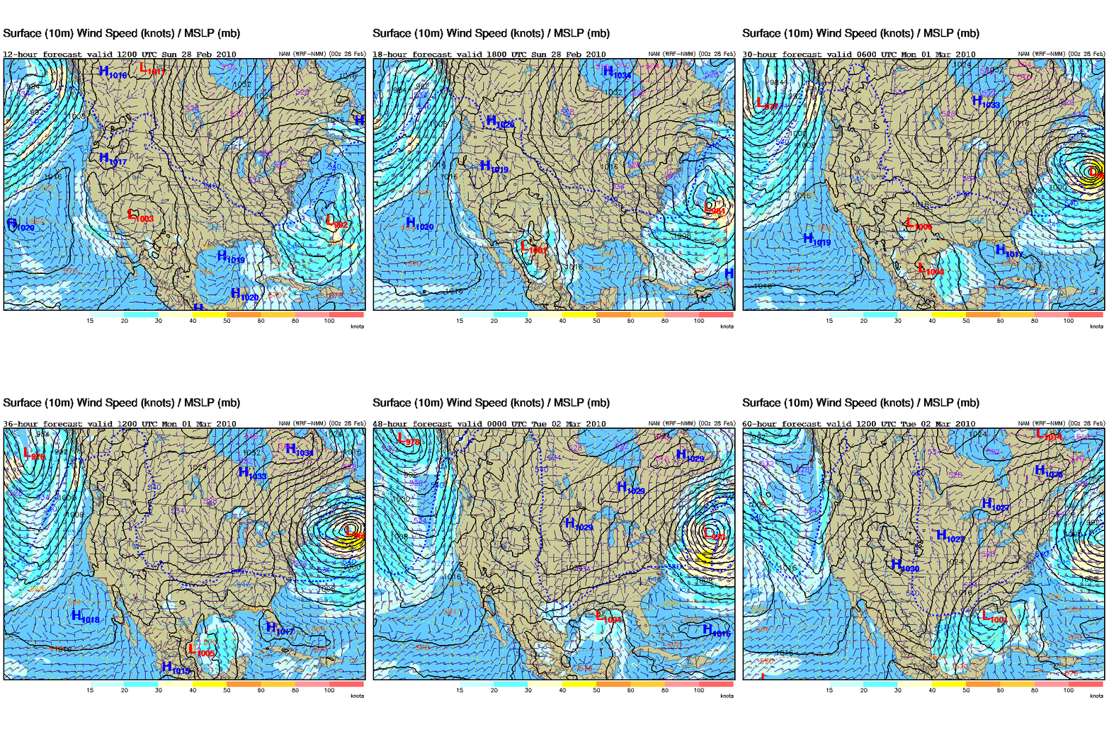
Dynamically, the setup over the next 48 to 60 hours looks *almost* classic for snow here in central Alabama. An upper level disturbance will come in from the west, and interact with a thermal boundary near the Gulf Coast, producing a low pressure area due to divergence aloft lowering the surface pressure, and the warm air moving northward ahead of the low (that is less dense) causing faster pressure falls along the front. The models differ quite a bit on the northward extent of heavy precipitation, but the consensus is that about 0.25″ of liquid water will fall near BHM, with higher amounts over south Alabama.
The air will also be cold enough aloft so that the precipitation will fall as snow, at least aloft. Even though surface temperatures Monday afternoon may reach 50 degrees, snow falling should melt as it gets below the freezing level (near 4,000 feet at BHM Monday afternoon), using up heat and cooling the air more. So, the precipitation should begin as rain Monday afternoon, then change over to snow Monday night.
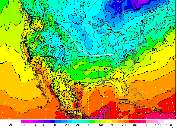
This system is particularly difficult because it will be moving slower than most systems (see the 500 mb loop), allowing warm air to spread northward ahead of it today and tomorrow. We will likely reach the 50s with sunshine today, and even with clouds moving in, reach well into the 40s Monday. Our days are longer now (over 11 hours of daylight), and the sun angle is higher in the sky, meaning at least 50% more heat is coming in from the sun now than it was in late December. And, there is no extreme Arctic air to our north (like there was in 1993). Take a look at model surface temperatures Monday afternoon.
The closest freezing temperatures at the surface will be near Lexington, Kentucky. So, the cold has to be brought down with the snow. It will snow, probably quite a bit, 3,000 feet above the ground. The heavier the precipitation is, the more cooling, and more snow will reach the ground. It is likely that 1″ or more of snow will fall in BHM, with some places south of I-20 getting 2-3″. But, then we have the problem of warm ground temperatures, after sunny skies tomorrow. With surface temperatures struggling to go below freezing (unless we get very heavy precipitation, a small but important possibility), it is likely that little accumulation will occur, with the 1″ of snow melting as it falls or shortly afterwards. There could still be road problems Tuesday night, as melted snow freezes on roads.
So, the bottom line is that it will take a lot of precipitation (on the order of 0.50″ or more) to bring enough cold down to the ground to allow significant accumulation. That is possible, and it depends on the strength of the system. The most likely event will be rain changing to snow Monday night, and the snow may even be heavy at times. However, warm temperatures near the ground will help the snow to melt, leaving 1″ or less on the ground by the time it tapers off Tuesday afternoon. I.e., it will be pretty as it falls, but not stick much. If the system is more intense than the consensus, the mass of snow falling could bring temperatures down to freezing Tuesday morning, especially on ridge tops in east Alabama, producing snow accumulations and icy roads.
A lot can change with this system as it comes out of the mountains today and tonight, so keep an eye on this blog for updates.
Category: Winter Weather


Comments (8)
Trackback URL | Comments RSS Feed
Sites That Link to this Post