Snow update – 330 pm
“This is truly a throwing at a dart board to determine”
“…this thing is fraught with danger for a forecaster”
“THERE IS DEFINITELY A WIDE RANGE OF SOLUTIONS TO CHOOSE FROM THIS MORNING WHEN IT COMES TO THE AMOUNT OF THE WHITE STUFF WE WILL SEE.”
“we are still in the process of looking at every possible scenario with this impending winter wx storm”
This is a very difficult snow forecast…one that has many variables. Above are 4 quotes from various meteorologists from this blog and the NWS from today. But, we have to do the best we can, and tell you the truth…and that is, while we have a pretty good idea of the overall storm, as James notes, there will likely be surprises with this system.
The reason it is so difficult is that dynamically, it’s almost classic for a big time snow storm in central Alabama. Temperatures at 850 mb (about 4,000 feet) are cold enough for snow, but it is 55 degrees in Birmingham!
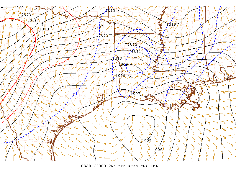
A surface low is developing rapidly in the Gulf. The approaching upper-level storm system is causing upper-level divergence, removing air and causing surface pressures to fall rapidly. Precipitation has already developed over much of Mississippi as the lead disturbance comes through.
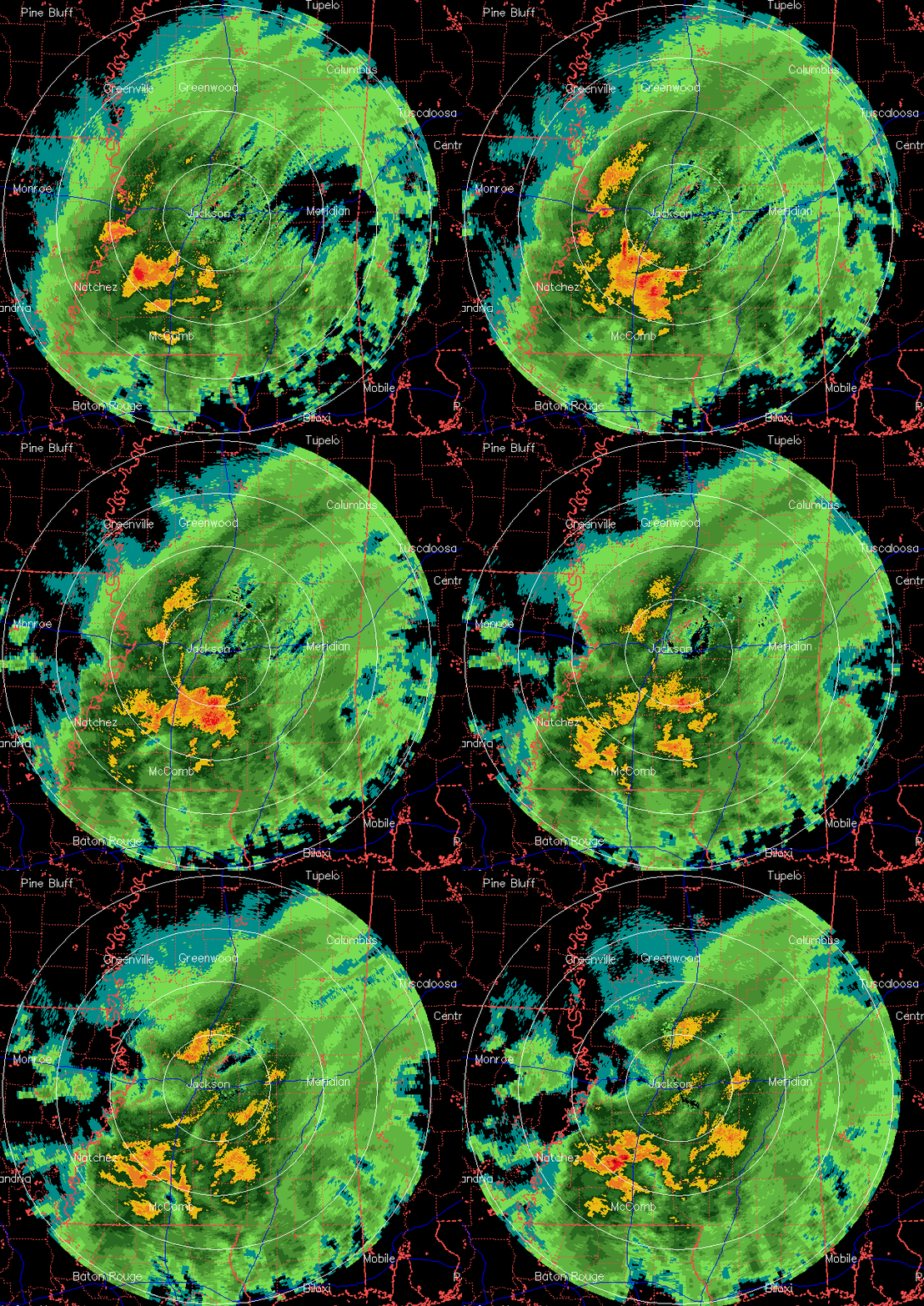
Notice the orange and red around the radar site at Jackson? That is showing the “bright band”, or the level where snow is melting aloft. Water-covered ice shows up very well on radar. The snow is melting between 2,000 and 4,000 feet.
The above charts show the rapidly falling pressures in Mississippi, and the 850 mb temps. Notice it is -2 C in central Mississippi, indicating snow is falling there, probably melting just above the surface.
As the precipitation moves in, the air will initially be cooled by evaporation of precipitation, probably into the mid 40s at BHM. Then, as snow continues to fall aloft and melt, using more heat, the freezing level will slowly get closer to the ground. It does not look like it can possibly get cold enough for any snow accumulations this evening. If we had stayed cold all day, as I mentioned this morning, maybe, but it didn’t.
The big question is this…will there be enough precipitation wrapping around the north and northwest side of the storm tomorrow morning to make the air cold enough for snow to accumulate? It is more likely to occur over east Alabama, especially at higher elevations, as the low moves into south Georgia or north Florida. The NWS has issued a Winter Weather Adv for eastern and central Alabama, from Birmingham eastward to the state line.
Warm ground temperatures should prevent accumulations over 1″ in BHM, unless we get a sudden burst of heavy precipitation with the upper-level low tomorrow.
Category: Uncategorized


