Overnight Rain and Storms: Timing and What to Expect
We will finally start to cool down towards the end of this week! Temperatures in the latter half of the week will drop into the lower 60s, with overnight lows dropping into the 30s. However, before we feel these cooler temperatures, we will have a line of showers as the cold front makes it way across the state.
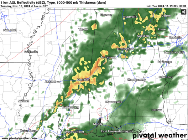
Right now, we are seeing only rain in a couple of counties in southern Central AL. Latest model runs are showing the main bulk of rain to enter the state between 2-3 am, with the rest of the line continuing to work its way into Alabama through the early morning hours. Here is a snapshot of the HRRR model for 6 am tomorrow:
We expect the northern third of the state to be mostly clear by the early afternoon. Showers will linger throughout the day for Central and Southern Alabama, with clearing expected to occur late tomorrow night.
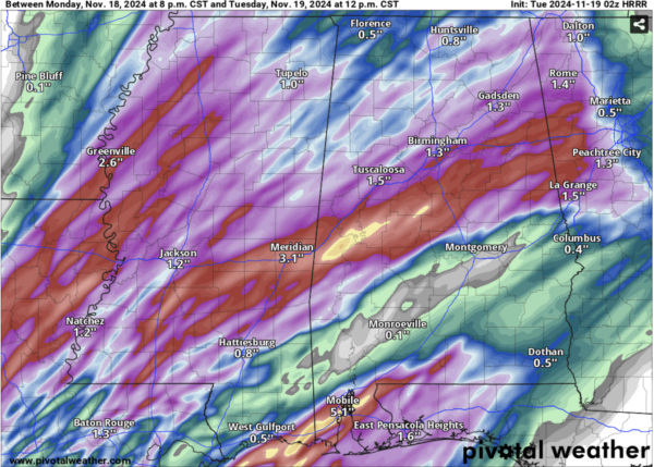
Central Alabama will receive the most rainfall, with some areas expected to get over 2 inches of rain. Around 1.5 inches of rain could fall in Birmingham and Tuscaloosa.
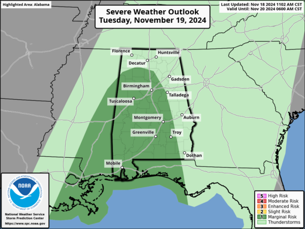
There is a potential for strong to severe storms tomorrow, with most of the risk being towards the southeastern corner of the state. The main concern will be high wind gusts, but a spin up tornado is possible as well. Stay vigilant throughout the day tomorrow and have multiple ways to receive weather alerts.
We will update throughout this event, including any severe thunderstorm/tornado warnings that are issued by the NWS.
Category: Alabama's Weather, ALL POSTS


