Anotehr Chilly Night in Store with a Hard Freeze across North Alabama
It was a chilly morning across North and Central Alabama on this first day of December, with light frost in many areas.
Morning clouds associated with an upper level disturbance to our north have been sweeping southeast and evaporating. You will still find them across Shelby, Talladega, Coosa, and Chilton Counties in the Central part of the state.
A few patches of cirrocumulus clouds have formed over eastern Tennessee and northeastern Alabama, but they are doing little to dampen the bright December sun.
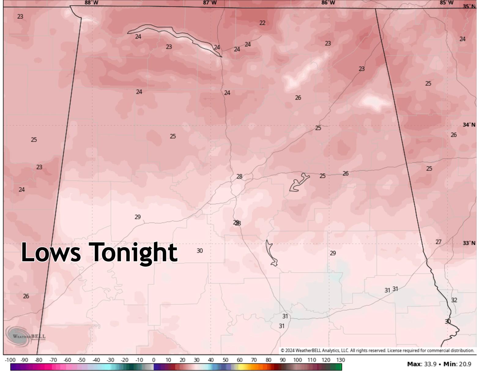
Temperatures are in the lower and middle 50s now in most areas. The warm spot for the area is Selma at 57F. Temperatures will rise a couple of more degrees before beginning a slow fall back into readings in the 20s tonight. Overnight lows will range from near 22F at New Market in Madison County to 31F at Auburn and Montgomery. The I-10 Corridor will drop to between 25-28F.
This means another widespread hard freeze for North Alabama. Some normally colder locations may drop into the teens.
Tomorrow will be a lot like today with another disturbance passing to our north. This one could bring a few snow flurries to northern and eastern Tennessee, and a few afternoon sprinkles to Northeast Alabama.
There will be another widespread hard freeze tomorrow night with lows ranging from 20-22F across North Alabama, 25-28F across North Central Alabama, and ranging up to near 30F in the US-80 Corridor.
Tuesday will be colder, with some North Alabama locations unable to get out of the 30s.
Wednesday will be milder, with a southwesterly flow developing, but a few showers will reach the Tennessee Valley by late afternoon, spreading southeastward through the overnight. Rainfall amounts will be light.
It will be cooler Thursday, Friday and Saturday.
Category: Alabama's Weather, ALL POSTS, Social Media
About the Author (Author Profile)
Bill Murray is the President of The Weather Factory. He is the site's official weather historian and a weekend forecaster. He also anchors the site's severe weather coverage. Bill Murray is the proud holder of National Weather Association Digital Seal #0001 @wxhistorianSubscribe
If you enjoyed this article, subscribe to receive more just like it.


