Tornado Watch Number One Issued to our West

The SPC has issued Tornado Watch #1 for 2025. It includes parts of eastern Texas, southern Arkansas, and western Louisiana. It goes until 6 p.m. CST.
It includes places like Texarkana (only the Arkansas side), El Dorado, Shreveport, Alexandria, Natchitoches and Nacogdoches, Beaumont, and Conroe.
Severe weather is increasing across East Texas, northwest Louisiana, and southern Arkansas late this morning. A line of thunderstorms ahead of a cold front is moving eastward, with a risk of damaging winds, isolated small hail, and tornadoes, especially near the advancing warm front. Strong wind shear and an intense low-level jet are supporting rotating storms. While a QLCS (quasi-linear convective system) is expected to remain dominant, there is potential for isolated supercells ahead of the line, which could enhance the tornado threat.
There is a tornado warning now for areas around Hope in Arkansas.
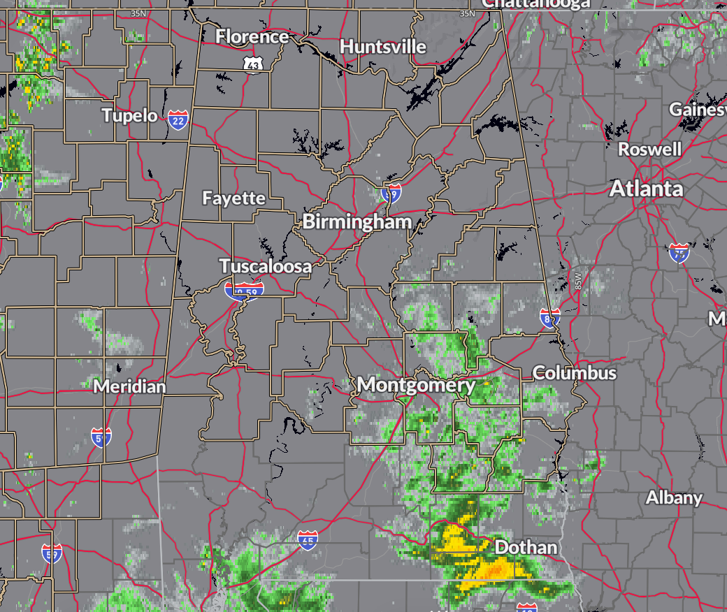
For Alabama, widespread light rain will develop through the day today as temperatures remain cool, with highs likely occurring after sunset. Rainfall amounts will generally be light, ranging from 0.01 to 0.05 inches. Here is current radar:
A wind advisory is in effect for strong winds ahead of the approaching cold front, with sustained winds of 15 to 25 mph and gusts up to 45 mph possible. The main line of storms, along the advancing cold front, will move into western Alabama around 8 pm tonight and exit the southeast part of the state by 8 to 9 am Monday. The severe weather threat is marginal, with a low risk of isolated damaging winds and brief tornadoes across the western half of Alabama from 8 pm to 2 am.
Behind the front, temperatures will fall rapidly, but freezing conditions are not expected until after the rain ends. Monday will be cold and breezy, with highs in the 30s to low 40s and lingering strong winds making it feel even colder. While some flurries may be possible in northern parts of the state, chances are currently too low to include in the forecast. Expect improving conditions Monday afternoon as drier air moves in.
Category: Alabama's Weather, ALL POSTS, Severe Weather, Social Media
About the Author (Author Profile)
Bill Murray is the President of The Weather Factory. He is the site's official weather historian and a weekend forecaster. He also anchors the site's severe weather coverage. Bill Murray is the proud holder of National Weather Association Digital Seal #0001 @wxhistorianSubscribe
If you enjoyed this article, subscribe to receive more just like it.


