Evening Update On Incoming Winter Storm And Extreme Cold
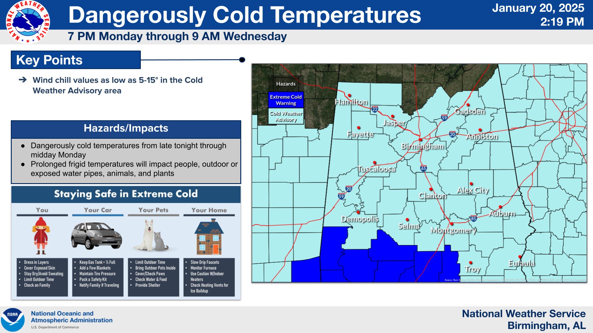
The first order of business is the continued dangerously cold temperatures across central Alabama tonight and through Wednesday morning. There is currently a cold weather advisory in effect for all of central and portions of northeastern Alabama as well. This is in effect until 9am on Wednesday. Within this cold weather advisory, wind chills are expected to drop into the single digits and low teens in many areas. As we have been reiterating for days, this type of cold can be dangerous, so its important that you dress appropriately and in layers, and please remember to check in on your friends and family members as well.
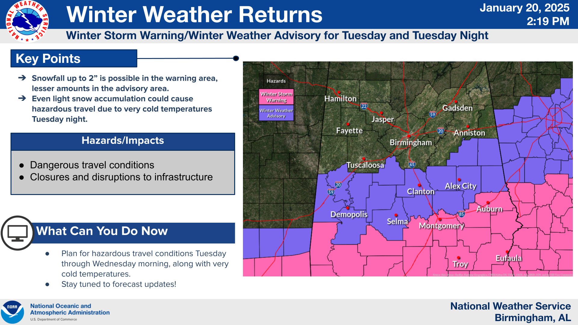
There have been some changes to the winter weather alerts since the last update. The winter storm warning is in effect for counties along and south of a line from Choctaw, Clarke, Wilcox, Lowndes, Montgomery, Macon, and Lee, and all counties to the south of there. This is where the most significant impacts are expected to occur as a result of snowfall, where 1-3″ could fall. The winter storm warning is the area shaded in pink, and is in effect from 6am Tuesday until 6am Wednesday.
There is also now a winter weather advisory in effect for Sumter, Greene, Marengo, Hale, Bibb, Dallas, Perry, Autauga, Elmore, Coosa, Tallapoosa, Clay, Randolph, and Chambers counties. Here, travel impacts are still possible, but snowfall will fall short of warning criteria, with less than 1″ expected. This is the area shaded in purple, which is in effect from 6am Tuesday until 6am Wednesday.
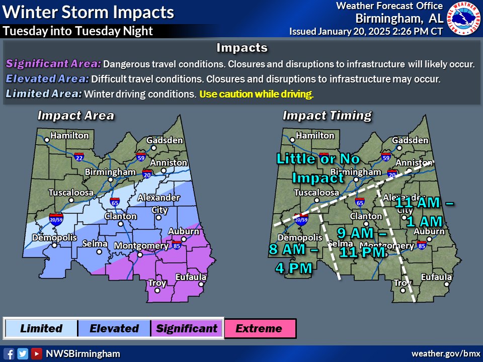
Within the winter storm warning area, elevated to significant impacts are expected. This includes delays, closures, snow covered roads, and slick travel conditions. Travel is not advised in the winter storm warning area unless it is an emergency. In the winter weather advisory area, limited impacts are expected, although some delays and closures as well as slick travel could still occur, and extra caution should certainly be used even outside the winter storm warning area. These risks are outlined well in the above graphic from NWS Birmingham, as well as the timing for the impacts.
Category: Alabama's Weather, ALL POSTS, Social Media
About the Author (Author Profile)
Jack is a junior at Mississippi State University studying meteorology. He has several years of forecasting experience through a local group of forecasters in Maryland where he resides. Jack plans to become a broadcast meteorologist after graduation.Subscribe
If you enjoyed this article, subscribe to receive more just like it.


