Radar Update at 5:05 p.m.
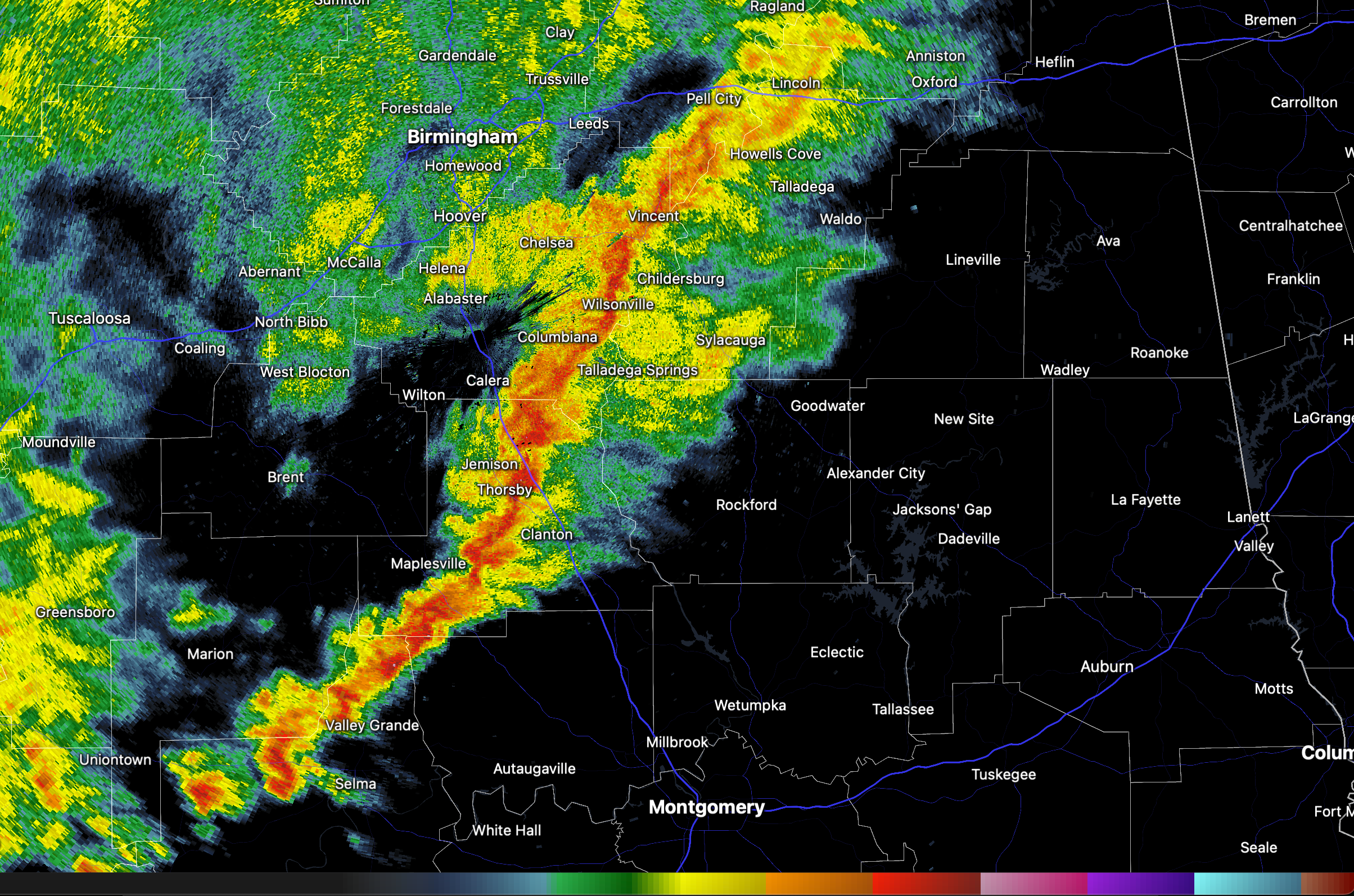
A line of heavier showers has developed across Central Alabama this afternoon in an area of elevated instability. There is no lightning, although echo tops are approaching 30,000 feet over southwestern Chilton County
The heavier cells extend from northwestern Talladega County, through southeastern Shelby, western Chilton County, into southern Perry and northern Dallas Counties.
The cells will be approaching Childersburg, Clanton, and Selma over the next 30 minutes.
There is substantial bulk shear ove rthe southern portion of the line, up through Chilton County, which is helping to increase the convection.
There is a marginal risk (level 1 out of 5) for severe weather including damaging winds and an isolated tornado or two, as far east as a line from Munford, to Alex City to Montgomery. The threat will rapidly diminish in a couple of hours.
Category: Alabama's Weather, ALL POSTS, Social Media
About the Author (Author Profile)
Bill Murray is the President of The Weather Factory. He is the site's official weather historian and a weekend forecaster. He also anchors the site's severe weather coverage. Bill Murray is the proud holder of National Weather Association Digital Seal #0001 @wxhistorianSubscribe
If you enjoyed this article, subscribe to receive more just like it.


