Tornado Warning Issued for Portions of Southwest Alabama
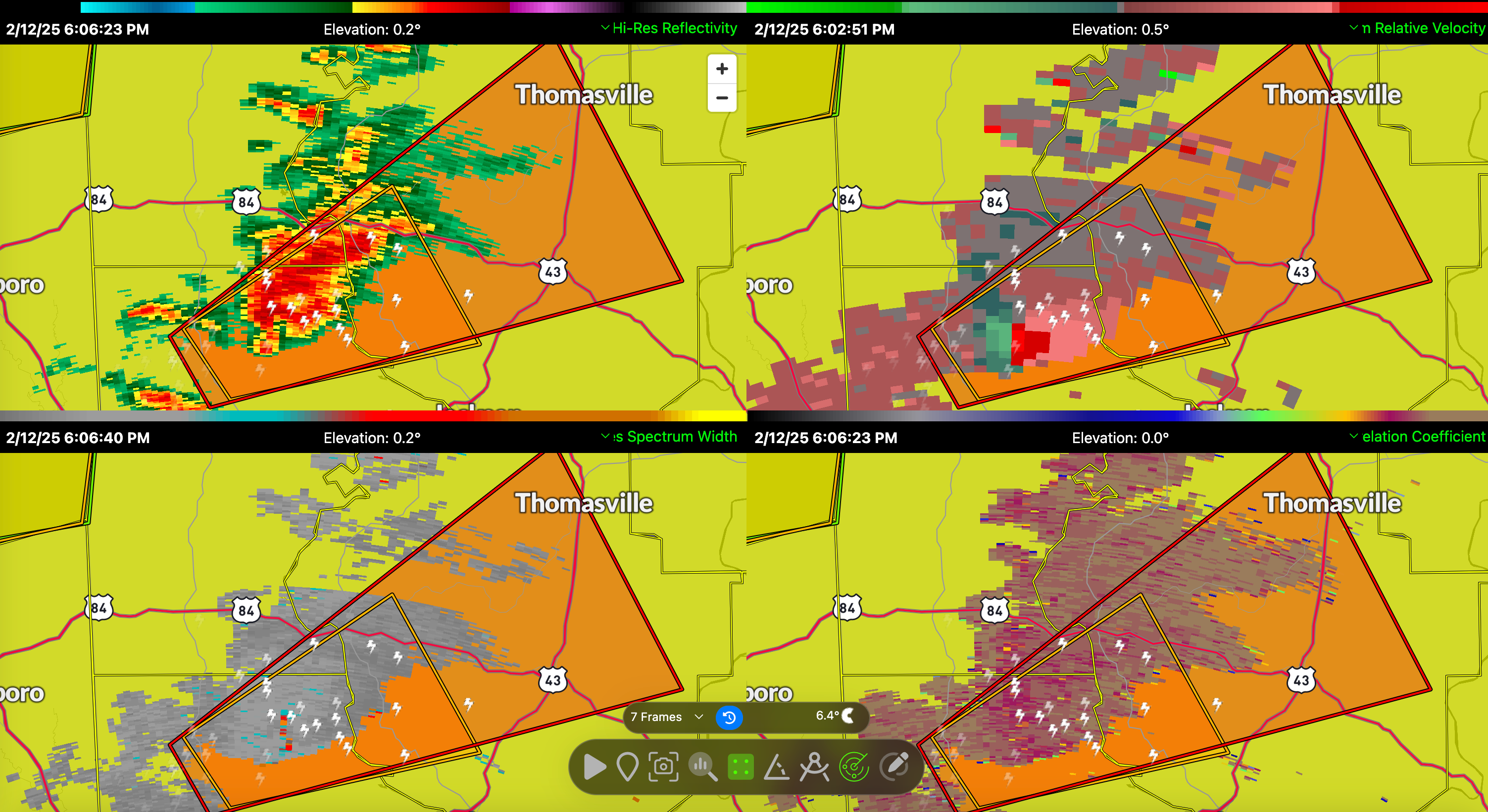
A tornado warning has been issued for parts of south central Choctaw County, north central Washington County, and northern Clarke County in southwestern Alabama until 6:45 PM CST.
At 6:00 PM CST, a severe thunderstorm capable of producing a tornado was located 4 miles southeast of Millry, or 8 miles north of Chatom, moving northeast at 45 mph. Radar has indicated rotation within this storm, and conditions remain favorable for tornado development.
Residents in the warned area should seek shelter immediately. This storm has the potential to produce flying debris, which will be dangerous to those caught without shelter. Mobile homes could be damaged or destroyed, and damage to roofs, windows, and vehicles is likely. Tree damage is also expected.
If you are in the path of this storm, move to an interior room on the lowest floor of a sturdy building. Avoid windows and cover yourself to protect against flying debris. Those in mobile homes or vehicles should seek a more secure shelter immediately.
This warning comes as part of a broader severe weather outbreak affecting Alabama. A warm front has lifted northward, creating an unstable environment with strong low-level wind shear. There is an increasing tornado threat, particularly in areas where storms interact with the warm front. Strong low-level jet dynamics and high moisture levels continue to fuel storm development across the region.
Category: Alabama's Weather, ALL POSTS, Severe Weather, Social Media
About the Author (Author Profile)
Bill Murray is the President of The Weather Factory. He is the site's official weather historian and a weekend forecaster. He also anchors the site's severe weather coverage. Bill Murray is the proud holder of National Weather Association Digital Seal #0001 @wxhistorianSubscribe
If you enjoyed this article, subscribe to receive more just like it.


