Flash Flood Warning In Effect For Portions Of Northern Alabama Until 10:15PM
The NWS has issued a flash flood warning for parts of Cullman, Morgan, and Marshall counties until 10:15PM. Here are the details from NWS:
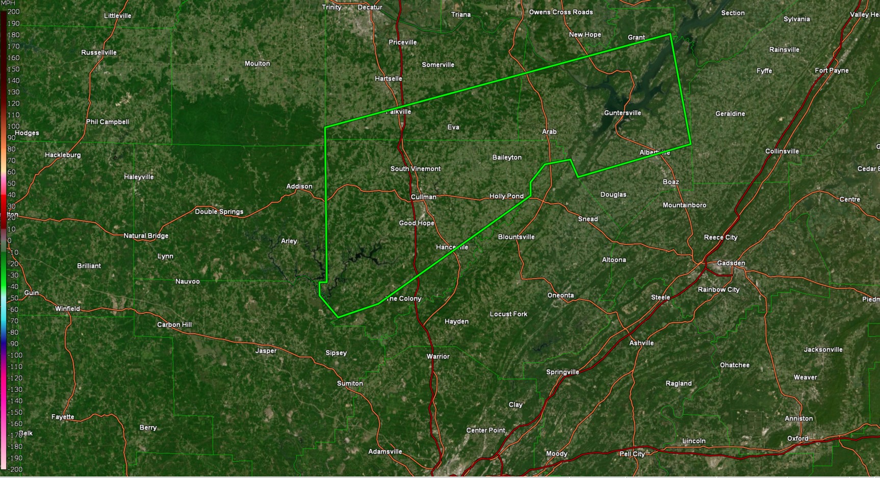
* Flash Flood Warning for...
  Cullman County in north central Alabama...
  Southern Morgan County in north central Alabama...
  Marshall County in northeastern Alabama...

* Until 1015 PM CST.

* At 706 PM CST, Doppler radar indicated thunderstorms producing
  heavy rain across the warned area. Between 1 and 2 inches of rain
  have fallen. Additional rainfall amounts of 1 to 2 inches are
  possible in the warned area. Flash flooding is ongoing or expected
  to begin shortly.

  HAZARD...Flash flooding caused by thunderstorms.

  SOURCE...Radar.

  IMPACT...Flash flooding of small creeks and streams, urban
           areas, highways, streets and underpasses as well as
           other poor drainage and low-lying areas.

* Some locations that will experience flash flooding include...
  Albertville, Cullman, Guntersville, Arab, Hanceville, Good Hope,
  Falkville, Grant, Holly Pond, Dodge City, Baldwin, Vinemont,
  Baileyton, West Point, Eva, Union Grove, Hulaco, Ryan Crossroads,
  Joppa and Walter.

PRECAUTIONARY/PREPAREDNESS ACTIONS...

Turn around, don't drown when encountering flooded roads. Most flood
deaths occur in vehicles.

Be especially cautious at night when it is harder to recognize the
dangers of flooding.
Category: Alabama's Weather, ALL POSTS, Social Media
About the Author (Author Profile)
Jack is a junior at Mississippi State University studying meteorology. He has several years of forecasting experience through a local group of forecasters in Maryland where he resides. Jack plans to become a broadcast meteorologist after graduation.Subscribe
If you enjoyed this article, subscribe to receive more just like it.


